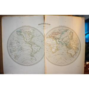
Old engraving by Grenier 1840 - Dufour's world map. Old geographic map published in 1840 to be framed on a double page with central fold for a prestigious atlas by Dufour and Duvotenay, engraved by Gr[...]
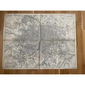
Very beautiful and interesting old map of the city of London from the English post office and dated 1871 Post office In good condition despite the folds, no tears. Paper card mounted on fabric Period [...]
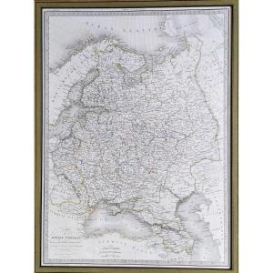
Geographical map. Drawn up by M. Lapie, Lieutenant Colonel
Engraved by Lallemand in Eymery Fruger & Cie, 1830. (Universal Atlas of Geography,Lapie).
61.3 x 46 cm in basin 24 x 18 inches
66.9 x 48[...]
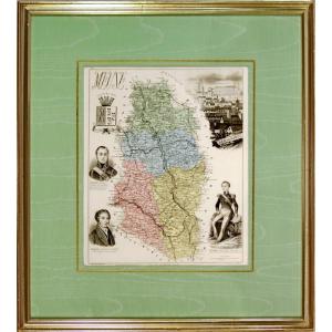
LA MEUSE (55) Departmental map Map from the book "New Illustrated Atlas, France and its Colonies by Migeon, Publisher. Dimension(s): Frame: Length 38 cm – Height 24 cm Width. Strip: 1.5 cm Condition: [...]
Engraving representing the World Exhibition in Paris in 1867, in its original frame from Restoration period.
Engraver: Th Muller
Dimensions: Width 82 cm, Height 53 cm
Without frame: Width 60 cm, [...]
Proantic uses a cookie to analyze traffic and improve its service by using Google Analytics. Data sent to Google Analytics (frequency of visits to the site and pages visited) are anonymous. No other cookie tracks your activity, your personal data is not collected. Thank you for helping us to have better understanding how Proantic is used.

 Le Magazine
 Rivista Artiquariato
 TRÉSORS magazine


