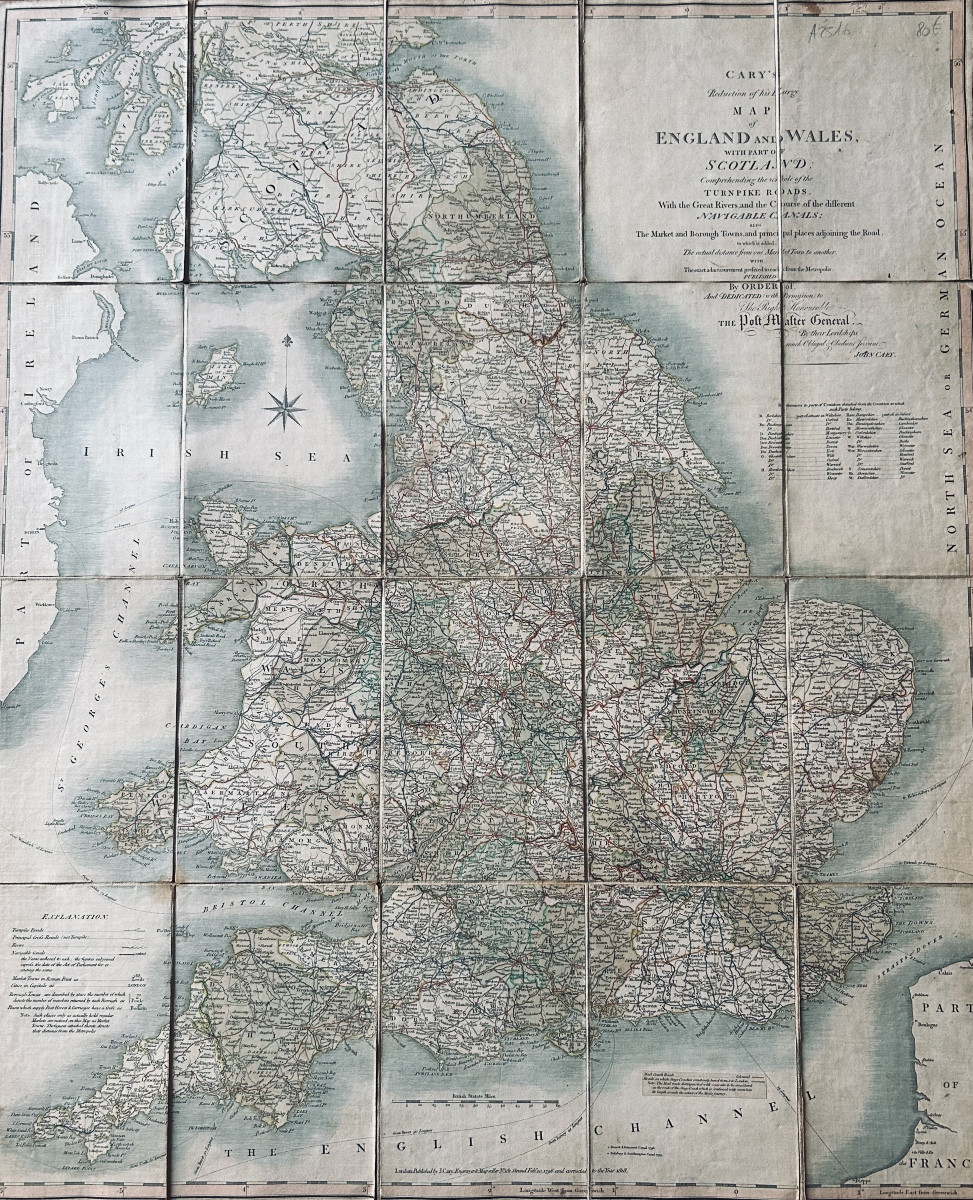
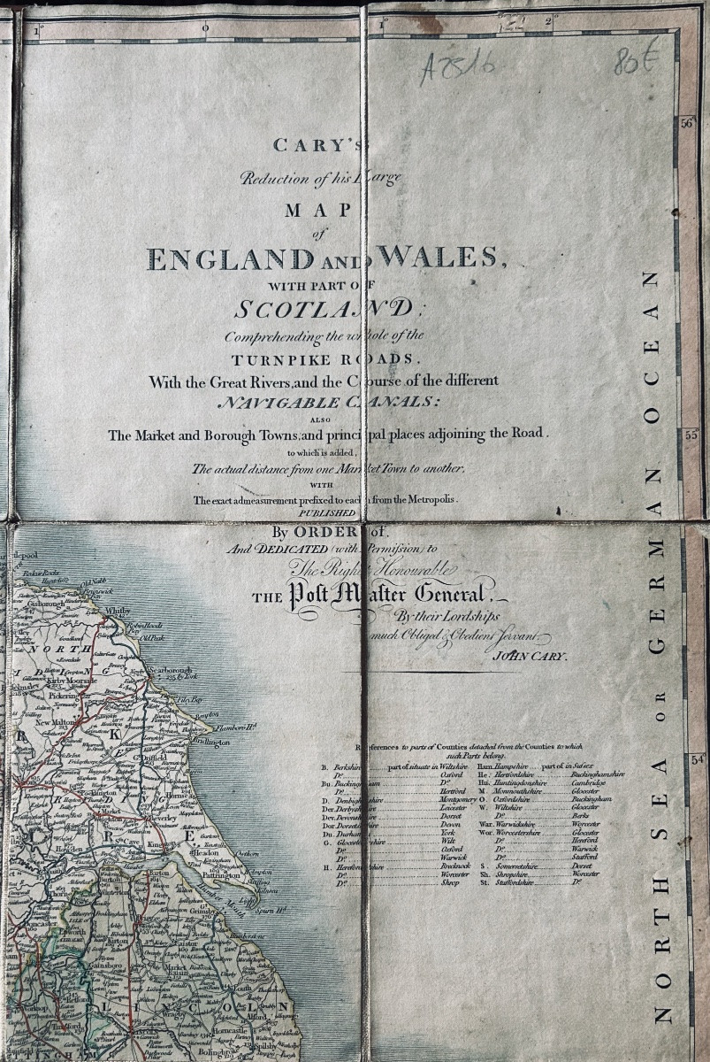
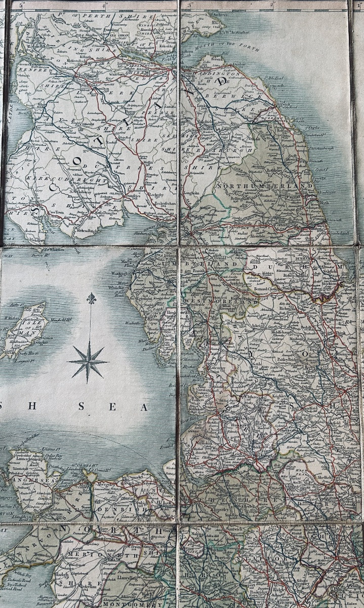
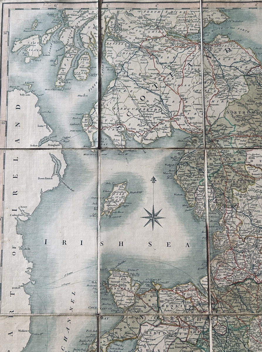
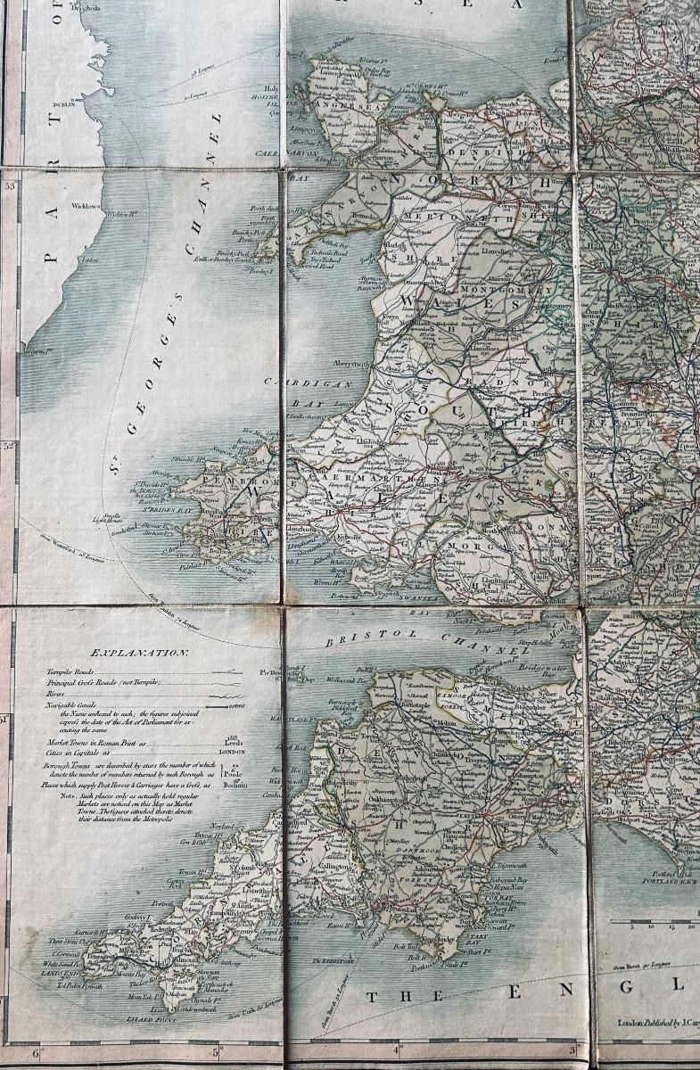
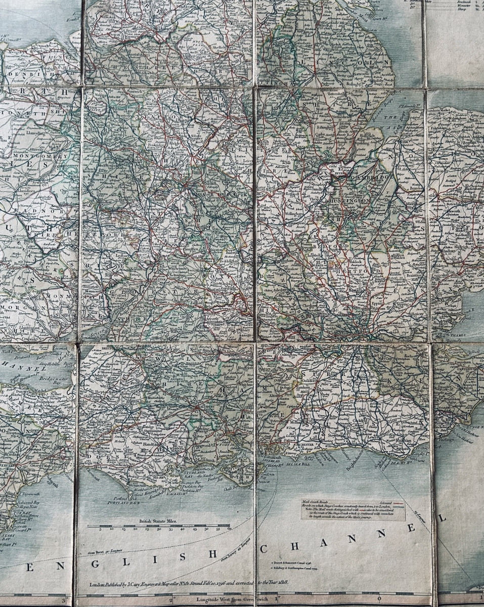

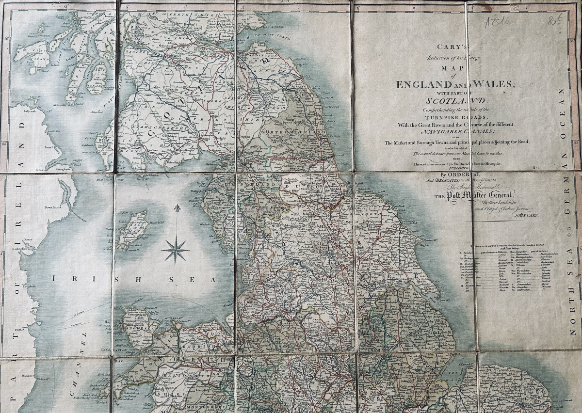

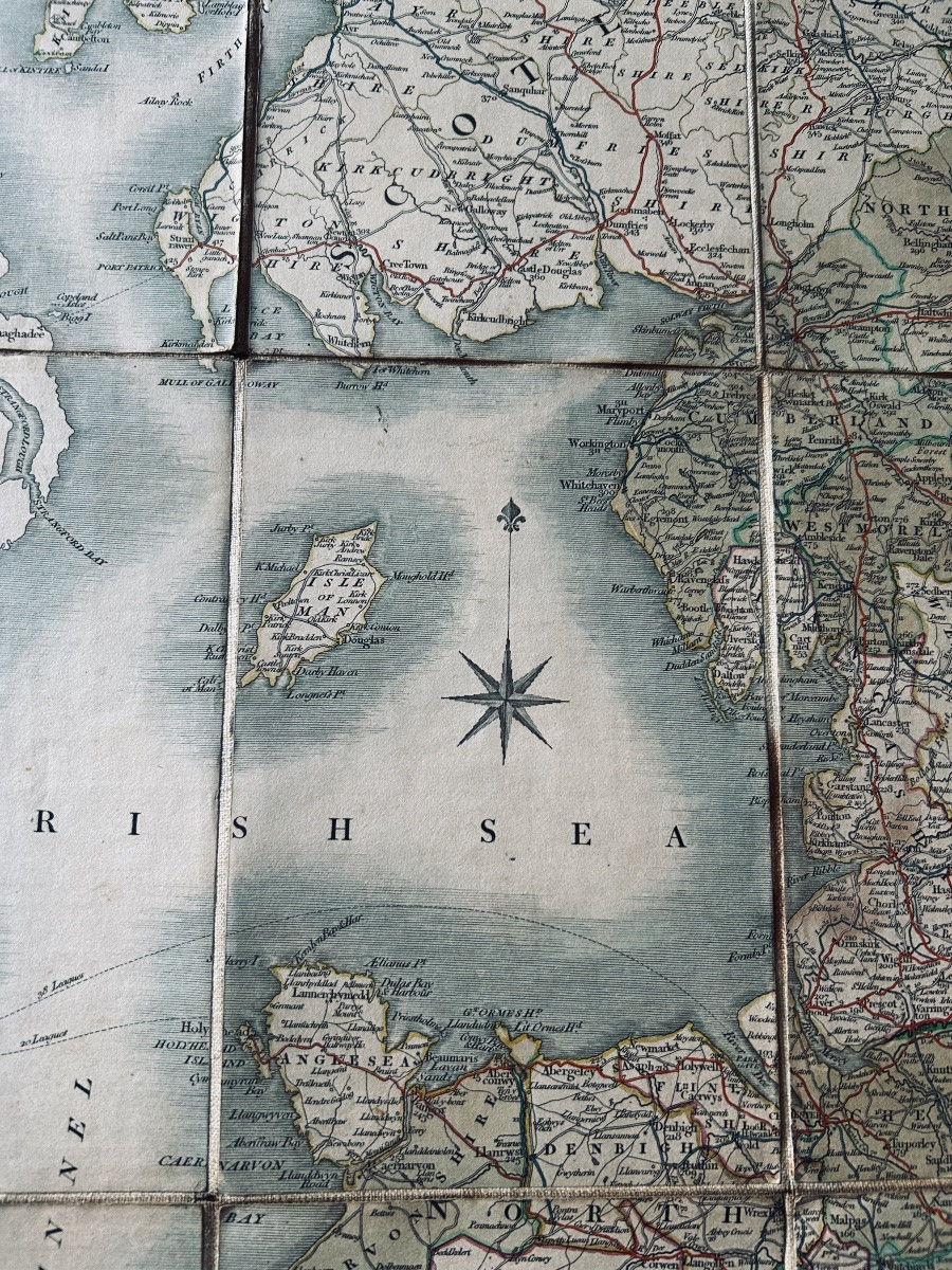
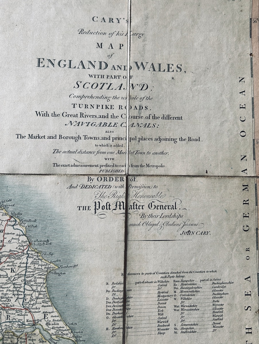


Cary - Cary's Reduction Of His Large Map Of England And Wales With Part Of Scotland. 1818
Artist: Cary (john) - Cary's Reduction Of His Large Map Of England And Wales With Part Of Scotland. Londres, 1818.
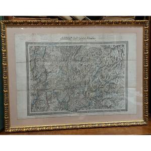
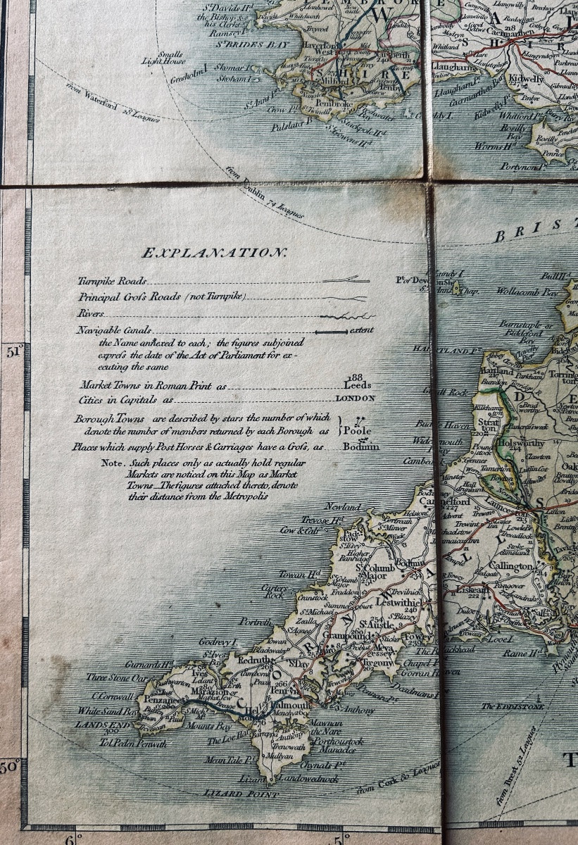
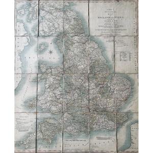
CARY (John) - Cary's reduction of his large map of England and Wales with part of Scotland. Understanding the whole of the Turnpike roads. With the great river and the course of the different navigable canals: the market and borough towns and principal places adjoining the road. London, Engraverk & Mapseller J. Cary, 1818; 760/640 mm, a sheet cut into 20 pieces, and mounted on fabric.
80 €
Period: 19th century
Style: Louis Philippe, Charles 10th
Condition: Excellent condition
Material: Paper
Length: une feuille de format 760/640 mm pliée et marouflée dans un cartonnage de l'époque.
Reference (ID): 1731950
Availability: In stock
Print