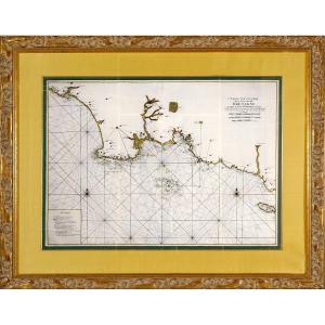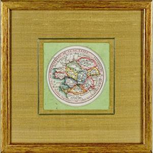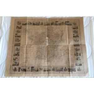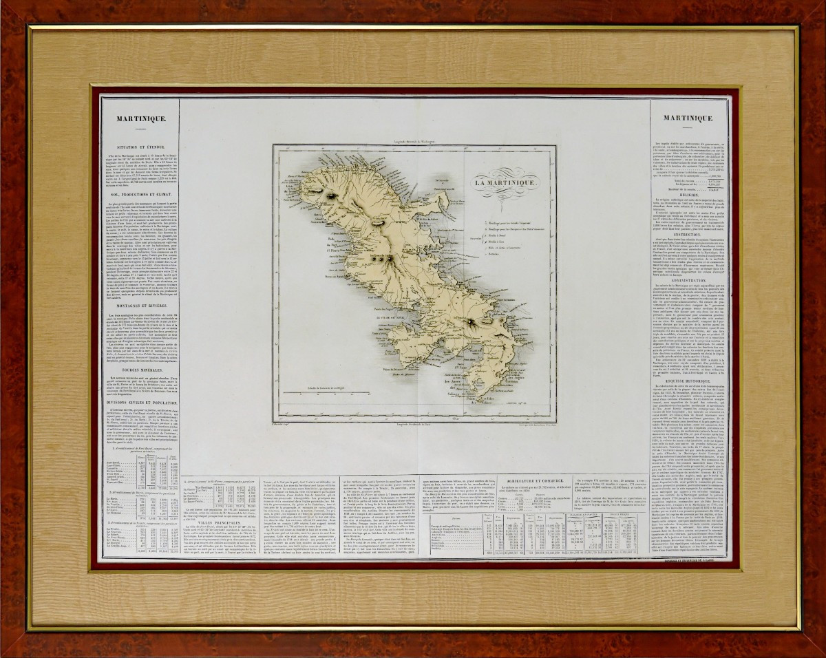


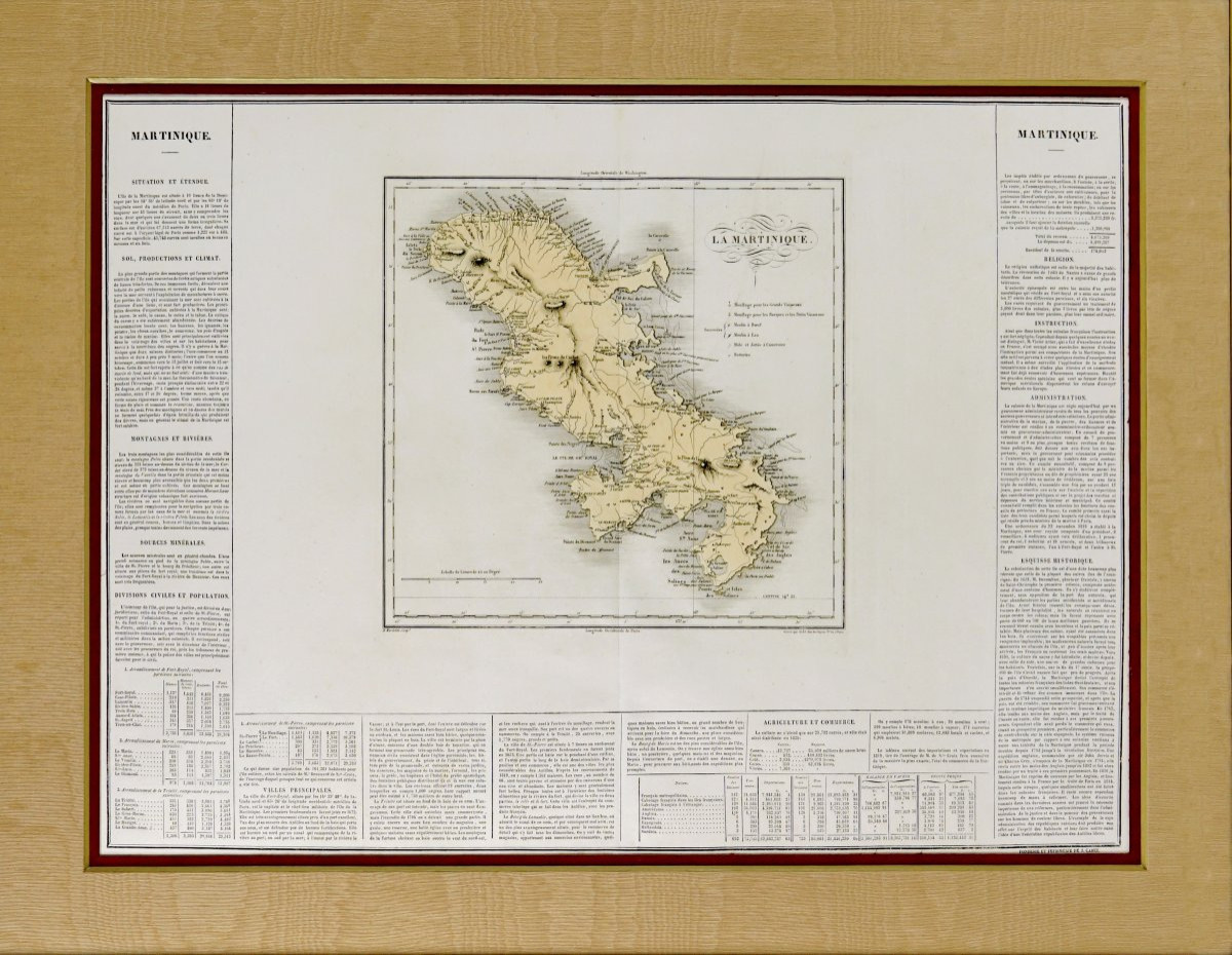


Large Engraving Of Martinique - Mid-19th Century
A VERY BEAUTIFUL and LARGE MAP OF MARTINIQUE, with a clear and legible map in the center, surrounded by economic, administrative, and historical information intended for an informed general public.
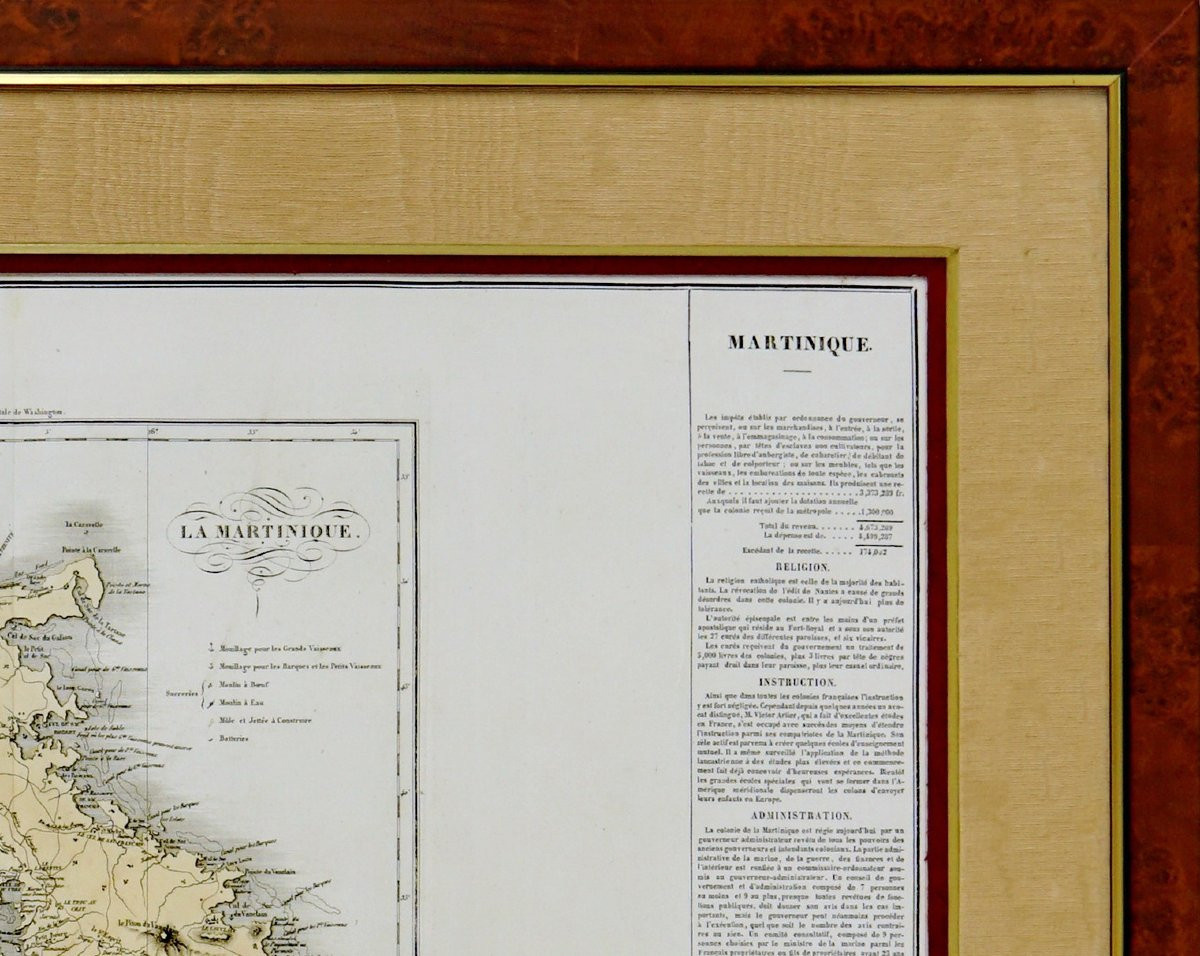
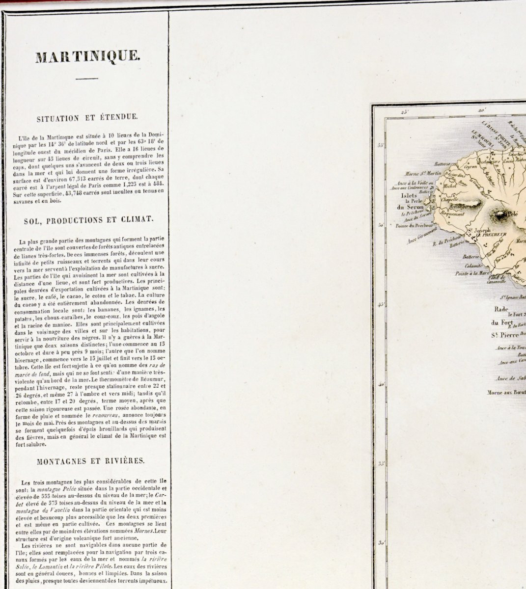
Central map: relief depicted by hatching, hydrographic network, capes and coves, localities (Saint-Pierre, Fort-Royal/Fort-de-France, La Trinité, Le Marin, etc.), major hills/volcanoes (including Mount Pelée), roads and anchorages.
Typographical border (printed on the same sheet) with notes and statistical tables:
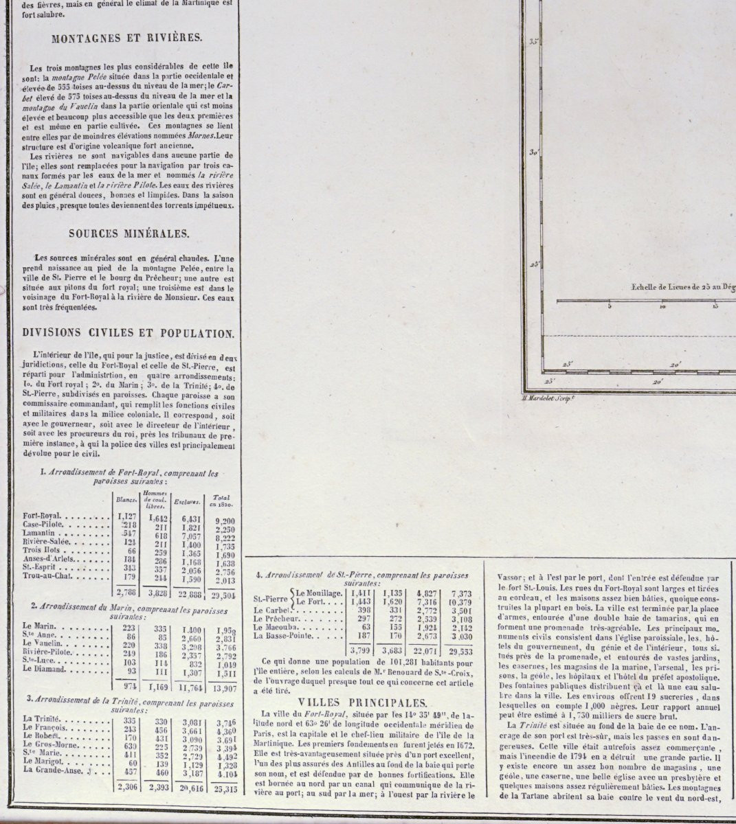
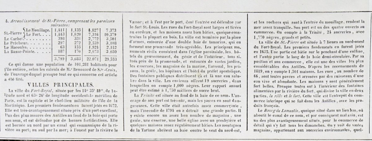
Left: Location and area; Soil, production and climate; Mountains and rivers; Mineral springs; Civil divisions and population.
Bottom: Main cities and tables with figures (population, surface area, etc.); Agriculture and trade (exports, commodities).
Right: Religion; Education; Administration; Historical sketch.
Polychrome highlights, hand-watercolored at the time.
Dimensions: Length 68.5 cm – Height 58.4 cm – Width of the rod 6 cm,
Condition(s): PERFECT CONDITION,
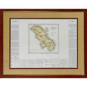
Frame: CURRENT - Old gold bevel - Marie-Louise in light camel color moiré - Walnut burl wood rod with a gold border.
Central map: relief depicted by hatching, hydrographic network, capes and coves, localities (Saint-Pierre, Fort-Royal/Fort-de-France, La Trinité, Le Marin, etc.), major hills/volcanoes (including Mount Pelée), roads and anchorages.
Typographical border (printed on the same sheet) with notes and statistical tables:
Left: Location and area; Soil, production and climate; Mountains and rivers; Mineral springs; Civil divisions and population.
Bottom: Main cities and tables with figures (population, surface area, etc.); Agriculture and trade (exports, commodities).
Right: Religion; Education; Administration; Historical sketch.
Polychrome highlights, hand-watercolored at the time.
Dimensions: Length 68.5 cm – Height 58.4 cm – Width of the rod 6 cm,
Condition(s): PERFECT CONDITION,
Frame: CURRENT - Old gold bevel - Marie-Louise in light camel color moiré - Walnut burl wood rod with a gold border.
780 €
Period: 19th century
Style: Louis Philippe, Charles 10th
Condition: Perfect condition
Material: Paper
Length: 68.5 cm
Height: 58.5 cm
Reference (ID): 1617740
Availability: In stock
Print