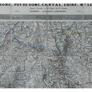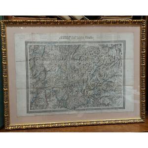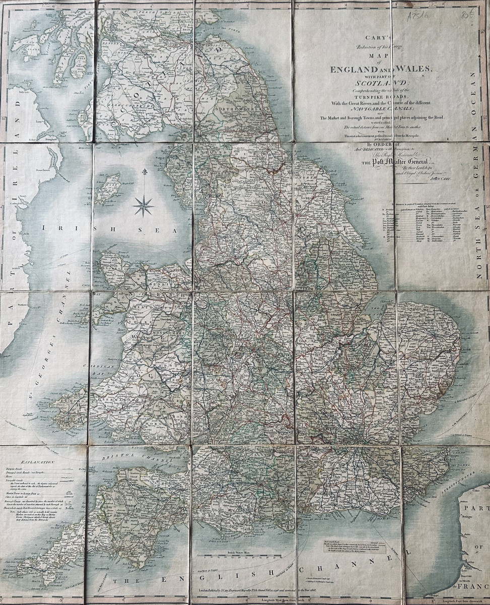
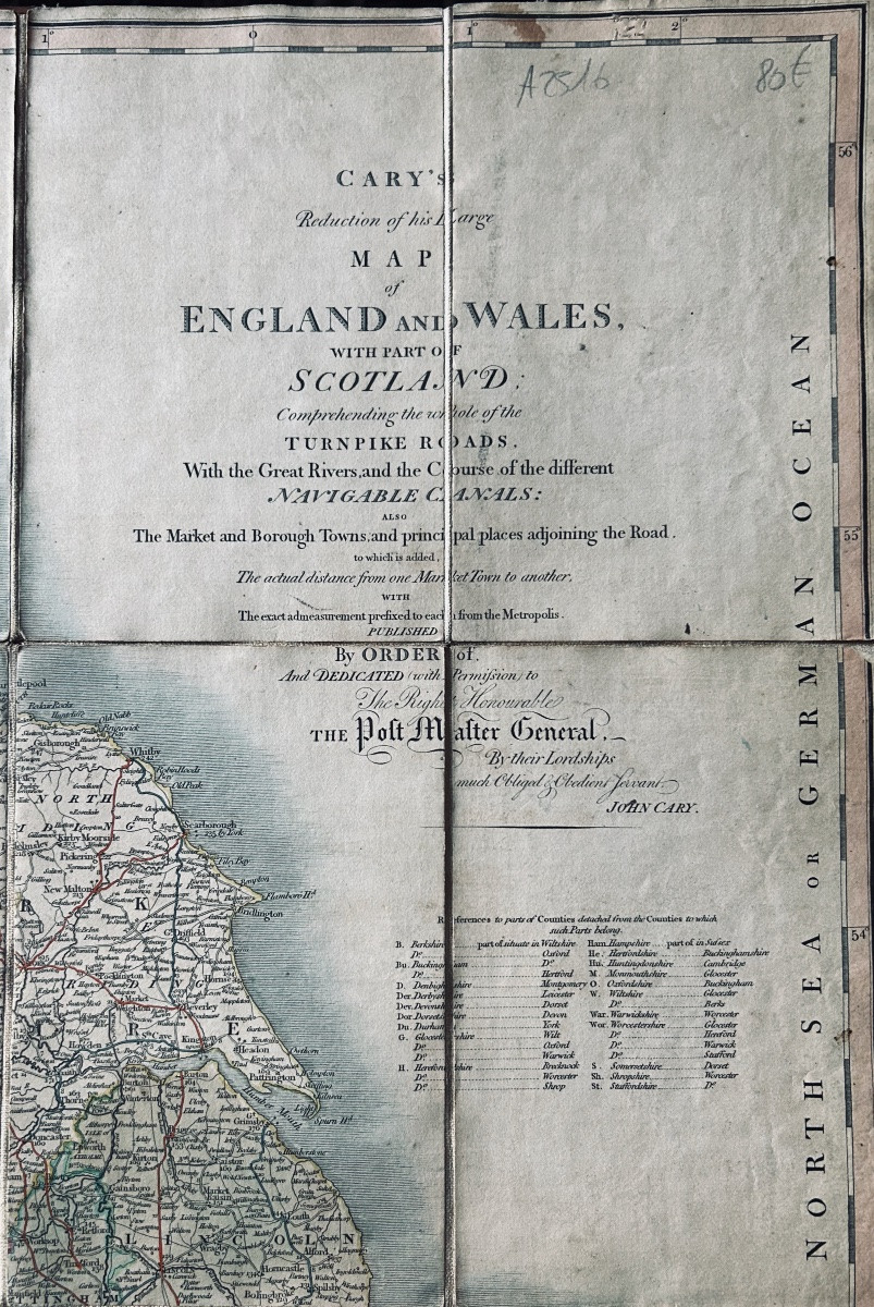
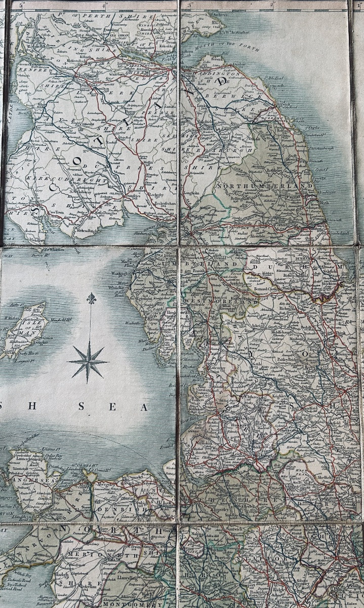
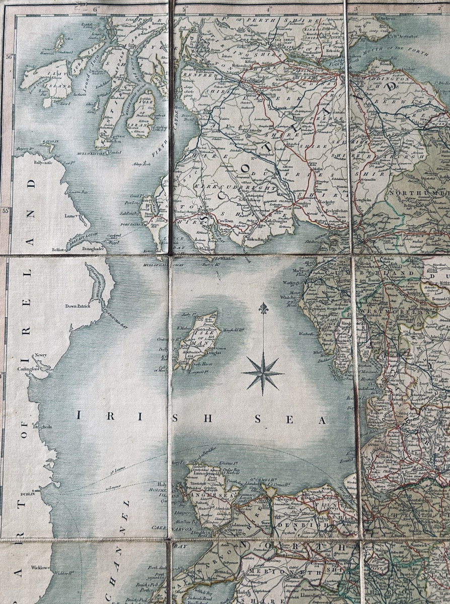
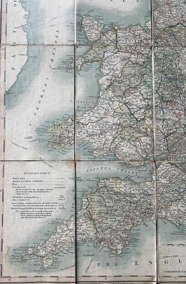
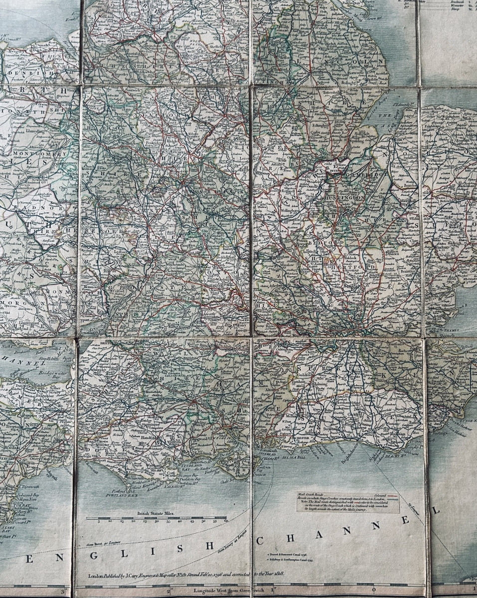

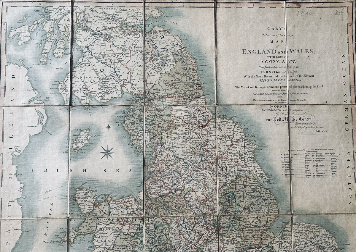

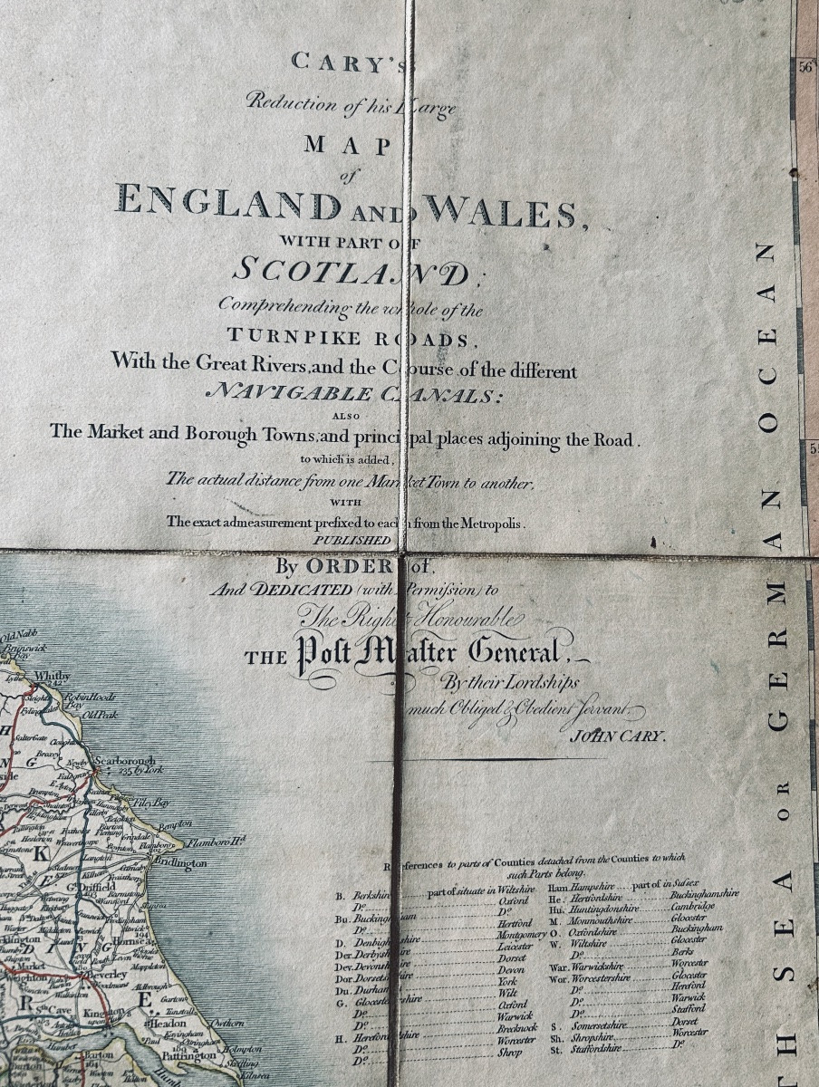
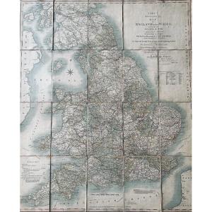


CARY - Cary's reduction of his large map of England and Wales with part of Scotland. 1818.
Artiste : Cary (john) - Cary's Reduction Of His Large Map Of England And Wales With Part Of Scotland. Londres, 1818.
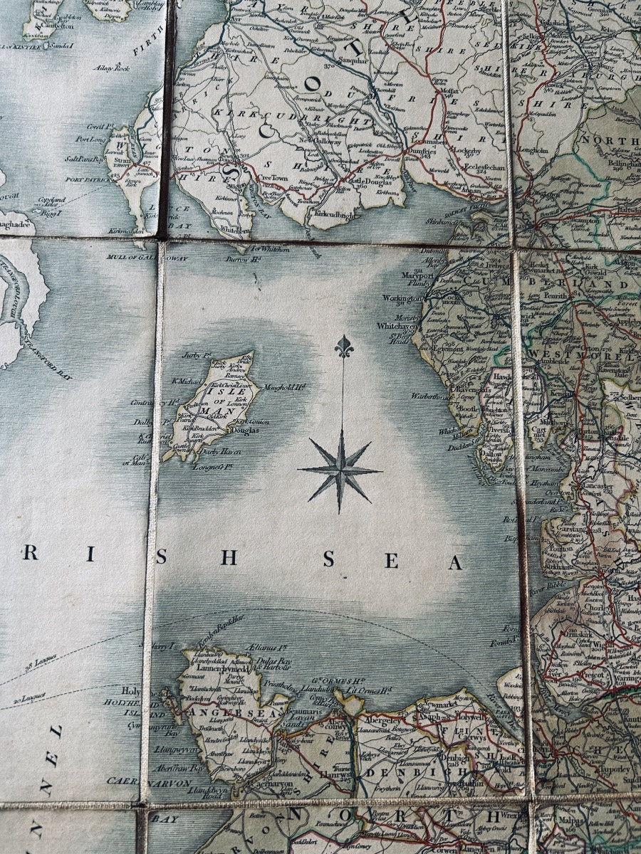
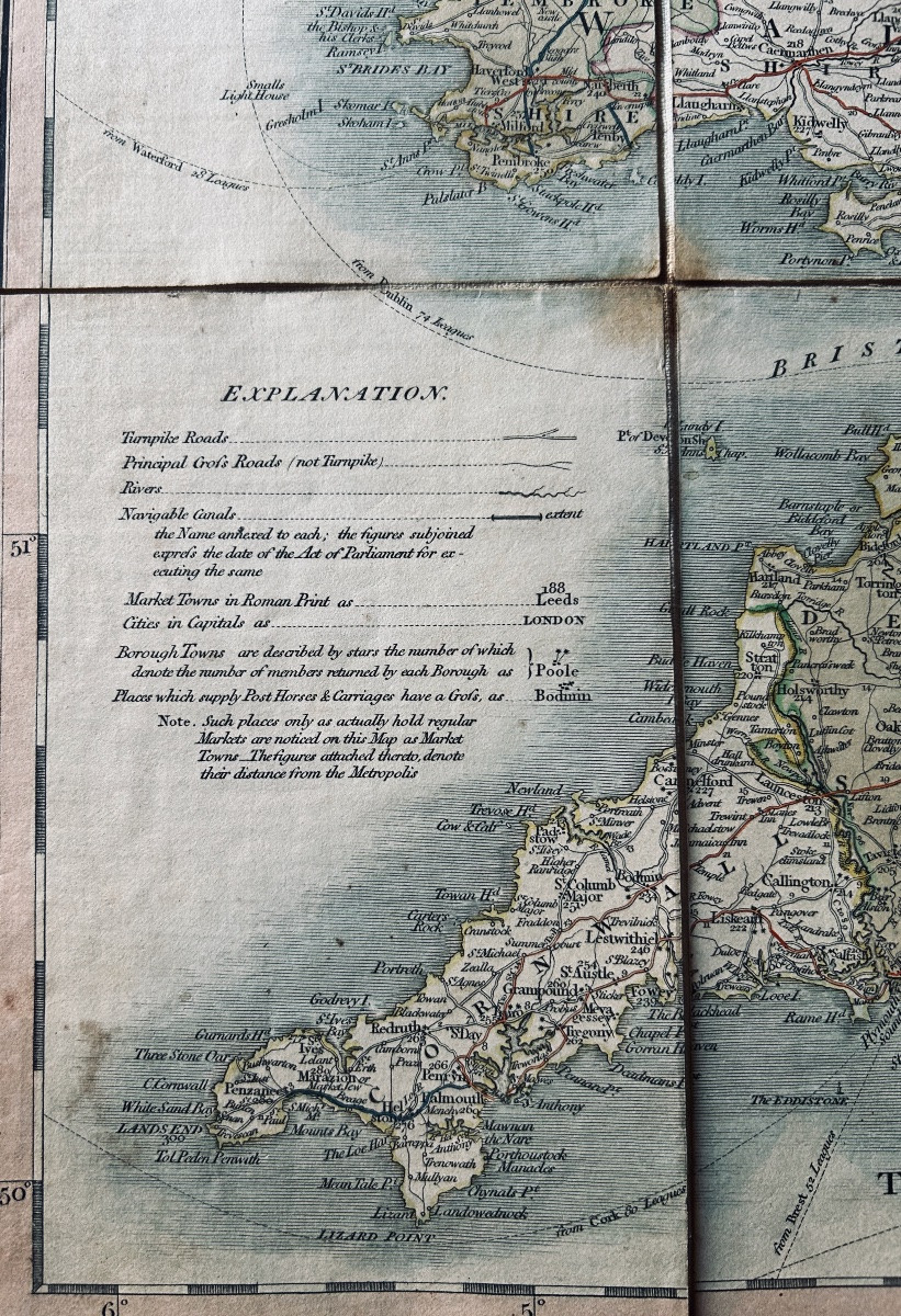
CARY (John) - Cary's reduction of his large map of England and Wales with part of Scotland. Comprehending the whole of the Turnpike roads. With the great river and the course of the different navigables canals : the market and borough towns and principal places adjoining the road. London, Engraverk & Mapseller J. Cary, 1818 ; 760/640 mm, une feuille coupée en 20 morceaux, et marouflé sur tissu.
80 €
Epoque : 19ème siècle
Style : Louis Philippe-Restauration-Charles X
Etat : Très bon état
Matière : Papier
Longueur : une feuille de format 760/640 mm pliée et marouflée dans un cartonnage de l'époque.
Référence (ID) : 1731950
Disponibilité : En stock
Imprimer fiche