THIS OBJECT WAS SOLD
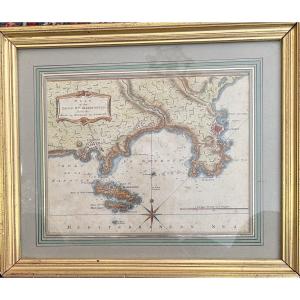
18th-century Framed Map Of Réunion Island, Bourbon By Bellin
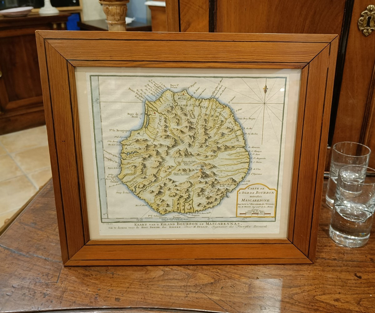
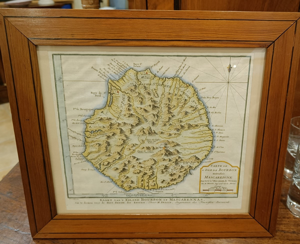
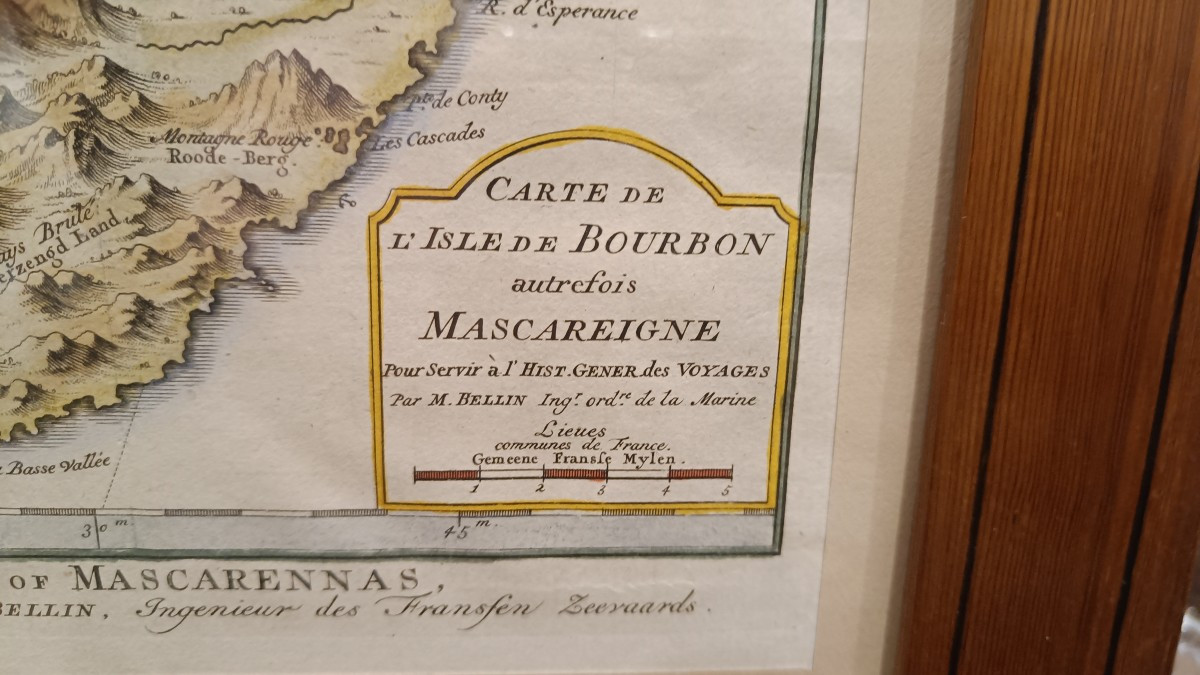
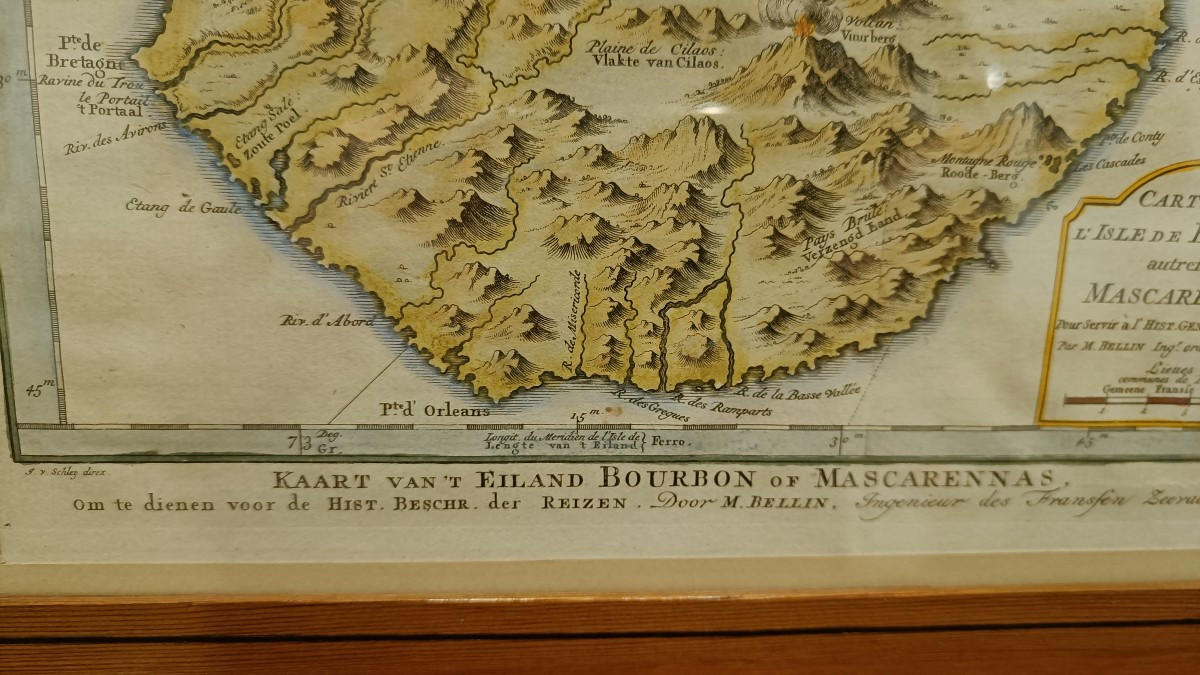
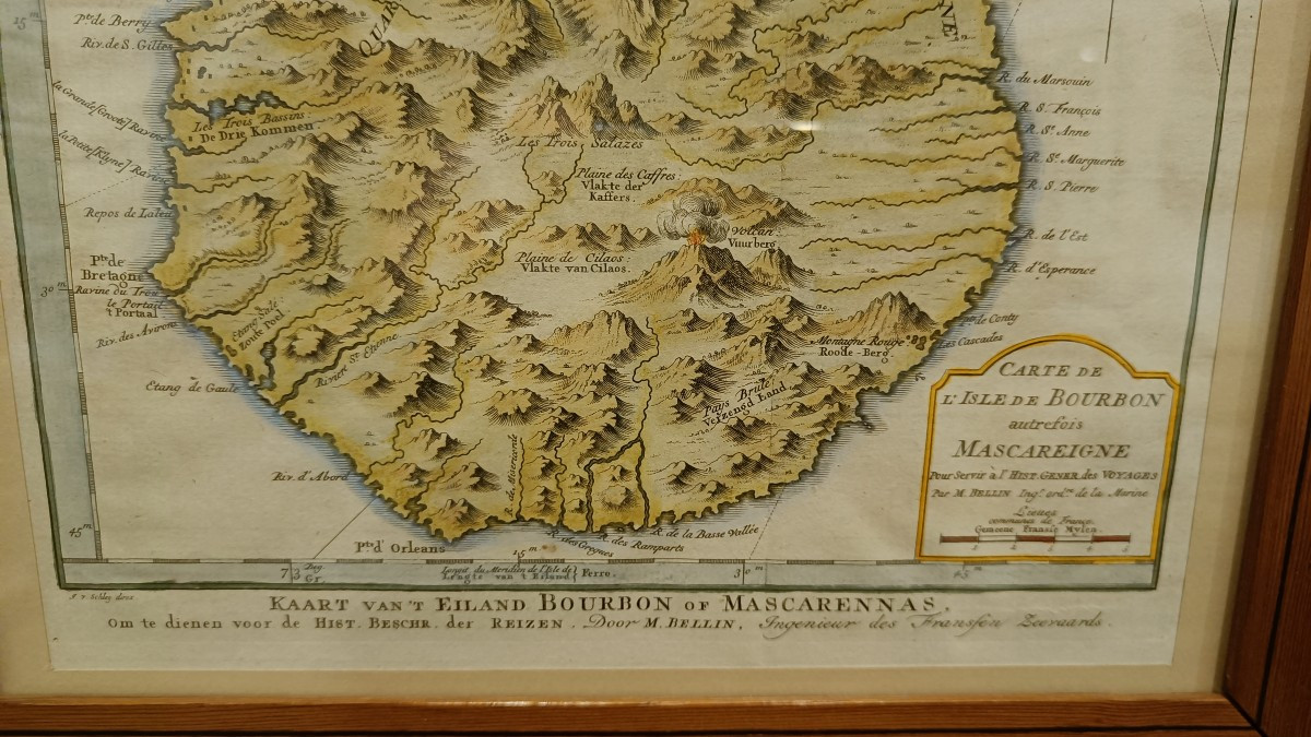
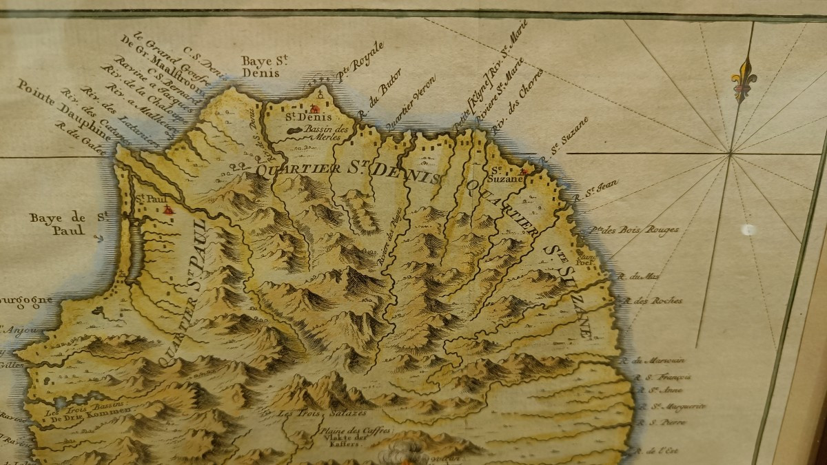
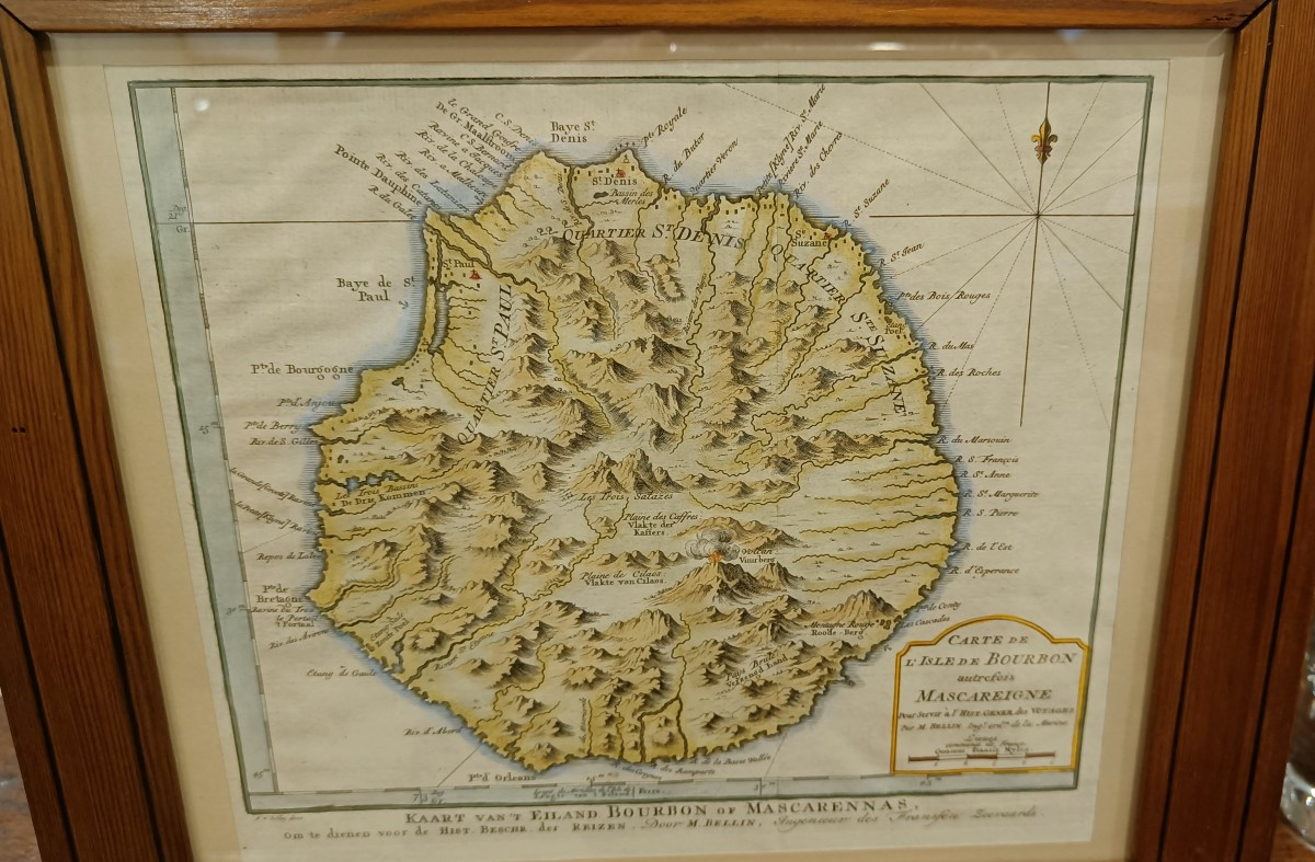
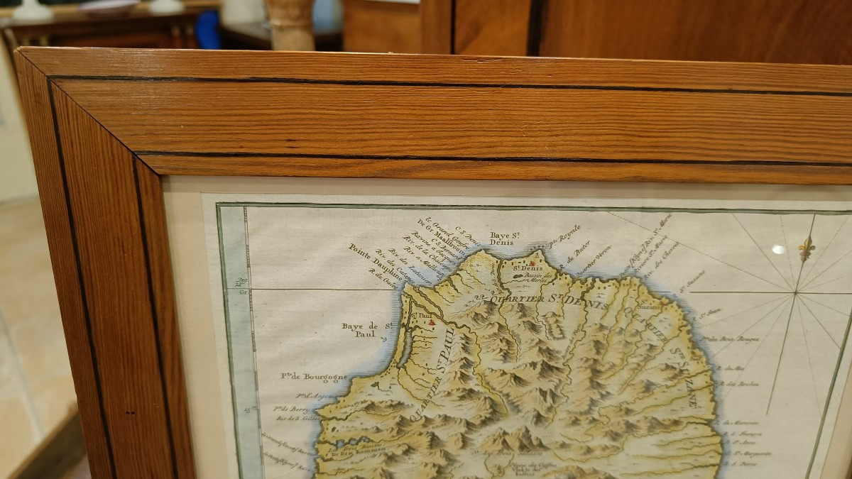


18th-century watercolor map of Bourbon Island, Réunion Island, circa 1750, by Bellin. Beautiful original colors from a Dutch edition with text in French and Dutch. Pitch pine frame with fillet, 35 cm x 31 cm
Explore similar pieces and discover your ideal find:
Old Maps