THIS OBJECT WAS SOLD

Old Handwritten Map 18th Century Dunkirk 1781 North Fortifications

Sold
Old Handwritten Map 18th Century Dunkirk 1781 North Fortifications
Sold
Old Handwritten Map 18th Century Dunkirk 1781 North Fortifications-photo-2
Sold
Old Handwritten Map 18th Century Dunkirk 1781 North Fortifications-photo-3
More pictures
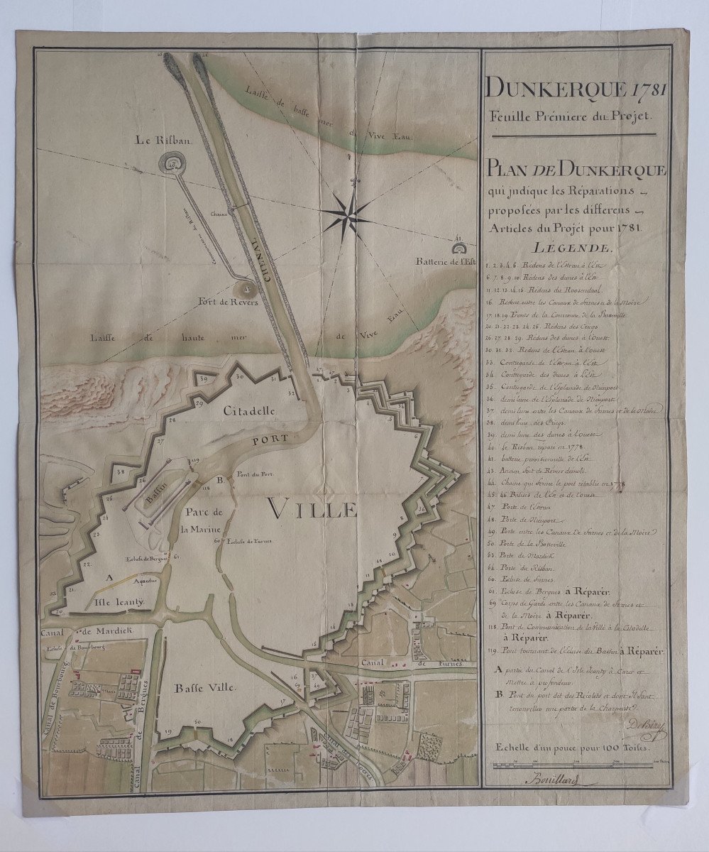
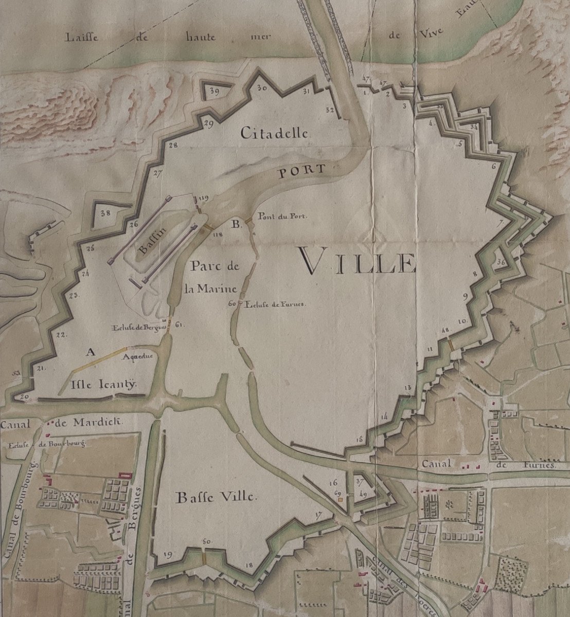
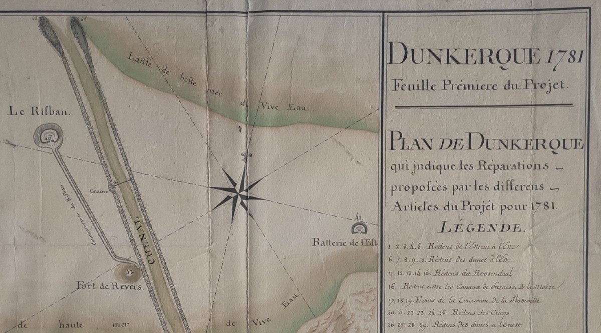
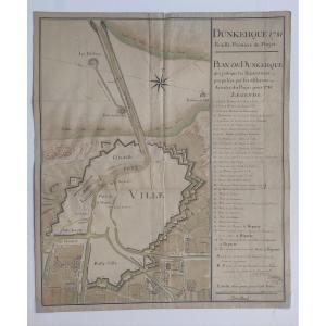
Old handwritten map (18th century): DUNKERQUE 1781, First Sheet of the Project - PLAN OF DUNKERQUE which indicates the Repairs proposed by the various Articles of the Project for 1781. Pen and ink wash. 52.5 x 45 cm. Fold marks. Repair on the back (the sheet was formerly divided into two parts along the vertical fold). Handwritten legend on the right. Scale in toises. (Ref. EB-1375)

Explore similar pieces and discover your ideal find:

Old Maps

Old Geographical Map Of Provence
Map Of Gaul Under The Romans By Adrien-hubert Brué 1820
Old Geographical Map Of Brittany
Framed Optical View Of A XVIIIth Theater
Engraving - Map Of Maine (anjou Touraine) And Its Coat Of Arms - Mid-17th Century
Old Plan Of Cayenne

2 rue de Viarmes
Rennes 35000, France

02 23 42 99 87

06 62 18 96 52

Follow the dealer

CONTACT

SIGN UP TO OUR NEWSLETTER

facebook
instagram

Raphaël Thomas
Old Plan Of Cayenne
966227-main-62b6e0f52b4cb.jpg

02 23 42 99 87

06 62 18 96 52


*We will send you a confirmation email from info@proantic.com .
Please check your messages, including the spam folder.