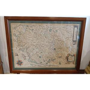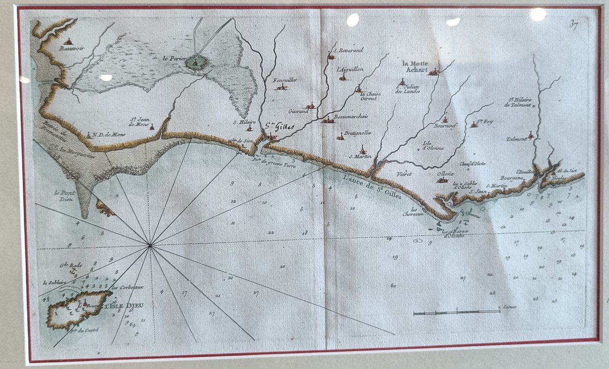
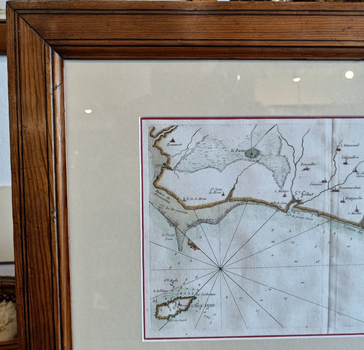
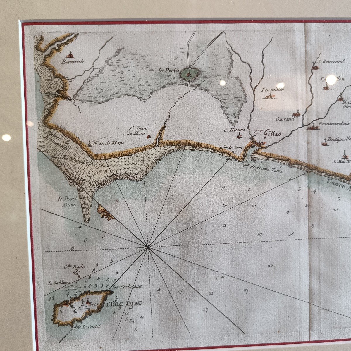
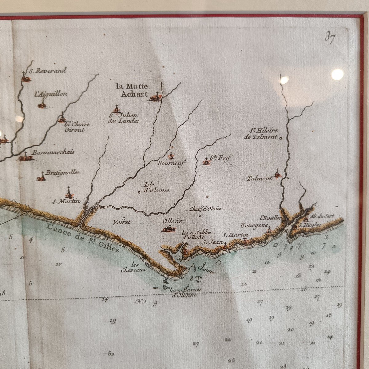
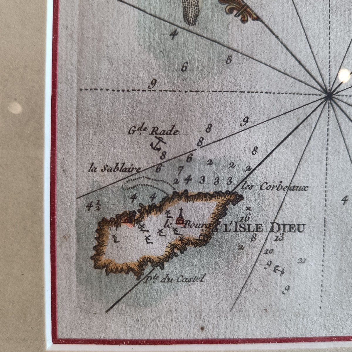
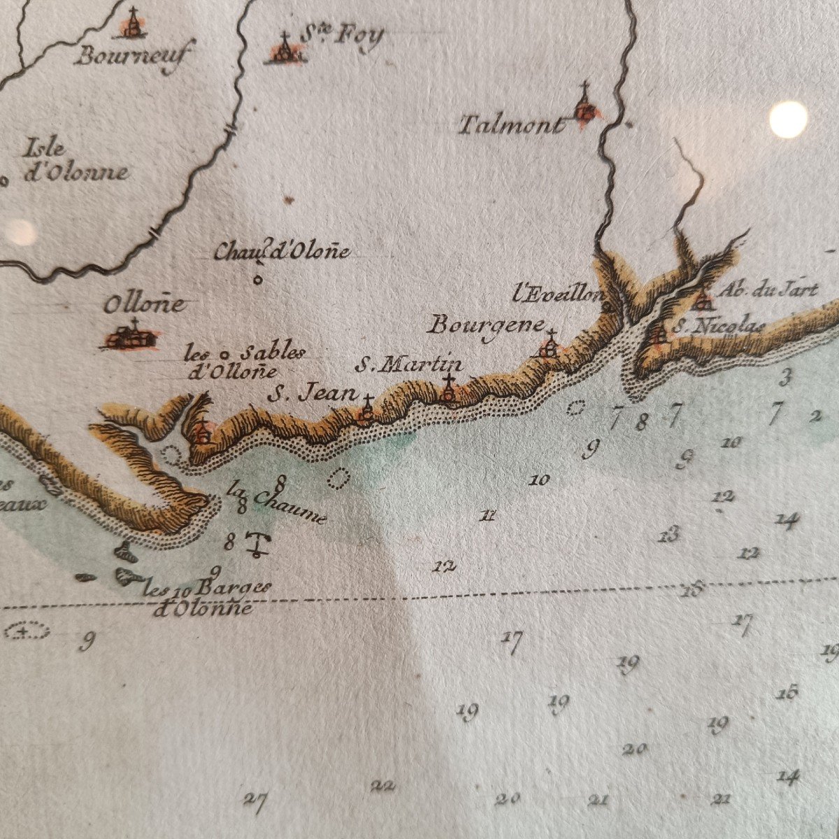
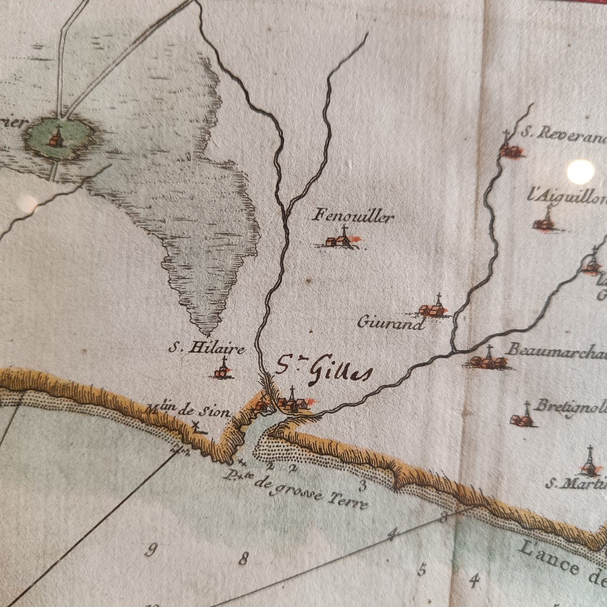
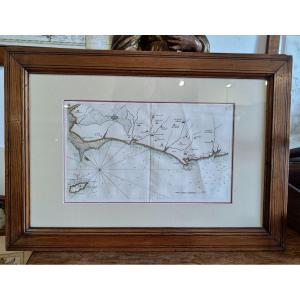


18th Century Watercolor Marine Map Of The Coasts Of Vendée, Ile d'Yeu, St Gilles, Les Sables d'Olonne
Artist: Georges Le Rouge
Marine map of the Côtes de Vendée going from Beauvoir sur Mer to the Abbey of Jard sur Mer with Ile d'Yeu, St Gilles, Olonne. Particularly detailed map at the scale of 2 leagues made by Georges le Rouge, military engineer and geographer of King Louis XV, made in 1757. Beautiful pitchpin frame (55.5 cm x 39 cm)
390 €
Period: 18th century
Style: Other Style
Condition: Excellent condition
Material: Paper
Width: 34 cm
Height: 20 cm
Reference (ID): 1044265
Availability: In stock
Print