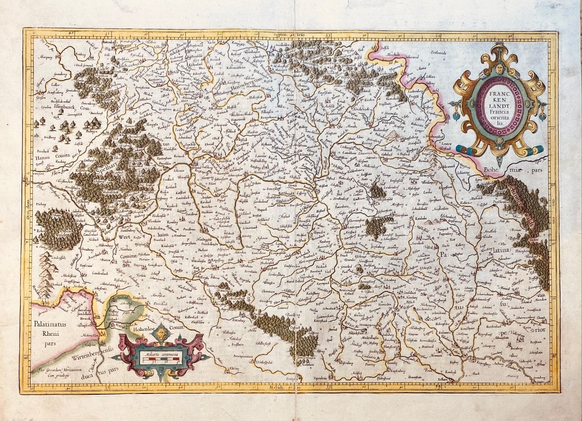


17th Century Card From Mercator: Franckenlandt. Francia Orientalis.
Artist: Mercator Gerardus ( 1512-1594 )
Map showing Franconia with the region of Heidelberg, Eichstätt, Cham and Schmalkalden.
circa 1627
Copper engraving in old color.
On the back, description in Latin.
Mercator, writer, astronomer and mathematician is considered the inventor of the cartographic projection which bears his name and his atlases established his fame. Mercator's sons and grandsons, all cartographers, continued his work and made various contributions to his atlas. The brass cards were bought in 1604 by Jodocus Hondius who, along with his sons, Jodocus II and Henricus, published expanded editions which dominated the card market for the next two decades.
Copper: 338 x 500
Sheet: 400 x 545
180 €
Period: 17th century
Style: Other Style
Condition: Pli médian usuel renforcé, trois courtes déchirures dans les bonnes marges.
Width: 545 mm
Height: 400 mm
Reference (ID): 787265
Availability: In stock
Print