


Dieppe - Normandy - Rare Engraving: Map Of Dieppe - 18th Century
RARE original print, engraved with a burin on wood or steel.
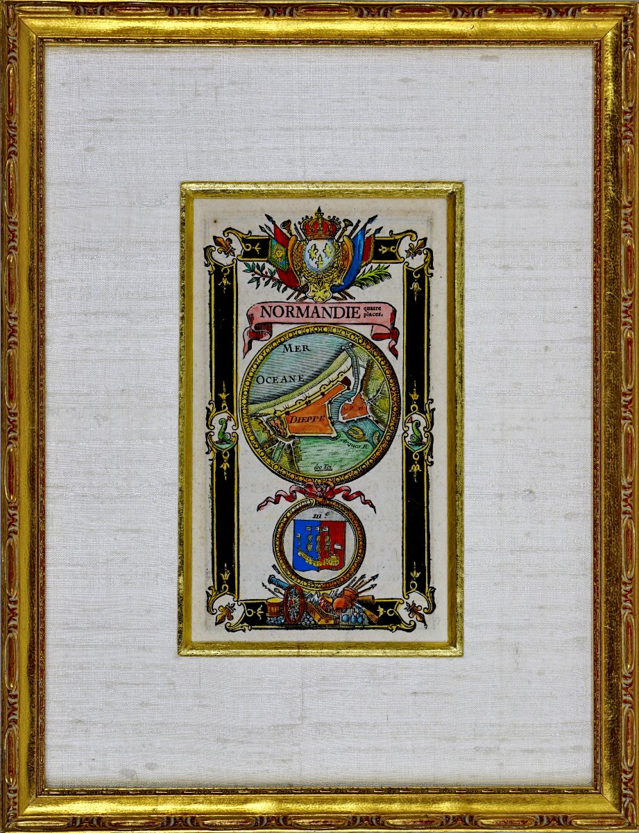
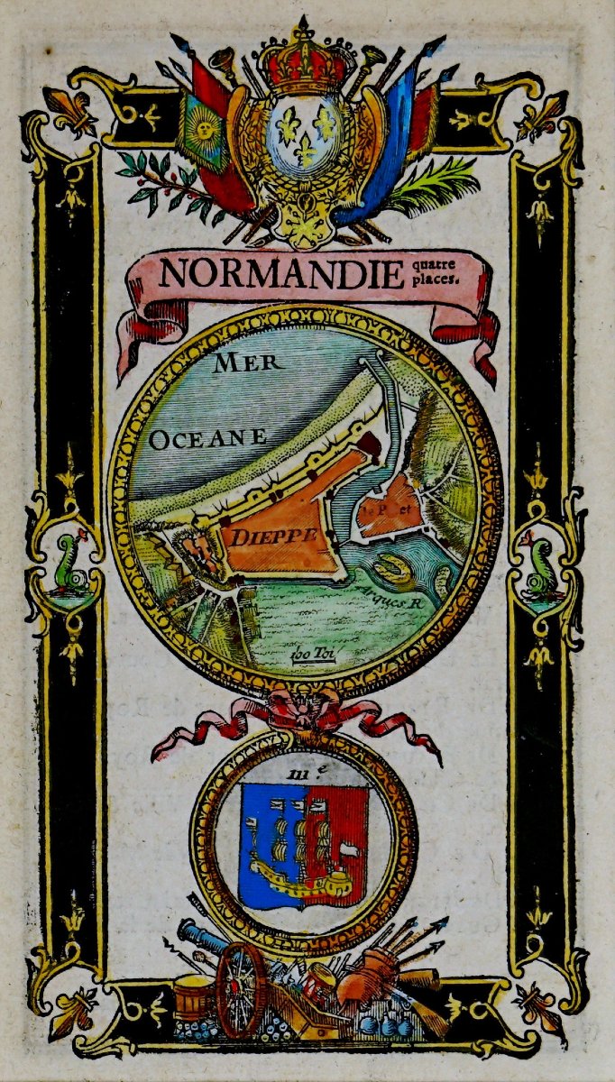
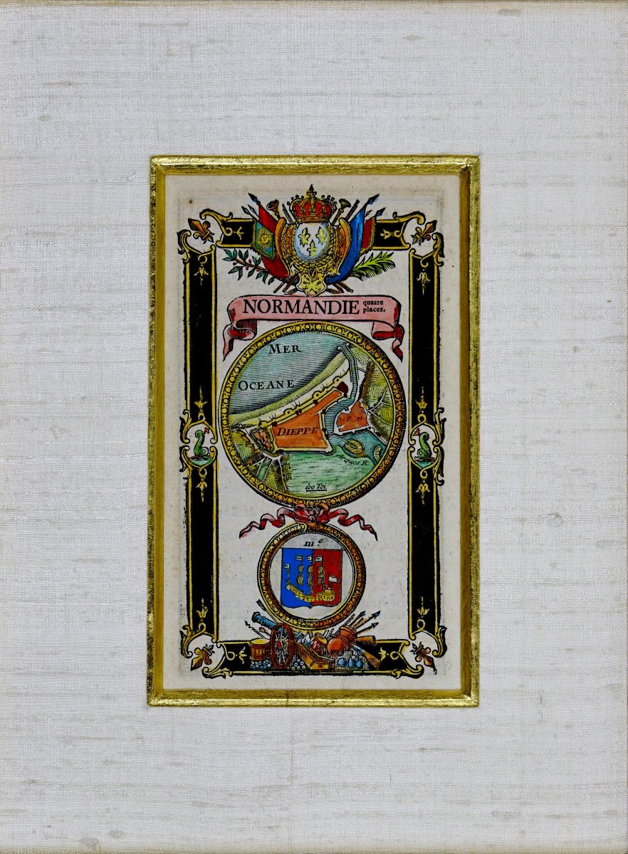
The composition is centered around a central medallion depicting a fortified map of DIEPPE, rendered in a cartographic style, featuring its bastions, defensive structures, and its opening to the sea labeled “Ocean.” Above it, a large ribboned cartouche bearing the inscription “NORMANDIE” is surmounted by a shield bearing three fleurs-de-lis beneath a royal crown, framed by palm leaves and ceremonial ornaments, affirming its affiliation with the Kingdom of France. In the lower part, a second medallion displays the city’s coat of arms, surrounded by military trophies consisting of cannons, drums, flags, and pikes, symbolizing the strategic and defensive role of the stronghold.
The entire design is set within an ornamental frame on a black background, richly decorated with foliage, floral motifs, and grotesque figures at the corners.
Created by Lemau de La Jaisse (1679–1745), a renowned French engraver known for his detailed depictions of fortified towns and military maps in the 18th century.
Hand-colored with watercolors, highlighting the finesse and precision of the linework.
Lemau de Jaisse (1679–1745) was a renowned engraver and cartographer who specialized in depicting plans, cityscapes, and detailed maps of fortifications and strategic cities in the Kingdom of France. His work was produced at a time when the fortification of territories was a major military and political issue, particularly during the reigns of Louis XIV and Louis XV.
His engravings, highly prized at the time, combine exceptional technical precision with a refined aesthetic sensibility. They were often included in military and geographical works, serving both military engineers and the crown’s officers and strategists.
Lemau de Jaisse was particularly renowned for his depictions of fortified cities and strategic coastal strongholds, highlighting the defensive systems of the Ancien Régime. His maps provide precise details of:
- Bastions, ramparts, and fortifications built according to Vauban’s principles.
- Military infrastructure (arsenals, barracks, powder magazines, coastal batteries).
- Access points and transportation routes (roads, bridges, ports, waterways).
His engravings are not merely technical documents; they are also enriched with numerous decorative elements that enhance their artistic value: ornate cartouches with elegant inscriptions. Coats of arms and crests of the cities or provinces depicted. Flags, cannons, cannonballs, drums, and military trophies, symbolizing the defensive and strategic power of the locations depicted.
Lemau de Jaisse’s works are today major historical records of 18th-century urban planning and fortification. They remain sought-after collector’s items, both for their geographical accuracy and their meticulous aesthetic detail.
Dimensions: Height: 28.5 cm – Width: 22 cm – Molding width: 1.5 cm,
Condition: PERFECT CONDITION,
Period: 18th (circa 1736) – LOUIS XV,
Frame: CURRENT - Gold bevel - White raw silk Marie-Louise mat - Wooden frame with patinated water-based gilding.
Lemau de Jaisse’s engravings are both valuable historical documents and true works of decorative art. They bear witness to the strategic importance of fortified towns in the 18th century, while illustrating the expertise of the cartographers and engravers of the time, combining topographic precision, attention to detail, and refined aesthetics.
Period: 18th century
Style: Louis 15th - Transition
Condition: Perfect condition
Material: Paper
Width: 22 cm
Height: 28.5 cm
Reference (ID): 1838834
Availability: In stock