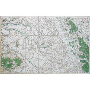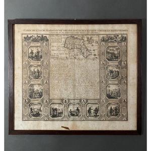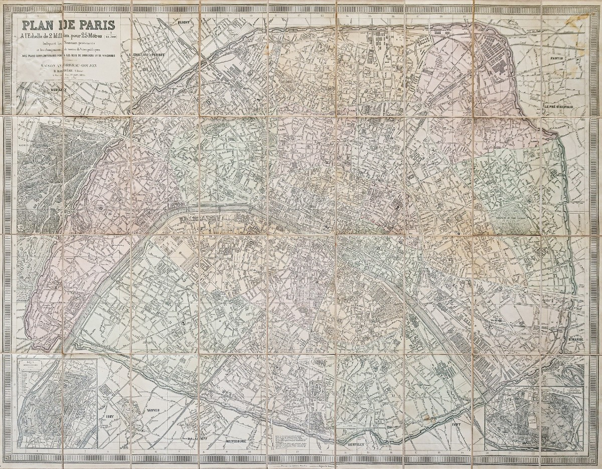
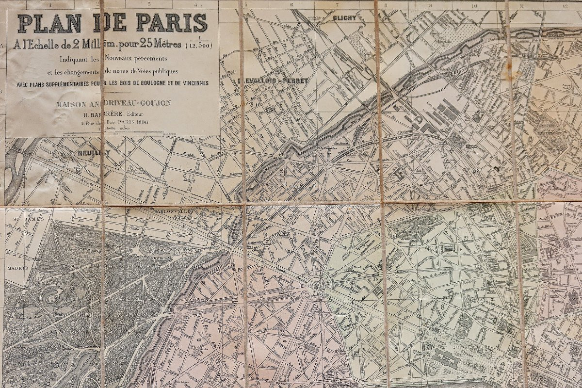
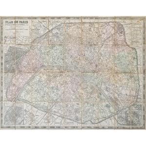


Large Map Of Paris
Epreuve originale réalisée en 1896. Andriveau goujon Editeur.
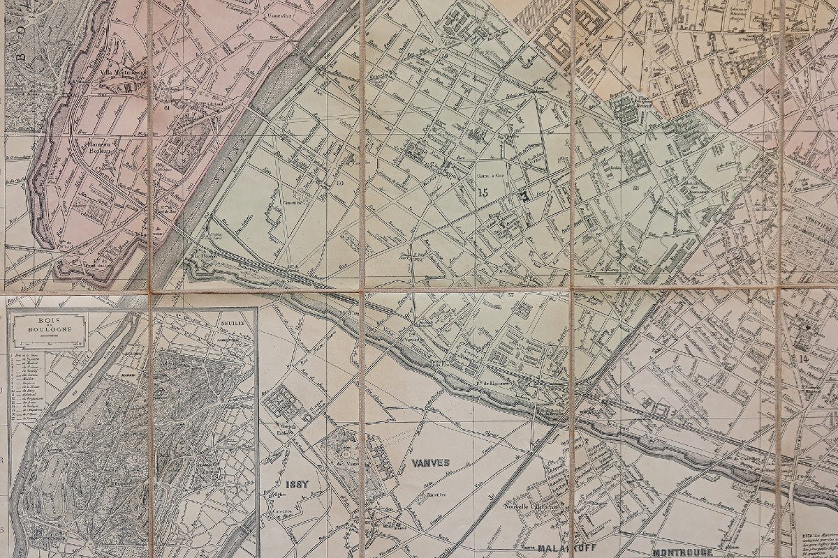
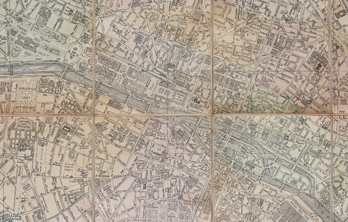
Plan entoilé d’époque monté en 36 sections.
Coloris anciens.
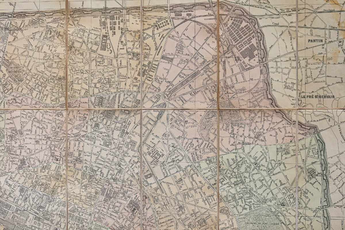
Traces de mouillures anciennes dans le quartier de Pantin.
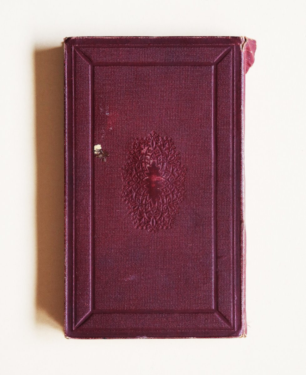
Jacquette de recouvrement fendue dans la partie supérieure du dos.
Bon état.
Format feuille : 106 x 122,5 cm.
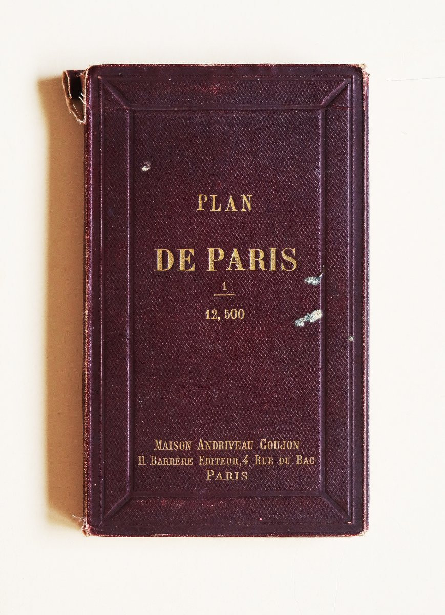
Format replié : 21 x 13 cm.
Original antique plan of 1896.
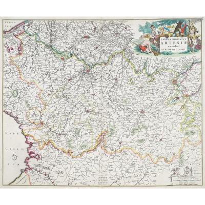
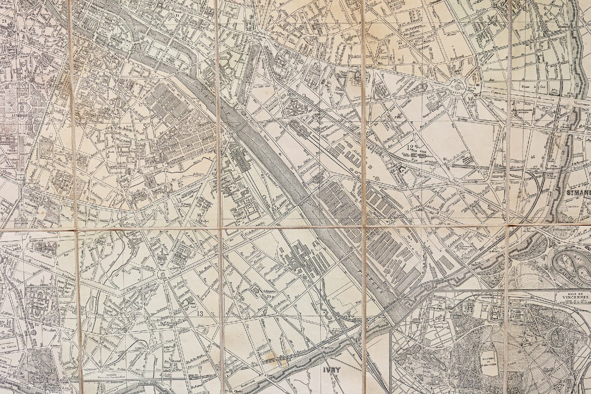
Plan de Paris indiquant les nouveaux percements et les changements de noms des voies publiques. Deux cartouches illustrant le bois de Boulogne et le bois de Vincennes dans les angles inférieurs.
Vous pouvez consulter l’ensemble des cartes, livres et gravures disponibles sur votre région en cliquant sur le lien de notre site internet spécialisé en archives anciennes géographiques :
https://cartes-livres-anciens.com/categorie-produit/cartes-geographiques-anciennes-original-antique-maps/france/paris-plans-maps/
Règlement sécurisé par carte bancaire sur notre site internet en cliquant sur le lien ci-dessous : https://cartes-livres-anciens.com/produit/cartes-geographiques-anciennes-original-antique-maps/france/paris-plans-maps/grand-plan-de-paris/
Toutes nos cartes et gravures sont accompagnées d’un certificat d’authenticité.
Original map produced in 1896. Published by Andriveau Goujon. Contemporary linen-backed map mounted in 36 sections. Original colors. Traces of old damp stains in the Pantin district. Dust jacket split at the top of the spine. Good condition. Sheet size: 106 x 122.5 cm. Folded size: 21 x 13 cm. Original antique map of 1896. Map of Paris showing new road openings and changes in street names. Two cartouches illustrating the Bois de Boulogne and the Bois de Vincennes are located in the lower corners. You can view all the maps, books, and engravings available for your region by clicking on the link to our website specializing in antique geographical archives: https://cartes-livres-anciens.com/categorie-produit/cartes-geographiques-anciennes-original-antique-maps/france/paris-plans-maps/ Secure payment by credit card is available on our website by clicking on the link below: https://cartes-livres-anciens.com/produit/cartes-geographiques-anciennes-original-antique-maps/france/paris-plans-maps/grand-plan-de-paris/ All our maps and engravings come with a certificate of authenticity.
Plan entoilé d’époque monté en 36 sections.
Coloris anciens.
Traces de mouillures anciennes dans le quartier de Pantin.
Jacquette de recouvrement fendue dans la partie supérieure du dos.
Bon état.
Format feuille : 106 x 122,5 cm.
Format replié : 21 x 13 cm.
Original antique plan of 1896.
Plan de Paris indiquant les nouveaux percements et les changements de noms des voies publiques. Deux cartouches illustrant le bois de Boulogne et le bois de Vincennes dans les angles inférieurs.
Vous pouvez consulter l’ensemble des cartes, livres et gravures disponibles sur votre région en cliquant sur le lien de notre site internet spécialisé en archives anciennes géographiques :
https://cartes-livres-anciens.com/categorie-produit/cartes-geographiques-anciennes-original-antique-maps/france/paris-plans-maps/
Règlement sécurisé par carte bancaire sur notre site internet en cliquant sur le lien ci-dessous : https://cartes-livres-anciens.com/produit/cartes-geographiques-anciennes-original-antique-maps/france/paris-plans-maps/grand-plan-de-paris/
Toutes nos cartes et gravures sont accompagnées d’un certificat d’authenticité.
Original map produced in 1896. Published by Andriveau Goujon. Contemporary linen-backed map mounted in 36 sections. Original colors. Traces of old damp stains in the Pantin district. Dust jacket split at the top of the spine. Good condition. Sheet size: 106 x 122.5 cm. Folded size: 21 x 13 cm. Original antique map of 1896. Map of Paris showing new road openings and changes in street names. Two cartouches illustrating the Bois de Boulogne and the Bois de Vincennes are located in the lower corners. You can view all the maps, books, and engravings available for your region by clicking on the link to our website specializing in antique geographical archives: https://cartes-livres-anciens.com/categorie-produit/cartes-geographiques-anciennes-original-antique-maps/france/paris-plans-maps/ Secure payment by credit card is available on our website by clicking on the link below: https://cartes-livres-anciens.com/produit/cartes-geographiques-anciennes-original-antique-maps/france/paris-plans-maps/grand-plan-de-paris/ All our maps and engravings come with a certificate of authenticity.
450 €
Period: 19th century
Style: Other Style
Condition: Good condition
Material: Paper
Reference (ID): 1723580
Availability: In stock
Print