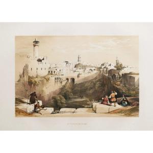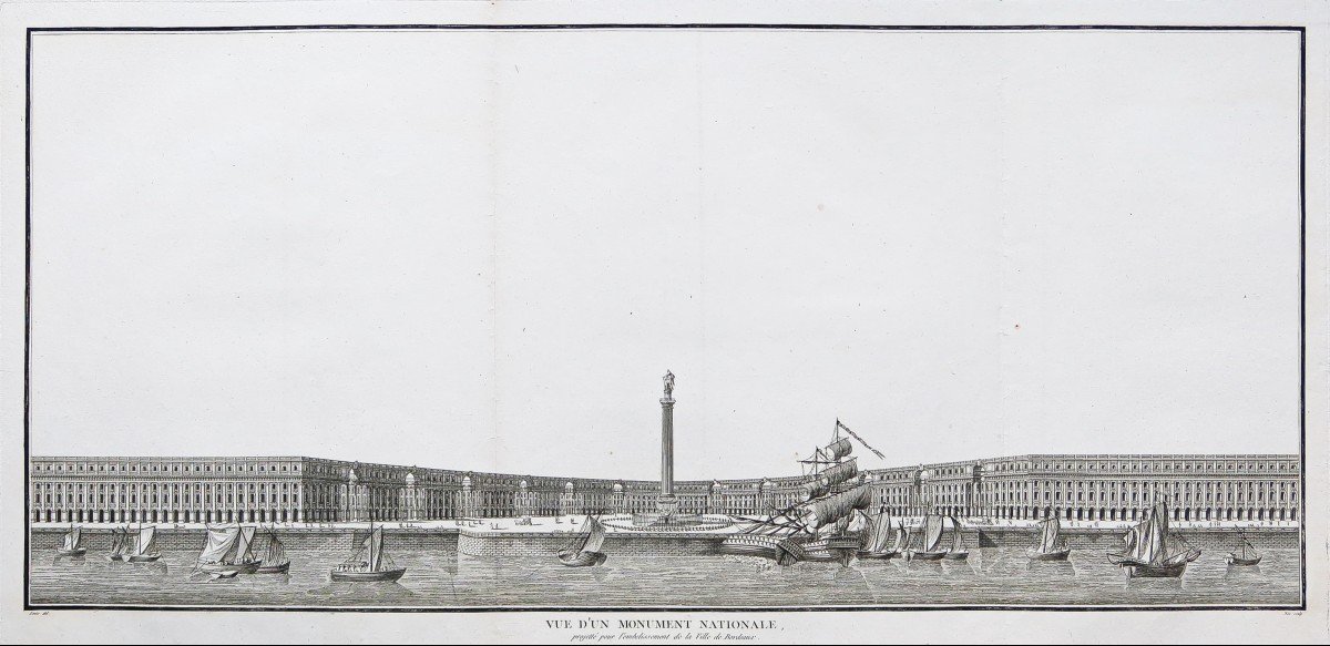

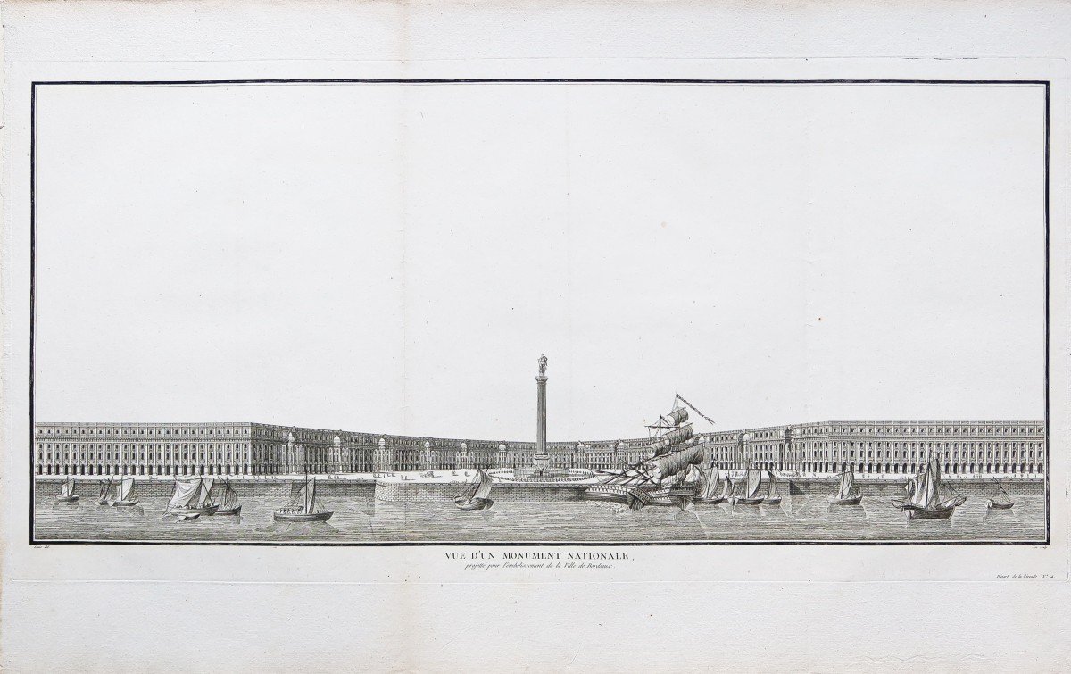


Panorama Of The City Of Bordeaux
Vue d’un monument National, projeté pour l’embellissement de la ville de Bordeaux.
Epreuve originale réalisée en 1785. Née graveur et Louis dessinateur.
Fines traces de plis latéraux d’origine.
Excellent état
Format feuille: 85 x 54,5 cm.
Format gravure: 83,5 x 41 cm.
Vous pouvez consulter l’ensemble des cartes et gravures disponibles sur votre région en cliquant sur le lien de notre site internet spécialisé en archives anciennes géographiques:
Règlement sécurisé par carte bancaire sur notre site internet en cliquant sur le lien:
https://cartes-livres-anciens.com/produit/cartes-geographiques-anciennes-original-antique-maps/france/aquitaine-guyenne-gascogne-perigord/panorama-de-la-ville-de-bordeaux/
Toutes nos cartes et gravures sont accompagnées d’un certificat d’authenticité.
https://cartes-livres-anciens.com/categorie-produit/cartes-geographiques-anciennes-original-antique-maps/france/aquitaine-guyenne-gascogne-perigord/
La plus somptueuse iconographie sur les villes de France réalisée au 18èmesiècle par Laborde.Huit années, entre 1781 et 1789, furent nécessaires pour l’édition de cette œuvre monumentale. Cette collection de gravures parue en livraisons, fut dessinée et gravée par les meilleurs artistes du moment: Tavernier, Meunier, d’Aubigny, Lallemand, Moreau le Jeune ect…
View of a National monument, planned for the beautification of the city of Bordeaux. Original proof produced in 1785. Born engraver and Louis designer. Thin traces of the original side folds. Excellent condition Sheet size: 85 x 54.5 cm. Engraving format: 83.5 x 41 cm. You can consult all the maps and engravings available in your region by clicking on the link of our website specializing in ancient geographic archives: Secure payment by bank card on our website by clicking on the link: https: // maps- livres-anciens.com/produit/cartes-geographique-anciennes-original-antique-maps/france/aquitaine-guyenne-gascogne-perigord/panorama-de-la-ville-de-bordeaux/ All our maps and engravings are accompanied by 'a certificate of authenticity. https://cartes-livres-anciens.com/categorie-produit/cartes-geographique-anciennes-original-antique-maps/france/aquitaine-guyenne-gascogne-perigord/ The most sumptuous iconography on the cities of France produced in the 18th century century by Laborde. Eight years, between 1781 and 1789, were necessary for the publication of this monumental work. This collection of engravings published in deliveries, was drawn and engraved by the best artists of the moment: Tavernier, Meunier, d'Aubigny, Lallemand, Moreau le Jeune ect…
750 €
Period: 18th century
Style: Other Style
Condition: Excellent condition
Material: Paper
Reference (ID): 831189
Availability: In stock
Print