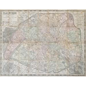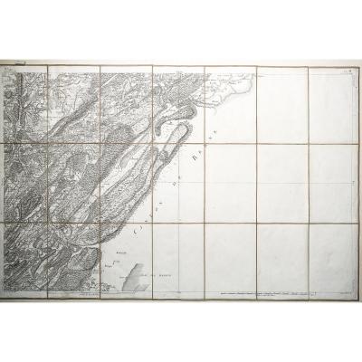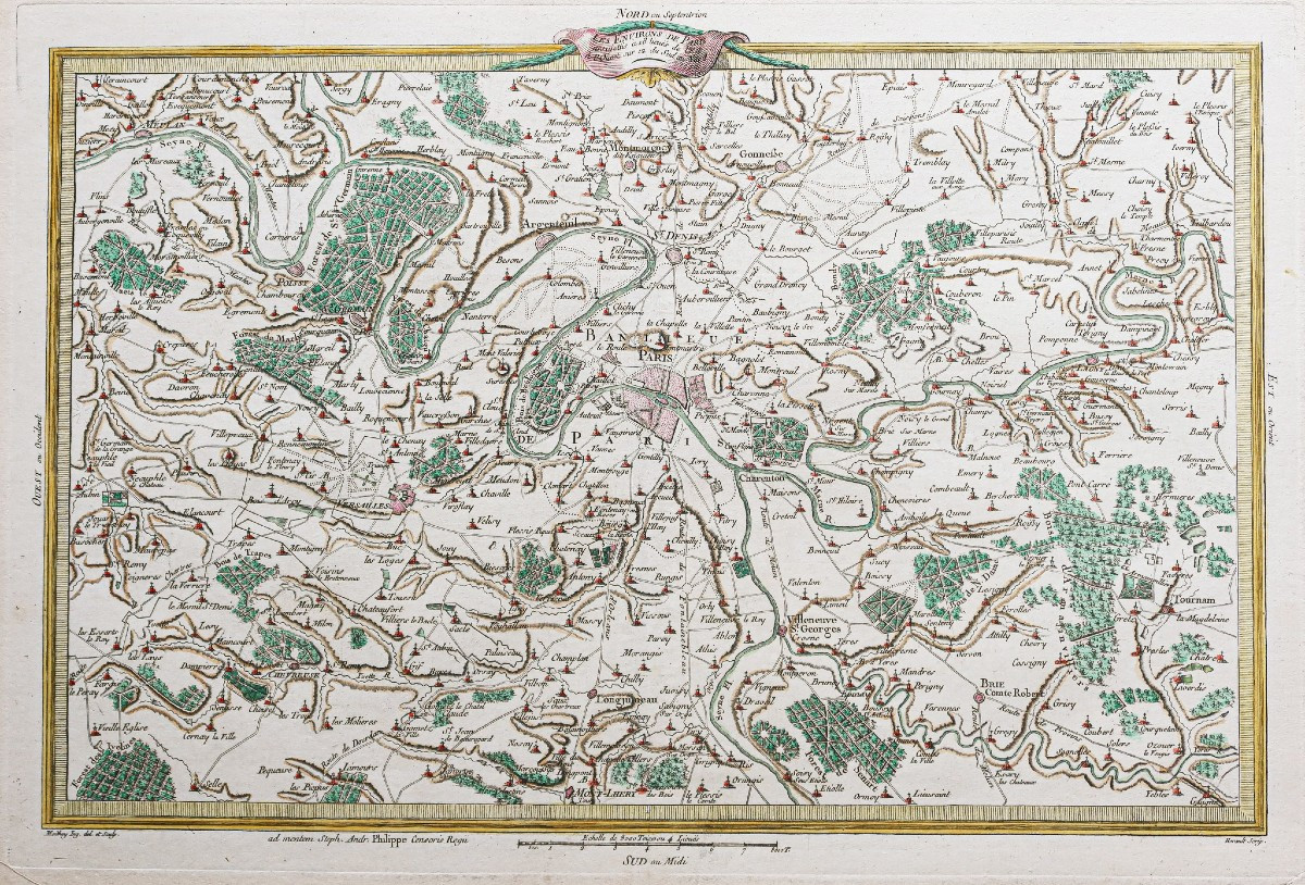


Old Map Of Paris And Its Surroundings
Original print made in 1787. Author: Philippe de Pretot. Beautiful watercolor coloring. Very good condition. Sheet size: 50.5 x 33.5 cm. Image size: 44.5 x 30.5 cm. Original antique map of 1787. You can view all the maps and engravings available for your region by clicking on the link to our website specializing in antique geographical archives: https://cartes-livres-anciens.com/categorie-produit/cartes-geographiques-anciennes-original-antique-maps/france/ile-de-france-78-versailles/ Secure payment by credit card on our website by clicking on the link: https://cartes-livres-anciens.com/produit/cartes-geographiques-anciennes-original-antique-maps/france/ile-de-france-78-versailles/carte-ancienne-de-paris-et-ses-environs/ All our maps and engravings are accompanied by a certificate of authenticity.
220 €
Period: 18th century
Style: Other Style
Condition: Excellent condition
Material: Paper
Reference (ID): 1653408
Availability: In stock
Print