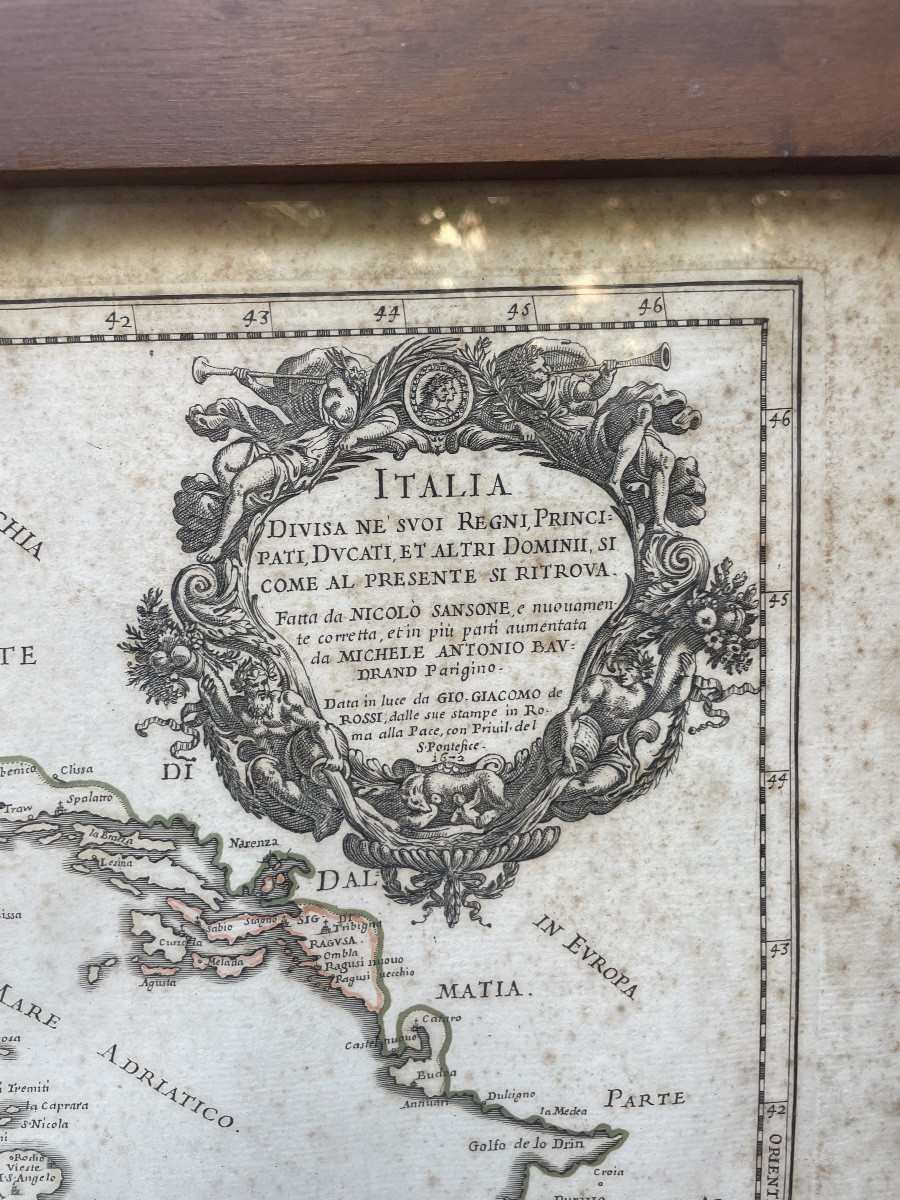


Geographical Map Italy XVIII Century
Geographical map italiy for George Widnam good conditions picture frame not original
300 €
Period: 18th century
Style: Louis 14th, Regency
Condition: Good condition
Material: Cardboard
Length: 67
Width: 55
Reference (ID): 1621327
Availability: In stock
Print