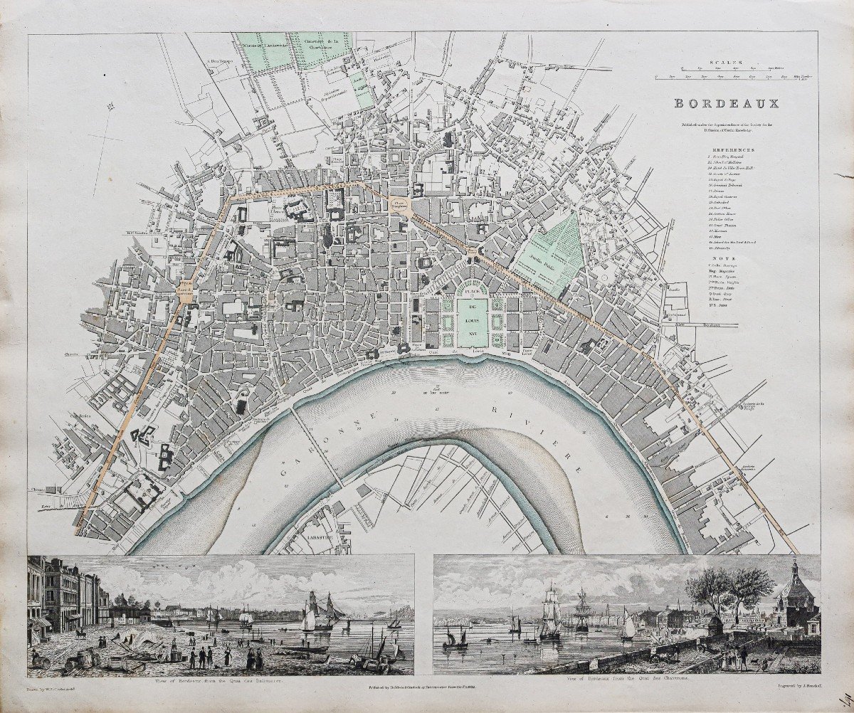
Old Map Of Bordeaux
Epreuve originale réalisée en 1832. J. Henshall graveur et Clarke dessinateur.
Fine consolidation dans la marge latérale droite n’atteignant pas la carte.
Bon état.
Format feuille : 41 x 34,5 cm.
Original antique engraving of 1832.
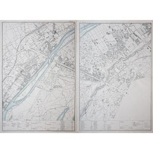
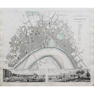
Plan très détaillé de Bordeaux avec légende situant les principaux lieux et monument de la ville. 2 encarts illustrant une vue du Quai des Salinières et du Quai des Chartrons.
Echelle des lieux.
Vous pouvez consulter l’ensemble des cartes, livres et gravures disponibles sur votre région en cliquant sur le lien de notre site internet spécialisé en archives anciennes géographiques :
https://cartes-livres-anciens.com/categorie-produit/cartes-geographiques-anciennes-original-antique-maps/france/aquitaine-guyenne-gascogne-perigord/
Règlement sécurisé par carte bancaire sur notre site internet en cliquant sur le lien ci-dessous :
https://cartes-livres-anciens.com/produit/cartes-geographiques-anciennes-original-antique-maps/france/aquitaine-guyenne-gascogne-perigord/plan-ancien-de-bordeaux-7/
Toutes nos cartes et gravures sont accompagnées d’un certificat d’authenticité.
Original proof made in 1832. J. Henshall engraver and Clarke designer. Fine consolidation in the right lateral margin not reaching the map. Good condition. Sheet size: 41 x 34.5 cm. Original antique engraving of 1832. Very detailed map of Bordeaux with legend locating the main places and monuments of the city. 2 inserts illustrating a view of the Quai des Salinières and the Quai des Chartrons. Scale of places. You can consult all the maps, books and engravings available in your region by clicking on the link to our website specializing in ancient geographical archives: https://cartes-livres-anciens.com/categorie-produit/cartes-gegraphiques -Ancienes-original-antique-maps/france/aquitaine-guyenne-gascogne-perigord/ Secure payment by credit card on our website by clicking on the link below: https://cartes-livres-anciens.com/produit /old-geographic-maps-original-antique-maps/france/aquitaine-guyenne-gascogne-perigord/old-plan-of-bordeaux-7/ All our maps and engravings are accompanied by a certificate of authenticity.
Fine consolidation dans la marge latérale droite n’atteignant pas la carte.
Bon état.
Format feuille : 41 x 34,5 cm.
Original antique engraving of 1832.
Plan très détaillé de Bordeaux avec légende situant les principaux lieux et monument de la ville. 2 encarts illustrant une vue du Quai des Salinières et du Quai des Chartrons.
Echelle des lieux.
Vous pouvez consulter l’ensemble des cartes, livres et gravures disponibles sur votre région en cliquant sur le lien de notre site internet spécialisé en archives anciennes géographiques :
https://cartes-livres-anciens.com/categorie-produit/cartes-geographiques-anciennes-original-antique-maps/france/aquitaine-guyenne-gascogne-perigord/
Règlement sécurisé par carte bancaire sur notre site internet en cliquant sur le lien ci-dessous :
https://cartes-livres-anciens.com/produit/cartes-geographiques-anciennes-original-antique-maps/france/aquitaine-guyenne-gascogne-perigord/plan-ancien-de-bordeaux-7/
Toutes nos cartes et gravures sont accompagnées d’un certificat d’authenticité.
Original proof made in 1832. J. Henshall engraver and Clarke designer. Fine consolidation in the right lateral margin not reaching the map. Good condition. Sheet size: 41 x 34.5 cm. Original antique engraving of 1832. Very detailed map of Bordeaux with legend locating the main places and monuments of the city. 2 inserts illustrating a view of the Quai des Salinières and the Quai des Chartrons. Scale of places. You can consult all the maps, books and engravings available in your region by clicking on the link to our website specializing in ancient geographical archives: https://cartes-livres-anciens.com/categorie-produit/cartes-gegraphiques -Ancienes-original-antique-maps/france/aquitaine-guyenne-gascogne-perigord/ Secure payment by credit card on our website by clicking on the link below: https://cartes-livres-anciens.com/produit /old-geographic-maps-original-antique-maps/france/aquitaine-guyenne-gascogne-perigord/old-plan-of-bordeaux-7/ All our maps and engravings are accompanied by a certificate of authenticity.
140 €
Period: 19th century
Style: Other Style
Condition: Good condition
Material: Paper
Reference (ID): 1291161
Availability: In stock
Print