
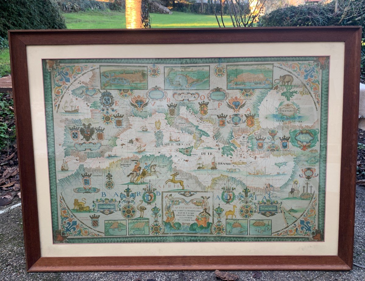


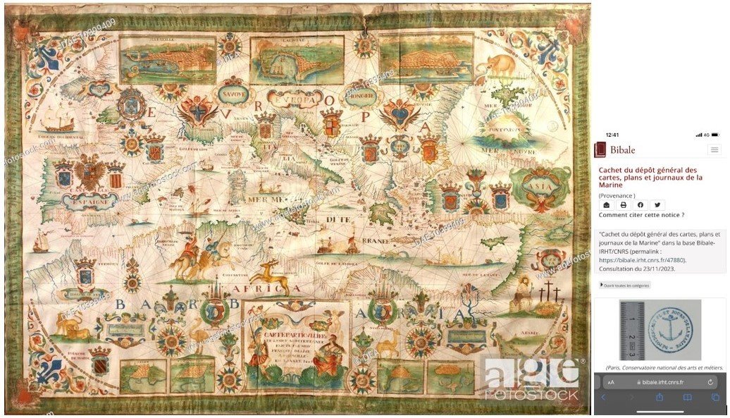


"Portulan By François Ollive, Dated 1664 & Entitled “particular Map Of The Mediterranean”"
Very very (!) large portulan map by ap François OLLIVE, watercolor (?) on paper from late 19th century.The original is kept at the National Maritime Museum under inventory number 9 NA 23 https://mnm. webmuseo.com/ws/musee-national-marine/app/collection/record/39105 Work: Details - Portulan, Portulan by François Ollive, 1664 Particular map of the Mediterranean Sea | Museum collections | National Navy Museum
https://mnm.webmuseo.com/ws/musee-national-marine/app/collection/record/39105
Oeuvre : Précisions - Portulan, Portulan de François Ollive, 1664 Carte particulière de la mer Méditerranée | Les collections du musée | Musée national de la Marine (webmuseo.com)
"A portualn is a handwritten marine map; unlike the world map of Middle Ages, it is not a theological representation of the world, but rather a navigation instrument ; it appears with the generalization of the compass in 13th cty in Mediterranean. The first portolan dates from 1290, it is the "Pisan map" of Genoa. In 14th and 15th centuries, Majorca and Barcelona became the great centers of cartography and receive influences from the Arab world and the Jewish world.
The Marseille school of cartography owes its origin to the OLIVA family, originally from Majorca and who established themselves in two Mediterranean ports: Messina and Marseille.
The Marseille school became flourishing in 17th century and testifies both to the know-how of the master cartographer and to the Baroque aesthetic. The production of portolans ceased at the beginning of 18th century; they were then replaced by maps established according to a more scientific process, projection and not plus triangulation: we can observe on the exhibited pieces the directions of the "quarter wind" or rums, represented by a mesh of straight lines."
http://bmvr.marseille.fr:patrimoine
Description: Our marine map, dated 1664, is a very high level quality reproduction of portolan produced by the workshop of François OLLIVE, in Marseille. It is titled “Special map of the Mediterranean Sea”.
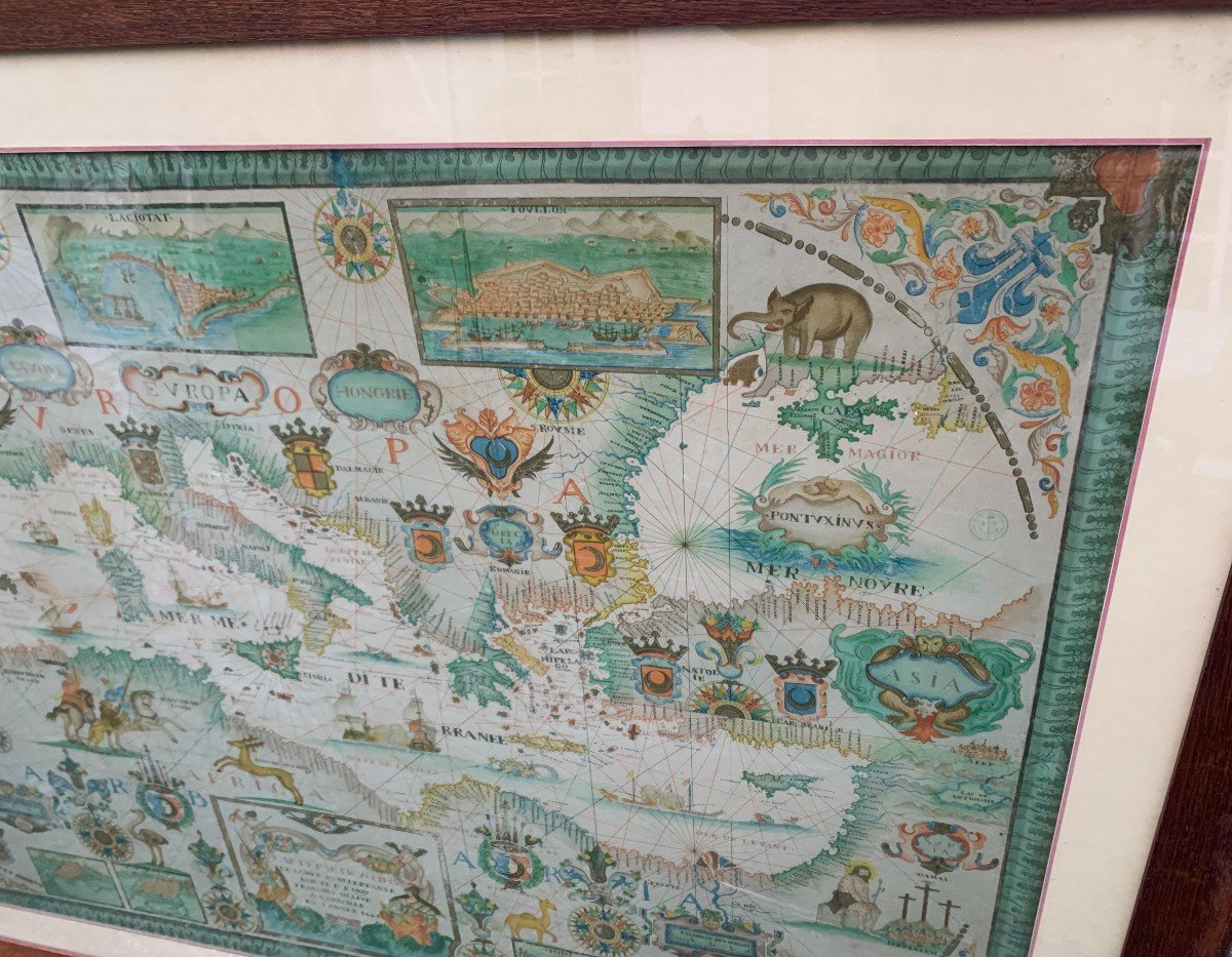
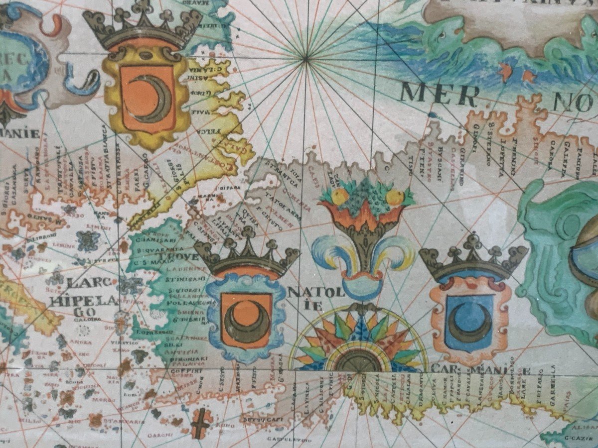
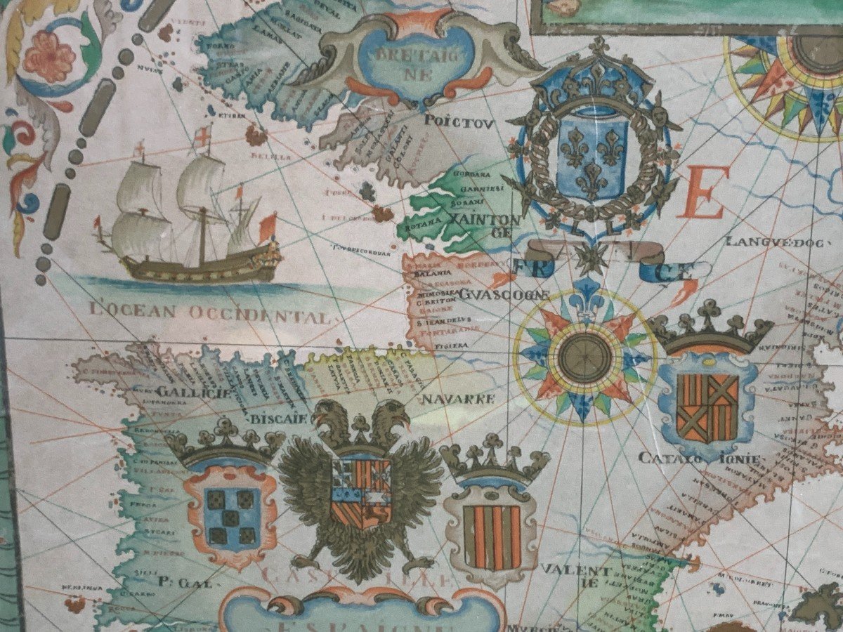
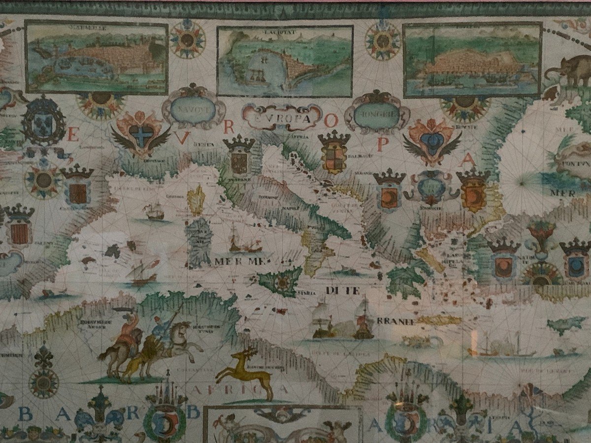
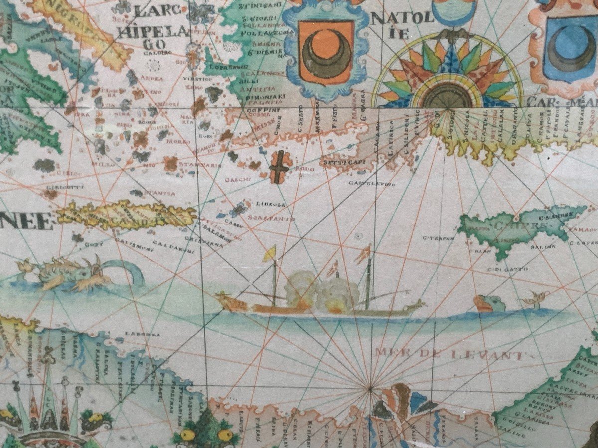
It contains the outline of the coasts, the rivers, the names of the remarkable places on the coast (ports, capes, etc.), the names of states and provinces, the seas, etc.
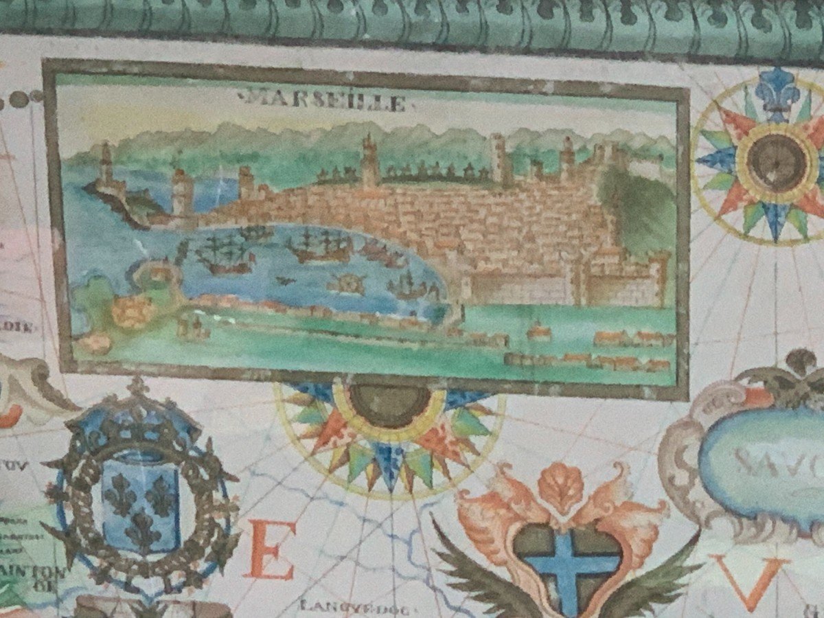
Six very colorful compass roses topped with exuberant decorations recall the original function of a portolan: to guide navigators who then navigate using a ruler, compass and compass. A network of straight lines starts from these rosettes to indicate the headings. The scale is given in nautical miles. Seven boxes, three at the top of the map, four at the bottom, represent an unrealistic view of the major ports of the Mediterranean: "Marseille, La Ciotat, Toullon, and Algiers, Tunis, Tripoli and Alessandria"
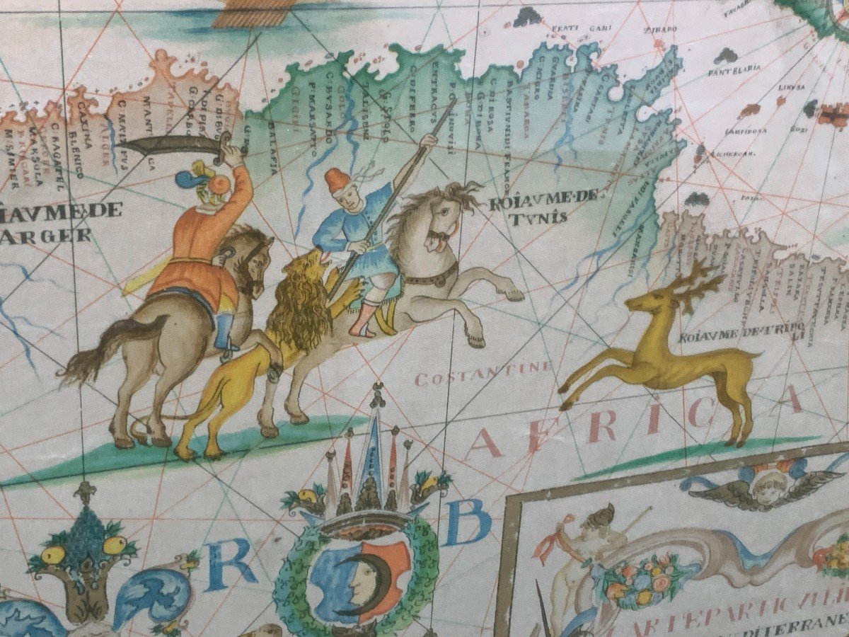
The document contains numerous inaccuracies which can be explained by the rudimentary means of topographic surveying of the time. The interior of the continents is not mapped, it is represented here by multiple patterns. Thus we find, illuminated, the names of countries and continents. Crowned coats of arms indicate the names of certain kingdoms. Representations of animals and characters illustrate the regions: lions in Africa, or an improbable Christ seated near a Jerusalem overlooked by the three crosses of Golgotha,... A wide variety of ships and some imaginary marine animals adorn the seas and ocean. In the four corners, fleur-de-lys remind us that the work is truly French and the illumination which frames the title is reminiscent of the statues and water features of Le Nôtre. This map was not used by sailors. It was rather a ceremonial document for wealthy merchants or enlightened amateurs.
Very good condition: no water defaults or foxing.
Sober oak framing and protection by a large glass plate.
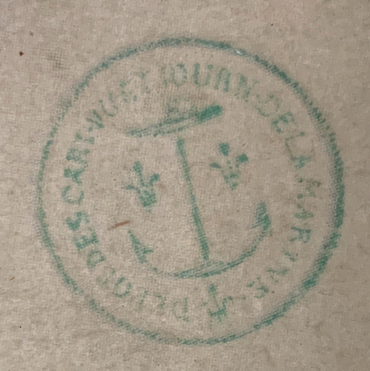
The map has a stamp listed in green ink, showing a marine anchor framed by 2 fleurs-de-lys and the words "DEPOT DES CART. PL. JOURN. DE LA MARINE" (maps, plans and journals, etc.) plesae check documentation in last photo
Very large dimensions: 125*90cm (frame) and 104*72cm (sheet, at sight)
The nautical chart includes an infinite multitude of details; for more photos, please ask me by email at fabien.siegfried@yahoo.com
No postal delivery (very heavy and fragility), contact me for delivery terms, transport quote. Possible hand delivery in Paris, Chartres, Le Mans, Lyon, Avignon, Montpelleier or Béziers once a month.


 Le Magazine de PROANTIC
 TRÉSORS Magazine
 Rivista Artiquariato