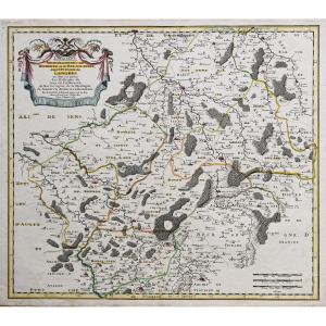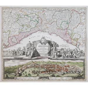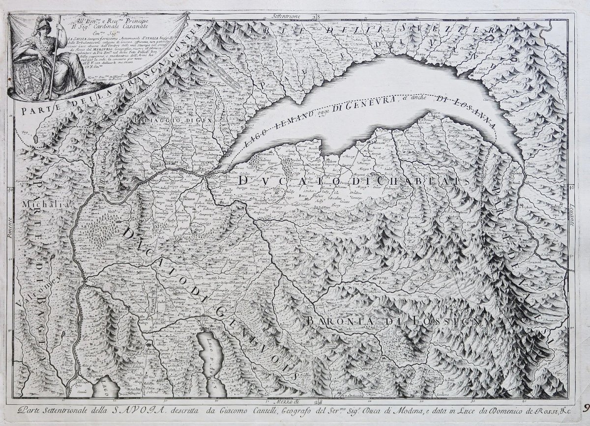
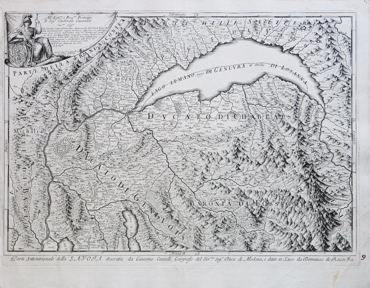
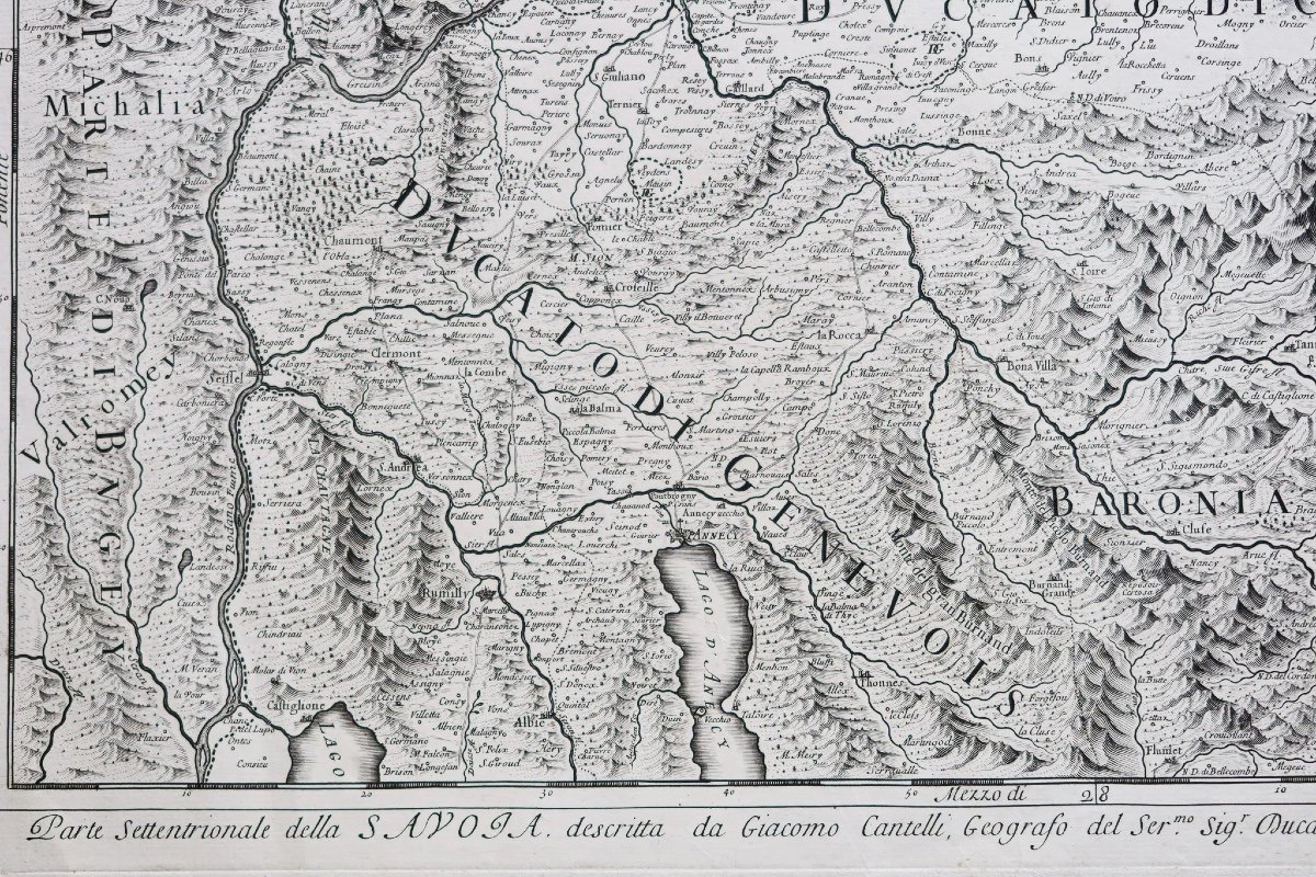
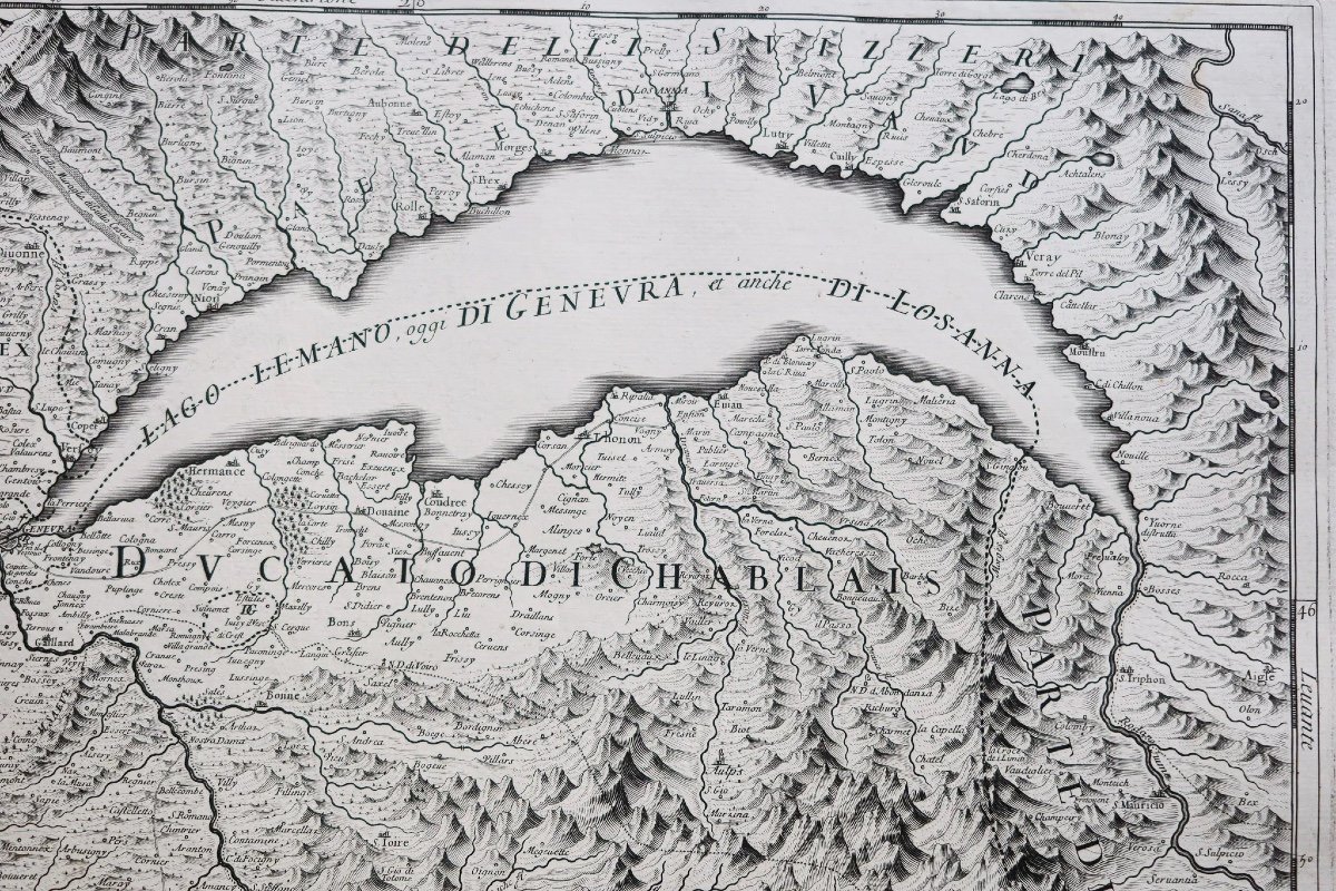
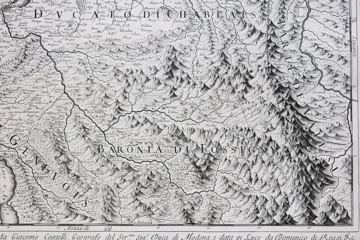
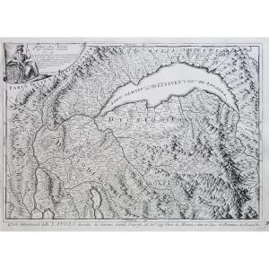


Old Geographical Map Of Savoie
Epreuve originale réalisée vers 1690. Giacomo Cantelli dessinateur et Rossi graveur.
Rousseurs claires dans les marges et fine pliure n’atteignant pas la carte.
1 trou de ver de 2mm dans le bandeau d’encadrement au niveau du cartouche supérieur.
Bon état.
Format feuille : 61,5 x 47,5 cm.
Format gravure : 57,5 x 42 cm.
Original antique map around 1690.
Belle impression bien contrastée dans la pure tradition de la cartographie italienne de la fin du 17e siècle, décrivant la partie nord de la Savoie.
Vous pouvez consulter l’ensemble des cartes et gravures disponibles sur votre région en cliquant sur le lien de notre site internet spécialisé en archives anciennes géographiques :
https://cartes-livres-anciens.com/categorie-produit/cartes-geographiques-anciennes-original-antique-maps/france/savoie/
Règlement sécurisé par carte bancaire sur notre site internet en cliquant sur le lien :
https://cartes-livres-anciens.com/produit/cartes-geographiques-anciennes-original-antique-maps/france/savoie/carte-geographique-ancienne-de-la-savoie-7/
Toutes nos cartes et gravures sont accompagnées d’un certificat d’authenticité.
Cantelli Giacomo fut un important cartographe et graveur italien qui travaillera pour Francesco II, duc de Modène au 17ème siècle. Il est bien connu pour avoir été le pionnier du style italien de carte géographique artistique qui sera finalement adopté et développé par Vincenzo Coronelli cartographe de Louis XIV.
Original proof made around 1690. Giacomo Cantelli designer and Rossi engraver. Light foxing in the margins and a fine fold not reaching the map. 1 2mm wormhole in the framing strip at the upper cartridge. Good condition. Sheet size: 61.5 x 47.5 cm. Engraving format: 57.5 x 42 cm. Original antique map around 1690. Beautiful, well-contrasted impression in the pure tradition of Italian cartography from the end of the 17th century, describing the northern part of Savoy. You can consult all the maps and engravings available in your region by clicking on the link to our website specializing in ancient geographical archives: https://cartes-livres-anciens.com/categorie-produit/cartes-gegraphiques-Ancienes -original-antique-maps/france/savoie/ Secure payment by credit card on our website by clicking on the link: https://cartes-livres-anciens.com/produit/cartes-gegraphiques-Ancienes-original-antique- maps/france/savoie/ancient-geographic-map-of-savoie-7/ All our maps and engravings are accompanied by a certificate of authenticity. Cantelli Giacomo was an important Italian cartographer and engraver who worked for Francesco II, Duke of Modena in the 17th century. He is well known for pioneering the Italian style of artistic geographic map that would eventually be adopted and developed by Vincenzo Coronelli, cartographer to Louis XIV.
340 €
Period: 17th century
Style: Other Style
Condition: Good condition
Material: Paper
Reference (ID): 1235020
Availability: In stock
Print