
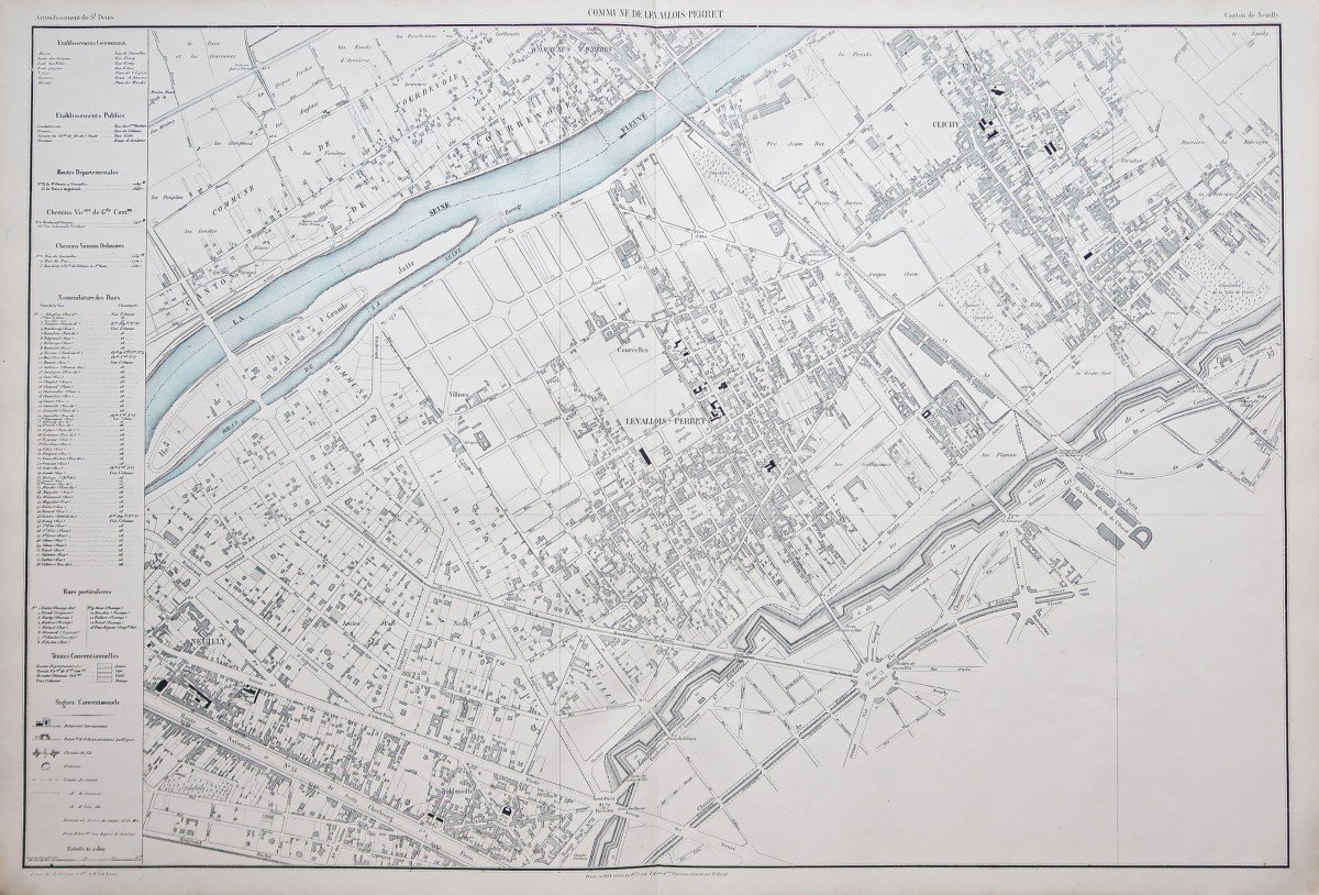
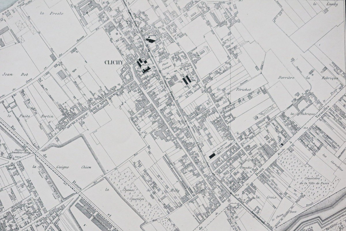
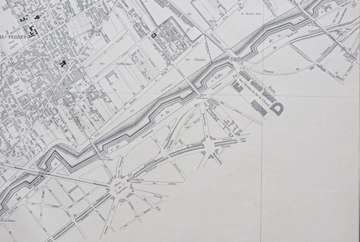


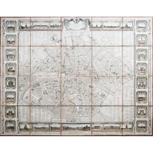
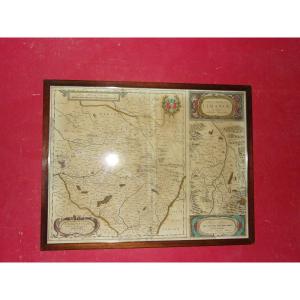
"Old Plan Of Levallois-perret -clichy"
Canton de Neuilly.Grande carte originale réalisée en 1874. Lefèvre cartographe.
Coloris aquarelle dans la Seine.
Très bon état.
Format feuille: 95 x 64,5 cm.
Original antique map of 1874.
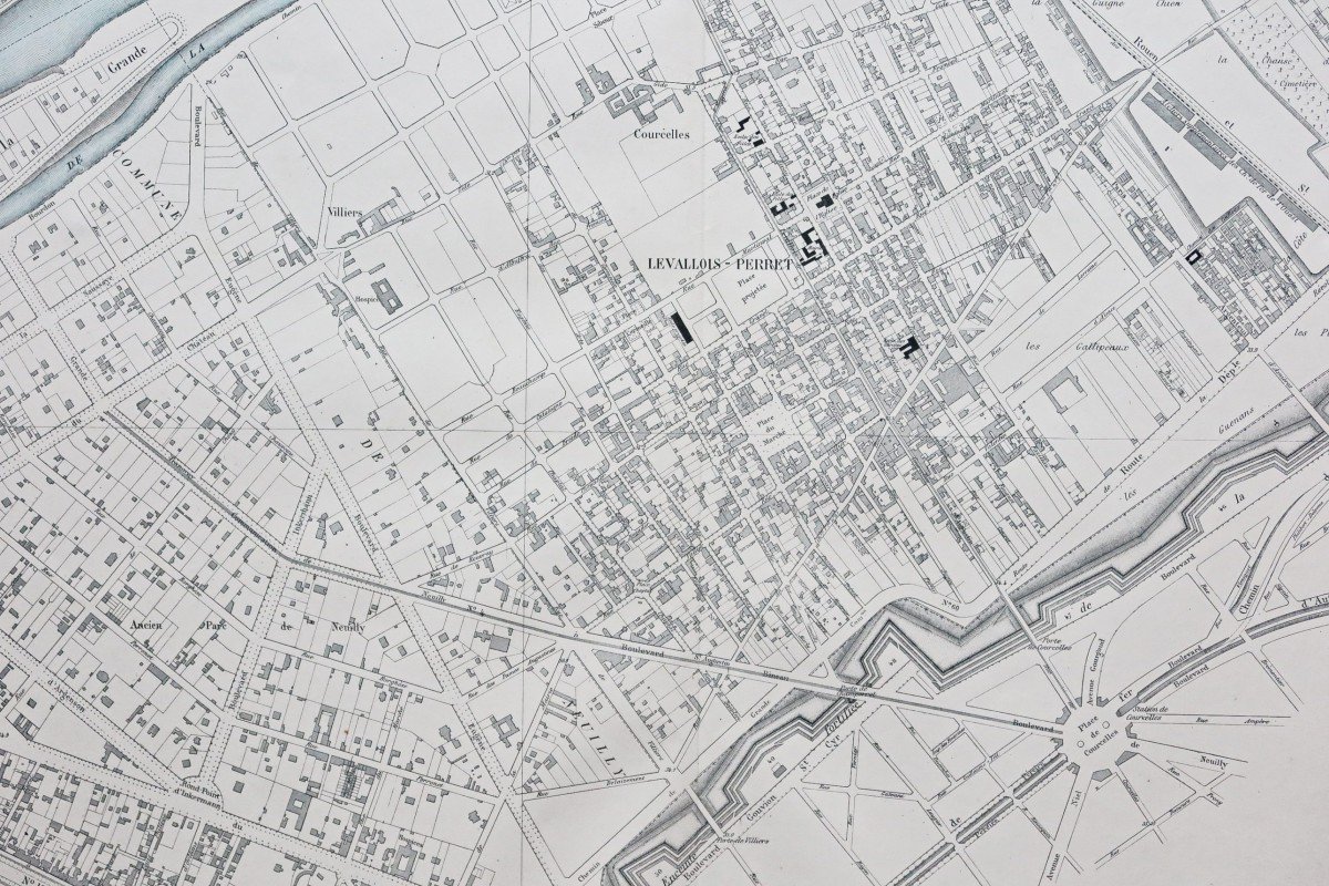
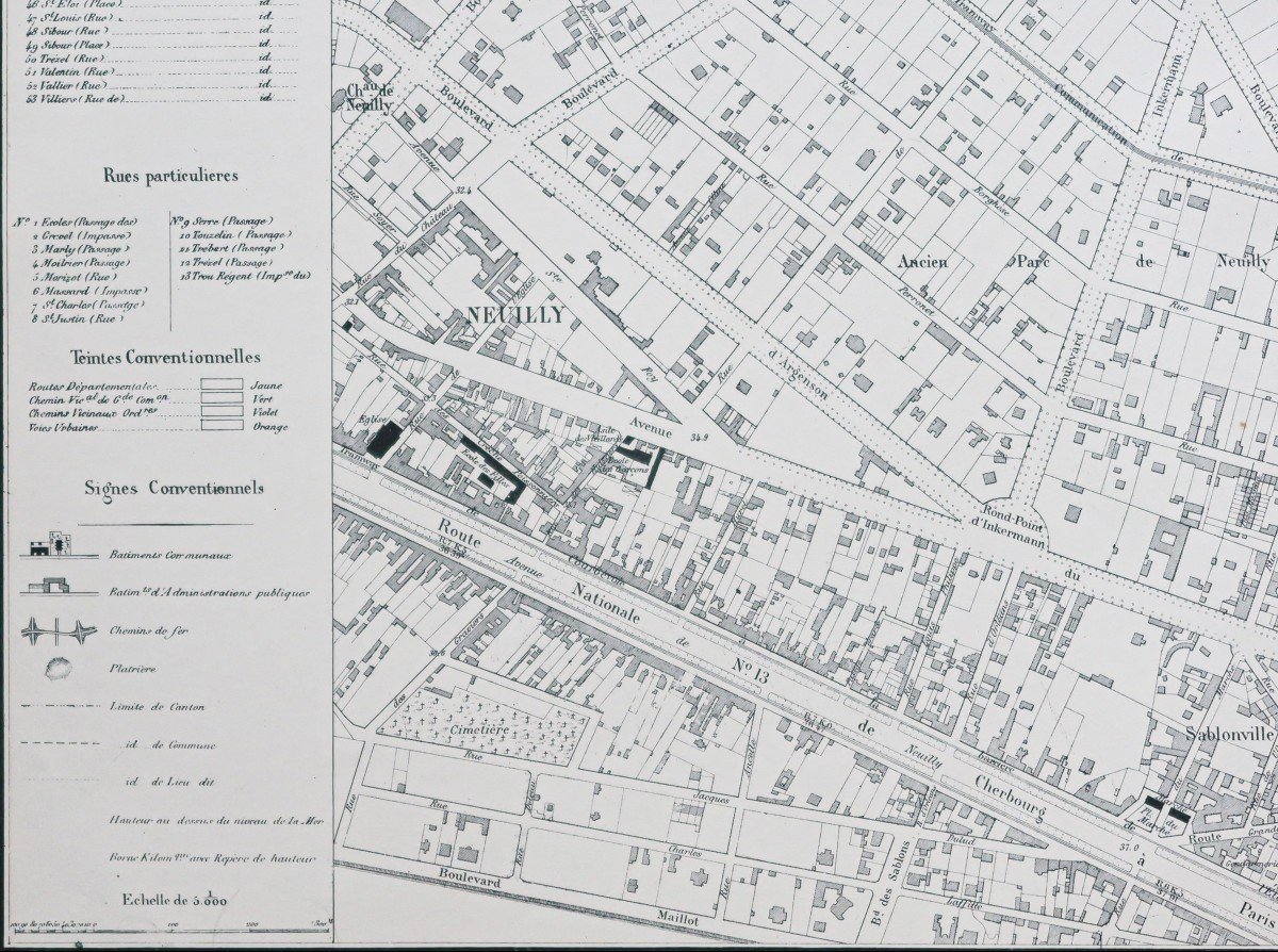
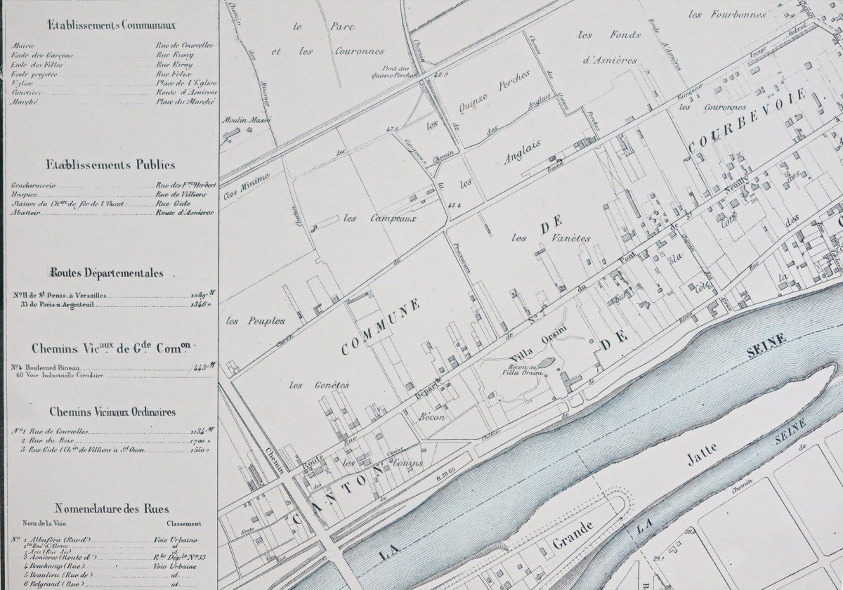
Large bandeau explicatif avec renvois numérotés de 1 à 53 indiquant les principales rues.
Dressée en 1854, révisée en 1873 par Lefèvre.
Peu courant.
Vous pouvez consulter l’ensemble des cartes, livres et gravures disponibles sur votre région en cliquant sur le lien de notre site internet spécialisé en archives anciennes géographiques:
https://cartes-livres-anciens.com/categorie-produit/cartes-geographiques-anciennes-original-antique-maps/france/ile-de-france-91-92/
Règlement sécurisé par carte bancaire sur notre site internet en cliquant sur le lien ci-dessous:
https://cartes-livres-anciens.com/produit/cartes-geographiques-anciennes-original-antique-maps/france/ile-de-france-91-92/plan-ancien-de-levallois-perret/
Toutes nos cartes et gravures sont accompagnées d’un certificat d’authenticité.
Canton of Neuilly. Large original map made in 1874. Lefèvre cartographer. Watercolor colors in the Seine. Very good state. Sheet size: 95 x 64.5 cm. Original antique map of 1874. Large explanatory banner with references numbered from 1 to 53 indicating the main streets. Drawn up in 1854, revised in 1873 by Lefèvre. Uncommon. You can consult all the maps, books and engravings available in your region by clicking on the link of our website specializing in ancient geographic archives: https://cartes-livres-anciens.com/categorie-produit/cartes-geographique -anciennes-original-antique-maps / france / ile-de-france-91-92 / Secure payment by credit card on our website by clicking on the link below: https://cartes-livres-anciens.com / product / old-geographic-maps-original-antique-maps / france / ile-de-france-91-92 / plan-ancien-de-levallois-perret / All our maps and engravings are accompanied by a certificate of authenticity.


 Le Magazine de PROANTIC
 TRÉSORS Magazine
 Rivista Artiquariato