


"Old Map Of Paris"
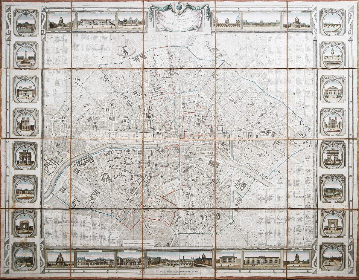
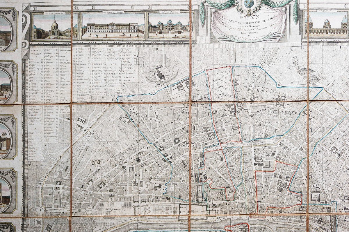
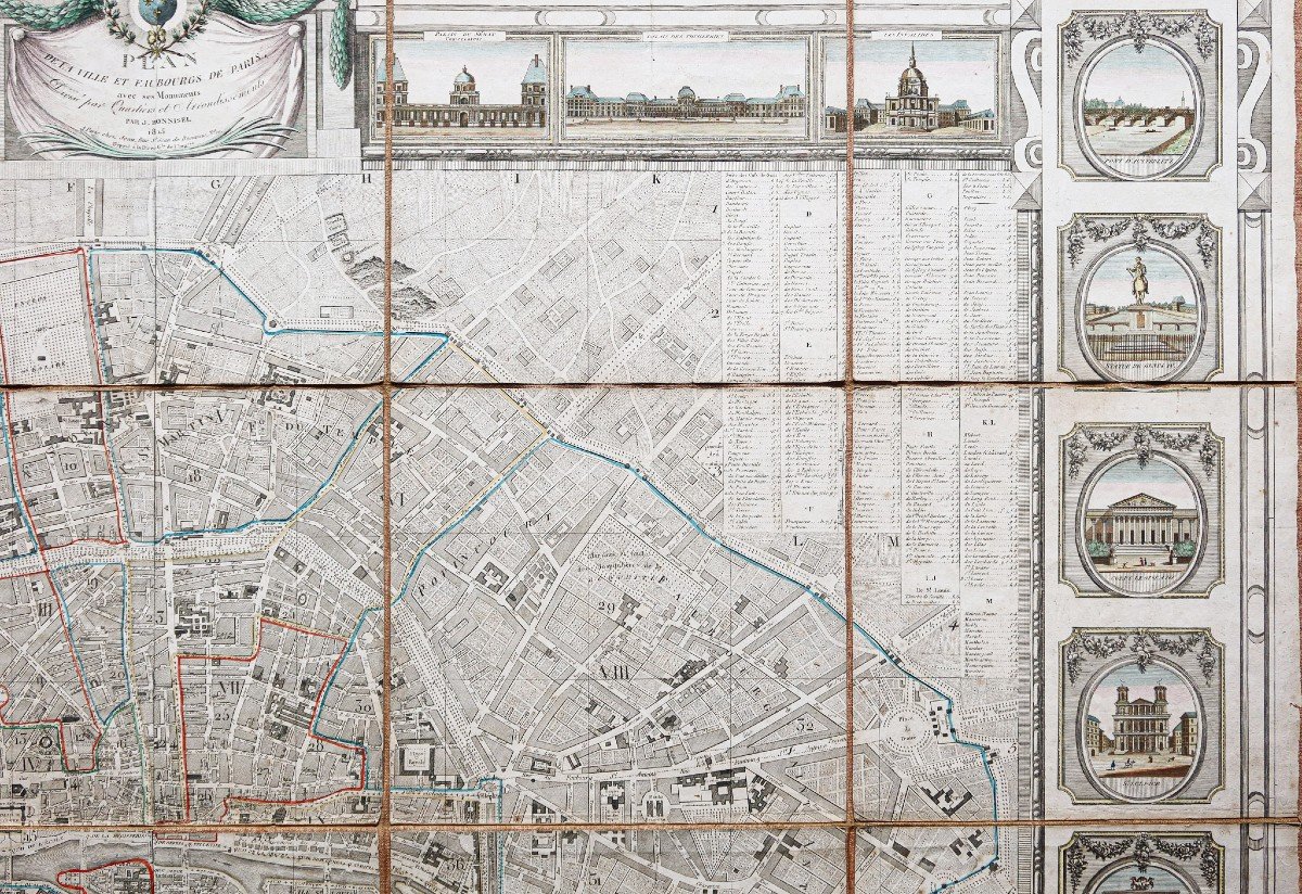
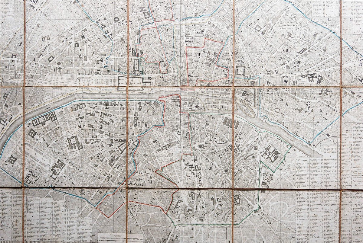
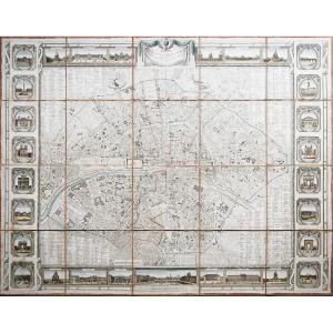
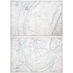
Plan de la ville et faubourgs de Paris avec ses monuments, divisé par quartiers et arrondissements.Epreuve originale réalisée en 1815. J. Bonnisel géographe.
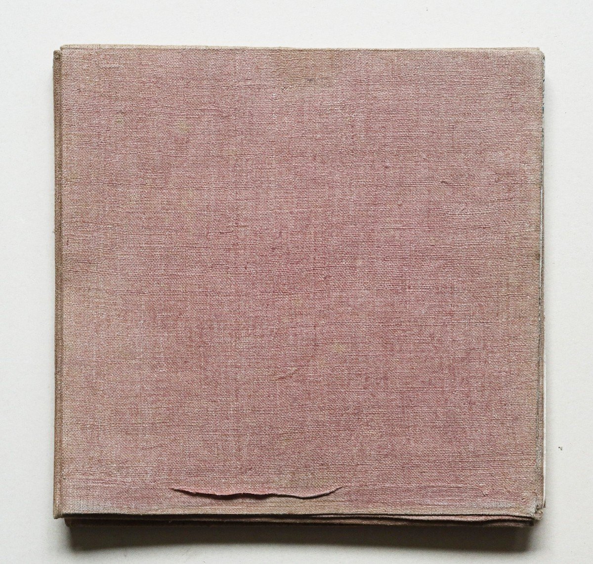
48 sections entoilées d’époque.
Rousseurs claires éparses.
Bon état.
Format : 124,5 x 96,5 cm.
Format repliée : 25 x 25 cm.
Original antique plan of 1815.
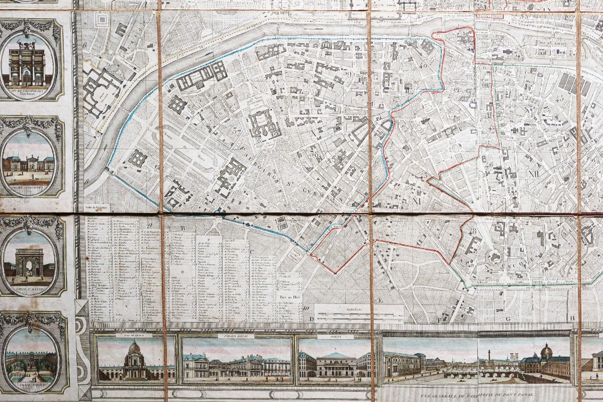
Plan très précis de Paris qui représente la ville divisée en 12 arrondissements et 48 sections, tel que c’est le cas depuis 1795. Cette répartition perdure jusqu’en 1860, où l’annexion des faubourgs et des grands projets de réaménagement de Paris sous Georges-Eugène Haussmann, entraine une refonte totale.
Renvois des rues de part et d’autre du plan. Cartouches illustrant les grands édifices construits sous Napoléon.
Beaux coloris aquarelle.
Peu courant.
Vous pouvez consulter l’ensemble des cartes, livres et gravures disponibles sur votre région en cliquant sur le lien de notre site internet spécialisé en archives anciennes géographiques :
https://cartes-livres-anciens.com/categorie-produit/cartes-geographiques-anciennes-original-antique-maps/france/paris-plans-maps/
Règlement sécurisé par carte bancaire sur notre site internet en cliquant sur le lien ci-dessous :
https://cartes-livres-anciens.com/produit/cartes-geographiques-anciennes-original-antique-maps/france/paris-plans-maps/plan-ancien-de-paris-8/
Toutes nos cartes et gravures sont accompagnées d’un certificat d’authenticité.
Map of the city and suburbs of Paris with its monuments, divided by districts and districts. Original proof made in 1815. J. Bonnisel geographer. 48 vintage canvas sections. Scattered light freckles. Good condition. Size: 124.5 x 96.5 cm. Folded format: 25 x 25 cm. Original antique plan of 1815. Very precise plan of Paris which represents the city divided into 12 arrondissements and 48 sections, as has been the case since 1795. This distribution lasted until 1860, when the annexation of the suburbs and large Paris redevelopment projects under Georges-Eugène Haussmann, led to a total overhaul. Street references on either side of the plan. Cartouches illustrating the large buildings constructed under Napoleon. Beautiful watercolor colors. Uncommon. You can consult all the maps, books and engravings available in your region by clicking on the link to our website specializing in ancient geographical archives: https://cartes-livres-anciens.com/categorie-produit/cartes-gegraphiques -Ancienes-original-antique-maps/france/paris-plans-maps/ Secure payment by credit card on our website by clicking on the link below: https://cartes-livres-anciens.com/produit/cartes -geographic-ancient-original-antique-maps/france/paris-plans-maps/plan-ancien-de-paris-8/ All our maps and engravings are accompanied by a certificate of authenticity.


 Le Magazine
 Rivista Artiquariato
 TRÉSORS magazine