Old Nautical Chart - La Turballe - Le Pouliguen - Pornic flag


628100-main-5f10091333f00.jpg 628100-5f100949810f4.jpg

Object description :

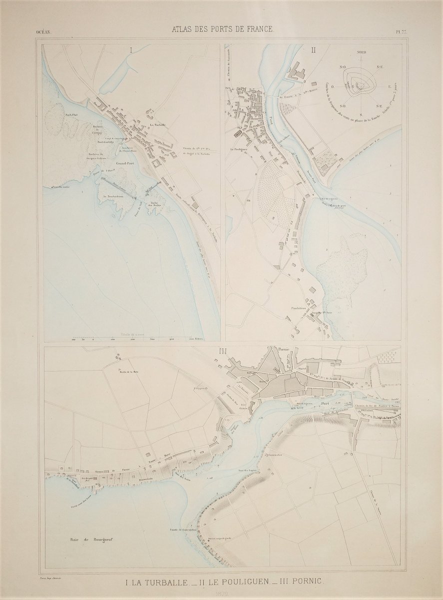
"Old Nautical Chart - La Turballe - Le Pouliguen - Pornic"
Original map engraved in 1879. Color printing. Very good state. Sheet format: 63 x 47 cm. You can consult all the maps, books and engravings available in your region by clicking on the link on our website specializing in ancient geographic archives: https://www.cartes-livres-anciens.com Secure payment by credit card on our website: https://cartes-livres-anciens.com/produit/cartes-geographiques-anciennes-original-antique-maps/france/pays-de-la-loire/carte-marine-ancienne-la-turballe- le-pouliguen-pornic-original-antique-chart /
Price: 165 €
Period: 19th century
Style: Other Style
Condition: Excellent condition

Material: Paper

Reference: 628100
Contact Dealer
line

"Patrick Serouge" See more objects from this dealer

line

"Old Maps, Other Style"

More objects on Proantic.com
Subscribe to newsletter
line
facebook
pinterest
instagram
Patrick Serouge
Antique Maps - Atlas - Antique Engraving - Rare Books
Old Nautical Chart - La Turballe - Le Pouliguen - Pornic
628100-main-5f10091333f00.jpg
+33(0)6 12 89 90 97
Tous nos documents sont accompagnés d'un certificat d'authenticité.


*We will send you a confirmation email from info@proantic.com Please check your messages, including the spam folder.

Thank you! Your submission has been received!

Oops! Something went wrong while submitting the form