


Loire-inférieure Department (44) - Rare Engraving – Late 18th Century (1792)
Artist: Le Vachez
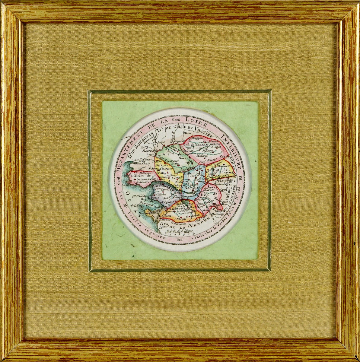
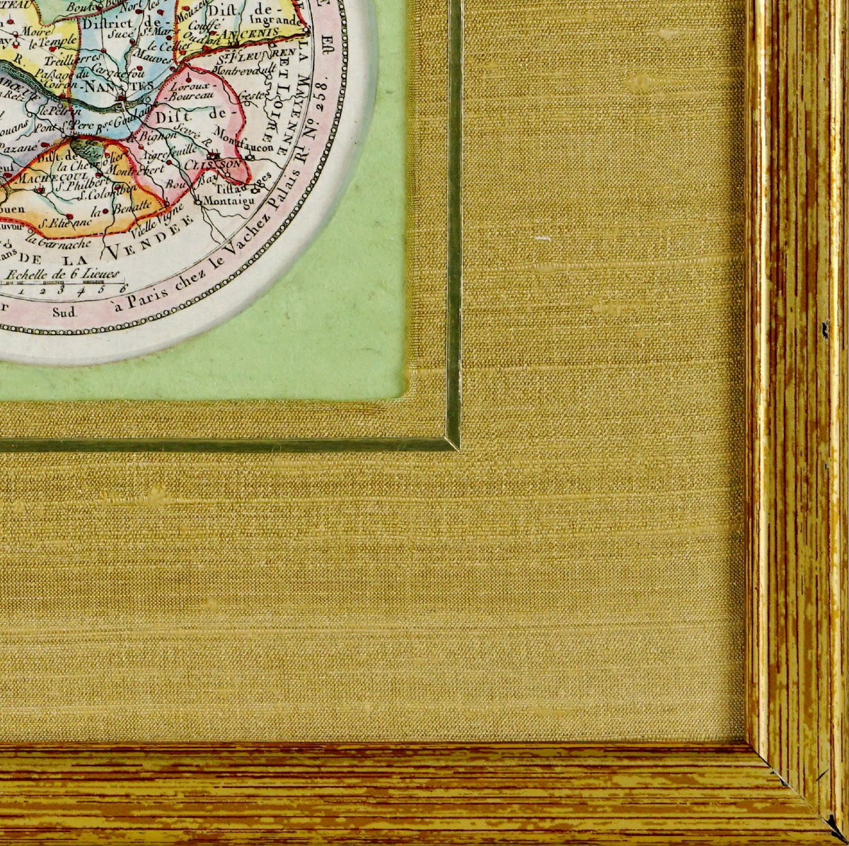
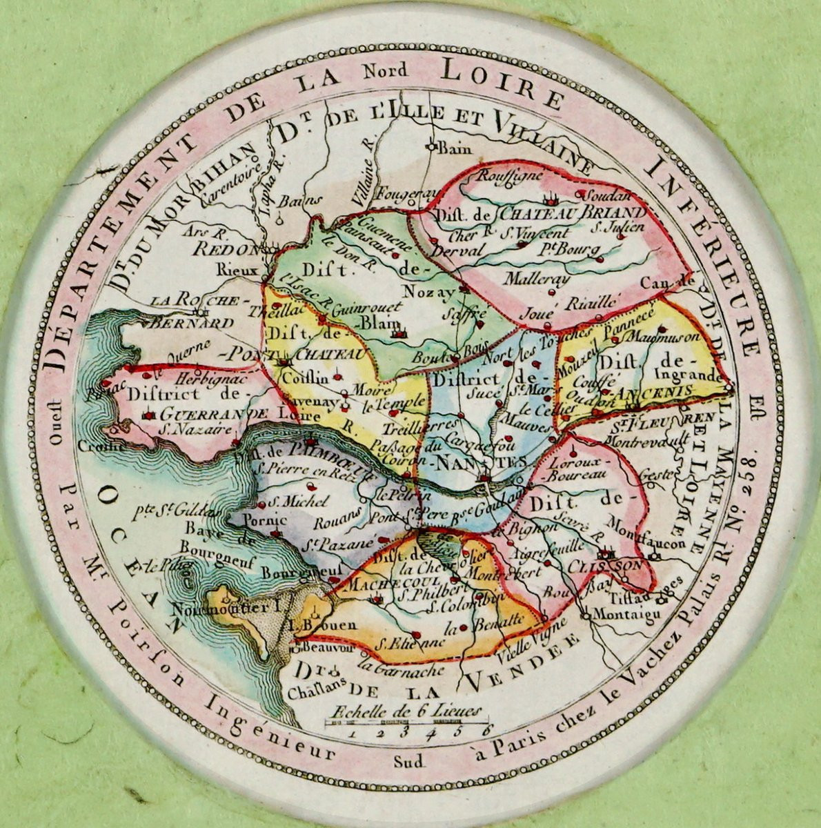
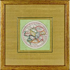
PropertiesView / Product LOIRE-INFÉRIEURE DEPARTMENT (44) - RARE Small departmental map – Late 18th century (1792) Original print, engraved on steel. Antique engraving representing the Loire-Inférieure department, from the revolutionary period and probably one of the very first maps published in 1792 for this new administrative division. Original 18th-century engraving from the National Atlas of the 83 departments, published in Paris in 1792 by Le Vachez, under the colonnades of the Palais-Royal. Map drawn by Captain Lejeune, geographer to the King. This exceptional print illustrates the new departmental territory as it emerged from the administrative reform of 1790, marking a fundamental step in French cartographic and political history. Polychrome highlights, hand-colored at the time. Dimensions: Framed - Length 21 cm – Height 21 cm - Width of frame: 1 cm, Condition: PERFECT CONDITION, Period: Engraving - EARLY 19TH CENTURY (1823), Frame(s): Current mounting comprising a first passe-partout in light green paper, enhanced with a passe-partout in golden beige wild silk, the whole being framed with a gilt wood frame with antique patina.
185 €
Period: 18th century
Style: Louis 16th, Directory
Condition: Perfect condition
Material: Paper
Length: 21 cm
Height: 21 cm
Reference (ID): 1720244
Availability: In stock
Print