


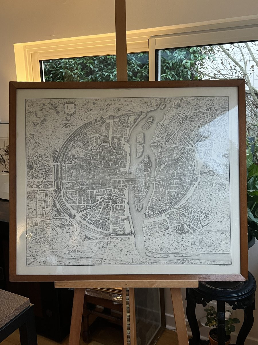


"Large Map Of Paris After 1766 – Reproduction From The First Quarter Of The 20th Century – 79 × 93 Cm"
Large Map of Paris after 1766. Reproduction from the first quarter of the 20th century.
Framed dimensions: 79 × 93 cm — Image size: 66 × 79 cm.
Map of Paris after 1766. Heliogravure / photomechanical print. First quarter of the 20th century (circa 1900–1925). Later wooden frame, under glass. Superb early reproduction of the map of Paris dated 1766, produced at the beginning of the 20th century with very high quality of execution. The map depicts the face of the capital before Haussmann's major urban renewal projects: tightly packed blocks, built bridges, the former course of the Seine, medieval quarters, and vast areas still largely rural around the ramparts. The fine, high-contrast printing makes the complex topography of pre-revolutionary Paris perfectly legible and highlights the characteristic precision of 18th-century maps. The large format gives the piece a spectacular presence, ideal for both classic and contemporary interiors. This map offers invaluable insight into the ancient structure of Paris, at a time when the city still retained its medieval grid before the profound transformations of the 19th century. It allows one to grasp at a glance the dynamism of a capital in transition: the density of the Île de la Cité, the original layout of the bridges, the still rural suburbs, and the historical construction of the urban fabric.
The edition from the first quarter of the 20th century provides remarkable legibility while faithfully respecting the 1766 drawing. The quality of the heliogravure, the imposing size of the plate, and the enduring appeal of the subject—Paris in the 18th century—contribute to making it a highly sought-after piece for both decoration and documentation. It is precisely these criteria (exceptional format, compelling subject matter, and meticulous antique printing) that justify a higher value than standard reproductions.
Good overall condition: clean paper, clear printing. Wooden frame.


 Le Magazine de PROANTIC
 TRÉSORS Magazine
 Rivista Artiquariato