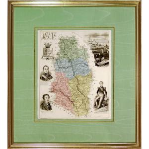
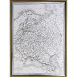
New Special Map Of The Roads Of France, 1854, V. Levasseur, 96 X 75.6 Cm
Artist: Victor Levasseur
"Illustrated Map of Picturesque Views, Costumes and Coats of Arms of the Principal Provinces of France."
"Drawn from the Post House Map and the most recent works of the Bridges and Roads Department, showing Imperial and Departmental Roads, Navigation Canals, Railways, the division of the Territory by Departments and Provinces, the division by Basins, and the legal distance from the Departmental Capitals to Paris, expressed in Kilometers and Post Leagues of 2000 Toises." By Victor Levasseur, "Geographer, Surveying Engineer of the Cadastre and the Paris Plan Service, Member of the Imperial Asiatic Society and the Geographical Society."
Engraved by Ch. Dyonnet, Paris, 1854, 2nd edition...
Rare map measuring 96 x 75.6 cm, unbacked, and in good used condition, despite the creases. A blue ink stamp on the back, but illegible...
Where we can see that France only had 86 departments, that Biarritz is not yet listed, that Clermont existed without "Ferrand", that La Roche-sur-Yon, formerly "Bourbon Vendée" was renamed "Napoléon Vendée", etc...
A very interesting historical document...
Very careful shipping included.
120 €
Period: 19th century
Style: Napoleon 3rd
Condition: Condition of use
Material: Paper
Length: 96 cm
Height: 75,6 cm
Reference (ID): 1649573
Availability: In stock
Print