

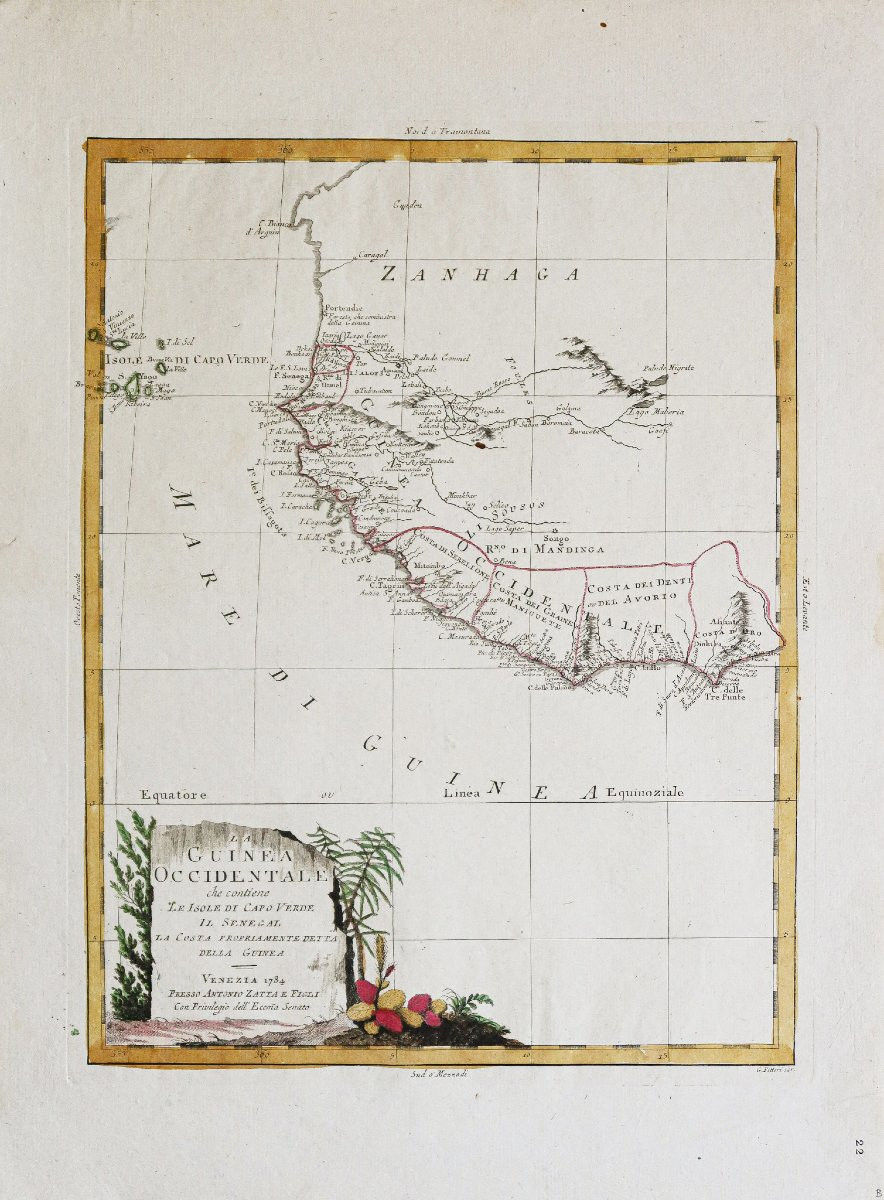

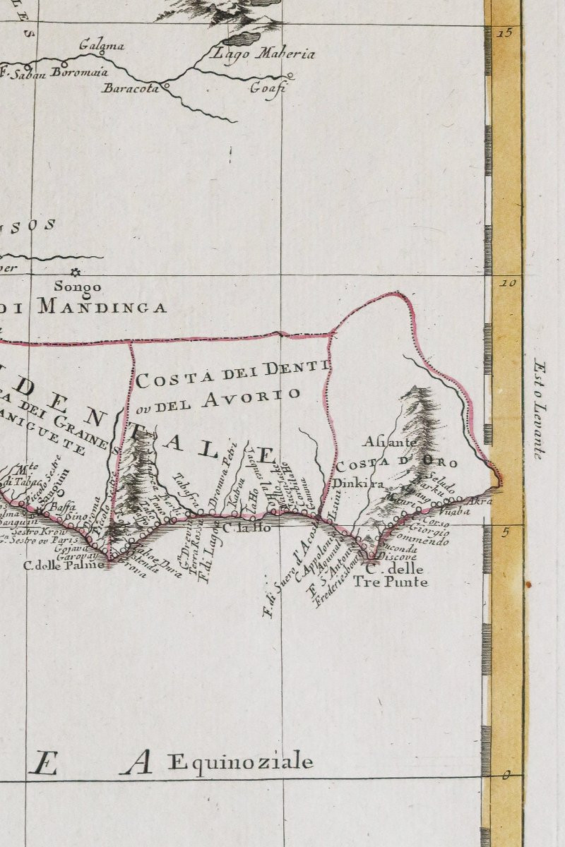


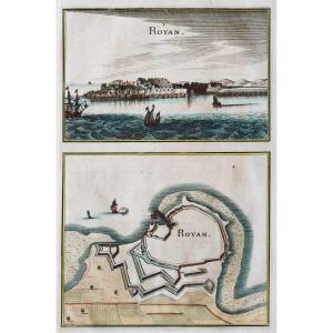
"Old Map Of West Africa - Senegal"
Epreuve originale réalisée en 1784. Zatta cartographe.Beaux coloris anciens.
Petite restauration de 1cm dans la marge latérale gauche, loin de la carte.
1 trace de pli dans la marge inférieure.
Bon état.
Format feuille : 52,5 x 39 cm.
Format gravure : 41,5 x 32 cm.
Original antique map of 1784.
Belle impression pour cette large carte de l’excellent cartographe italien Antonio Zatta.
Cartouche de titre décoratif.
Vous pouvez consulter l’ensemble des cartes, livres et gravures disponibles sur votre région en cliquant sur le lien de notre site internet spécialisé en archives anciennes géographiques : https://cartes-livres-anciens.com/categorie-produit/cartes-geographiques-anciennes-original-antique-maps/afrique/
Règlement sécurisé par carte bancaire sur notre site internet en cliquant sur le lien ci-dessous : https://cartes-livres-anciens.com/produit/cartes-geographiques-anciennes-original-antique-maps/afrique/afrique-de-louest/carte-ancienne-de-lafrique-de-louest/
Toutes nos cartes et gravures sont accompagnées d’un certificat d’authenticité.
Antonio Zatta (fl. 1757-1797) était un éditeur, cartographe et éditeur italien de premier plan. On sait peu de choses sur sa vie au-delà de ses nombreuses œuvres publiées qui ont survécu.
Il est possible qu’il soit né dès 1722 et ait vécu jusqu’à 1804. Il a vécu à Venise et son travail a prospéré entre 1757 et 1797. Il est surtout connu pour ses cartes et son atlas, Atlante Novissimo (1779-1785), et pour sa production prolifique d’imprimés et de livres à la fois précis et esthétiques. Zatta disposait clairement d’un vaste réseau d’où puiser des informations ; c’est ainsi qu’il a pu publier le premier aperçu des îles visitées par le capitaine Cook dans l’Atlante Novissimo. Zatta a également publié des livres de pièces de théâtre et d’architecture.
Original proof made in 1784. Zatta cartographer. Beautiful old colors. Small restoration of 1cm in the left side margin, far from the map. 1 trace of fold in the lower margin. Good condition. Sheet format: 52.5 x 39 cm. Engraving format: 41.5 x 32 cm. Original antique map of 1784. Beautiful impression for this large map of the excellent Italian cartographer Antonio Zatta. Decorative title cartouche. You can consult all the maps, books and engravings available on your region by clicking on the link of our website specialized in old geographical archives: https://cartes-livres-anciens.com/categorie-produit/cartes-geographiques-anciennes-original-antique-maps/afrique/ Secure payment by credit card on our website by clicking on the link below: https://cartes-livres-anciens.com/produit/cartes-geographiques-anciennes-original-antique-maps/afrique/afrique-de-louest/carte-ancienne-de-lafrique-de-louest/ All our maps and prints come with a certificate of authenticity. Antonio Zatta (fl. 1757-1797) was a prominent Italian editor, cartographer, and publisher. Little is known of his life beyond his many surviving published works. It is possible that he was born as early as 1722 and lived until 1804. He lived in Venice, and his work flourished between 1757 and 1797. He is best known for his maps and atlas, Atlante Novissimo (1779-1785), and for his prolific production of accurate and aesthetically pleasing prints and books. Zatta clearly had a vast network from which to draw information; this is how he was able to publish the first overview of the islands visited by Captain Cook in the Atlante Novissimo. Zatta also published books of plays and architecture.


 Le Magazine de PROANTIC
 TRÉSORS Magazine
 Rivista Artiquariato