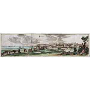
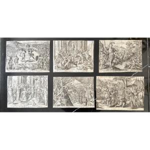
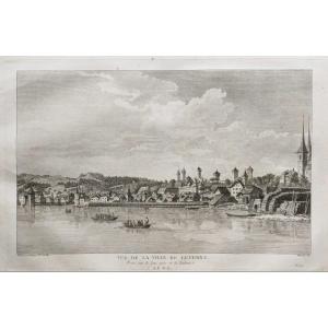
Old Engraving From Rochefort
Épreuve originale réalisée vers 1760.
Coloris aquarelle.
Très bon état.
Format feuille : 23 x 20 cm.
Format gravure : 20 x 17,5 cm.
Original antique engraving of 1760.
Gravure anglaise reprenant avec habilité les fameuses gravures d’Horace Vernet illustrant les ports de France.
Vous pouvez consulter l’ensemble des cartes, livres et gravures disponibles sur votre région en cliquant sur le lien de notre site internet spécialisé en archives anciennes géographiques :
https://cartes-livres-anciens.com/categorie-produit/cartes-geographiques-anciennes-original-antique-maps/france/poitou-charentes/
Règlement sécurisé par carte bancaire sur notre site internet en cliquant sur le lien ci-dessous :
https://cartes-livres-anciens.com/produit/cartes-geographiques-anciennes-original-antique-maps/france/poitou-charentes/gravure-ancienne-de-rochefort/
Toutes nos cartes et gravures sont accompagnées d’un certificat d’authenticité.
Original proof made around 1760. Watercolor colors. Very good condition. Sheet size: 23 x 20 cm. Engraving size: 20 x 17.5 cm. Original antique engraving of 1760. English engraving skillfully reproducing the famous engravings of Horace Vernet illustrating the ports of France. You can consult all the maps, books and engravings available in your region by clicking on the link to our website specializing in old geographical archives: https://cartes-livres-anciens.com/categorie-produit/cartes-geographiques-anciennes-original-antique-maps/france/poitou-charentes/ Secure payment by credit card on our website by clicking on the link below: https://cartes-livres-anciens.com/produit/cartes-geographiques-anciennes-original-antique-maps/france/poitou-charentes/gravure-ancienne-de-rochefort/All Our maps and engravings are accompanied by a certificate of authenticity.
135 €
Period: 19th century
Style: Other Style
Condition: Excellent condition
Material: Paper
Reference (ID): 1559679
Availability: In stock
Print