
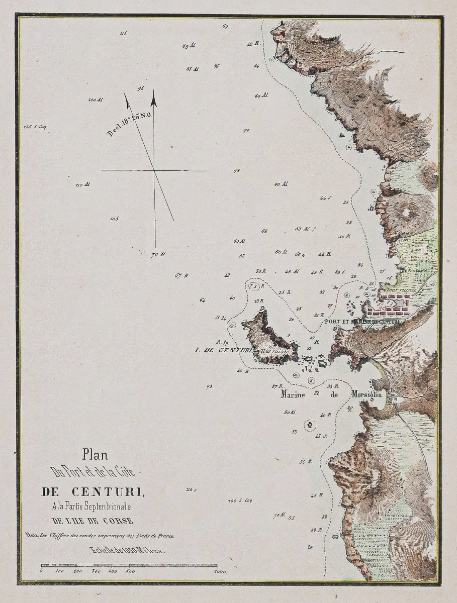
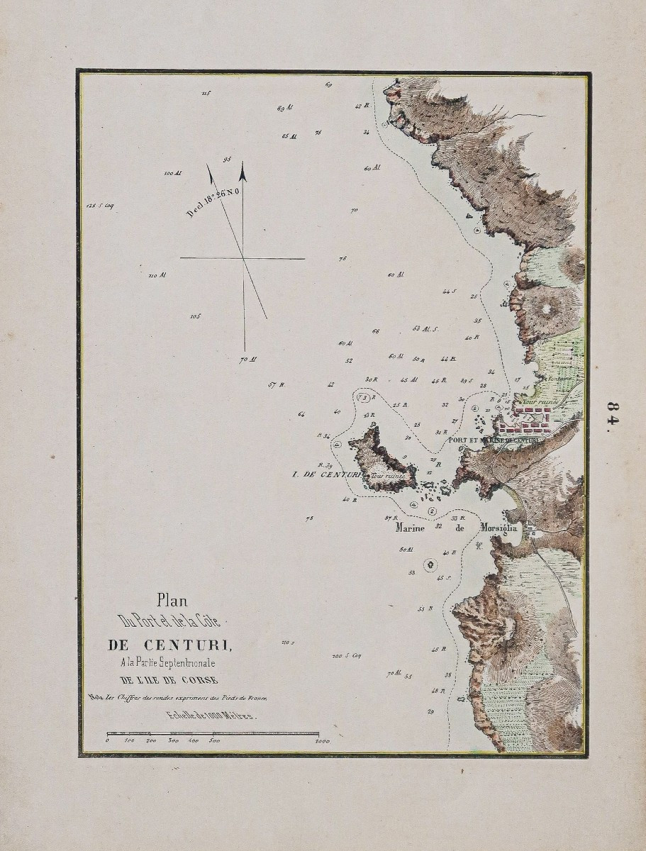


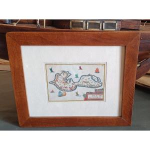
"Old Map Of The Port And Coast Of Centuri – Corsica"
Situé à la partie septentrionale de l’ile de CorseEpreuve originale réalisée en 1851. Gauttier Duparc lithographe.
Coloris aquarelle.
Très bon état.
Format feuille : 29 x 21 cm.
Original antique chart of 1851.
Carte marine très détaillée illustrant les reliefs, relevés des profondeurs, boussoles, échelle des lieux.
Vous pouvez consulter l’ensemble des cartes, livres et gravures disponibles sur votre région en cliquant sur le lien de notre site internet spécialisé en archives anciennes géographiques : https://cartes-livres-anciens.com/categorie-produit/cartes-geographiques-anciennes-original-antique-maps/france/corse/
Règlement sécurisé par carte bancaire sur notre site internet en cliquant sur le lien ci-dessous : https://cartes-livres-anciens.com/produit/cartes-geographiques-anciennes-original-antique-maps/france/corse/plan-ancien-du-port-et-de-la-cote-de-centuri-corse/
Toutes nos cartes et gravures sont accompagnées d’un certificat d’authenticité.
Located in the northern part of the island of Corsica. Original proof made in 1851. Gauttier Duparc lithograph. Watercolor colors. Very good condition. Sheet size: 29 x 21 cm. Original antique chart of 1851. Very detailed nautical chart illustrating reliefs, depth surveys, compasses, scale of places. You can consult all the maps, books and engravings available in your region by clicking on the link to our website specializing in old geographical archives: https://cartes-livres-anciens.com/categorie-produit/cartes-geographiques-anciennes-original-antique-maps/france/corse/ Secure payment by credit card on our website by clicking on the link below: https://cartes-livres-anciens.com/produit/cartes-geographiques-anciennes-original-antique-maps/france/corse/plan-ancien-du-port-et-de-la-cote-de-centuri-corse/ All our maps and engravings are accompanied by a certificate of authenticity.


 Le Magazine de PROANTIC
 TRÉSORS Magazine
 Rivista Artiquariato