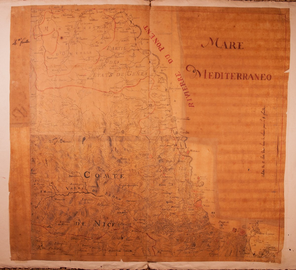
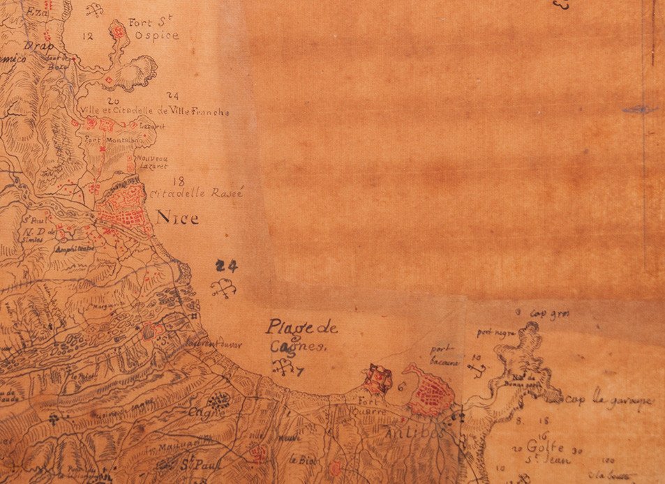

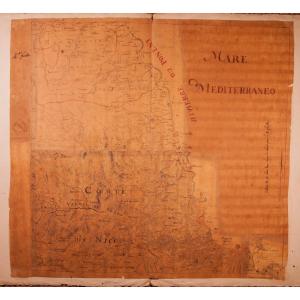


Manuscript Map Of The Riviera / Côte d'Azur 1740-1750
Rare map of the Riviera / Côte d'Azur around 1740-1750, including among others: Juan les Pins, Antibes, Cagnes, Nice, St-Jean-Cap-Ferrat, Monaco, Menton, Ventimiglia, Bordighera, San Remo.
Pen, black and red ink, wash and watercolor on tracing paper mounted on strong laid paper.
Accidents and lacks due to the fragility of the support.
Interesting piece of the history of the county of Nice.
Material: Layer
Width: 68 cm Height: 63 cm
Width of the laid paper support: 99 cm
Pen, black and red ink, wash and watercolor on tracing paper mounted on strong laid paper.
Accidents and lacks due to the fragility of the support.
Interesting piece of the history of the county of Nice.
Material: Layer
Width: 68 cm Height: 63 cm
Width of the laid paper support: 99 cm
600 €
Period: 18th century
Style: Louis 15th - Transition
Condition: In its current state
Material: Paper
Width: 68 cm
Height: 63 cm
Reference (ID): 1019698
Availability: In stock
Print