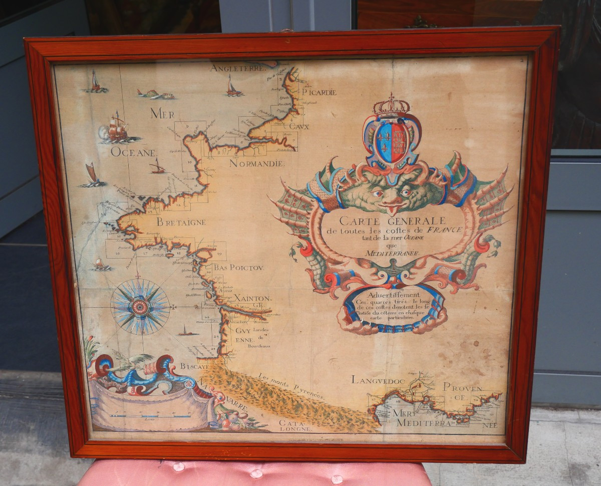
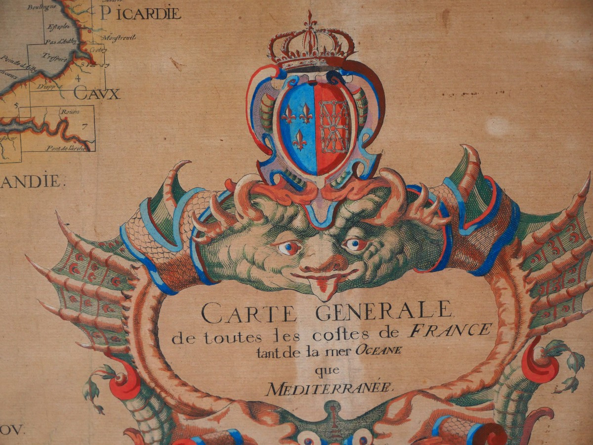

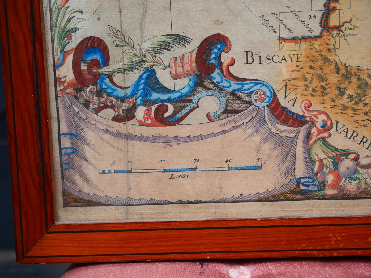
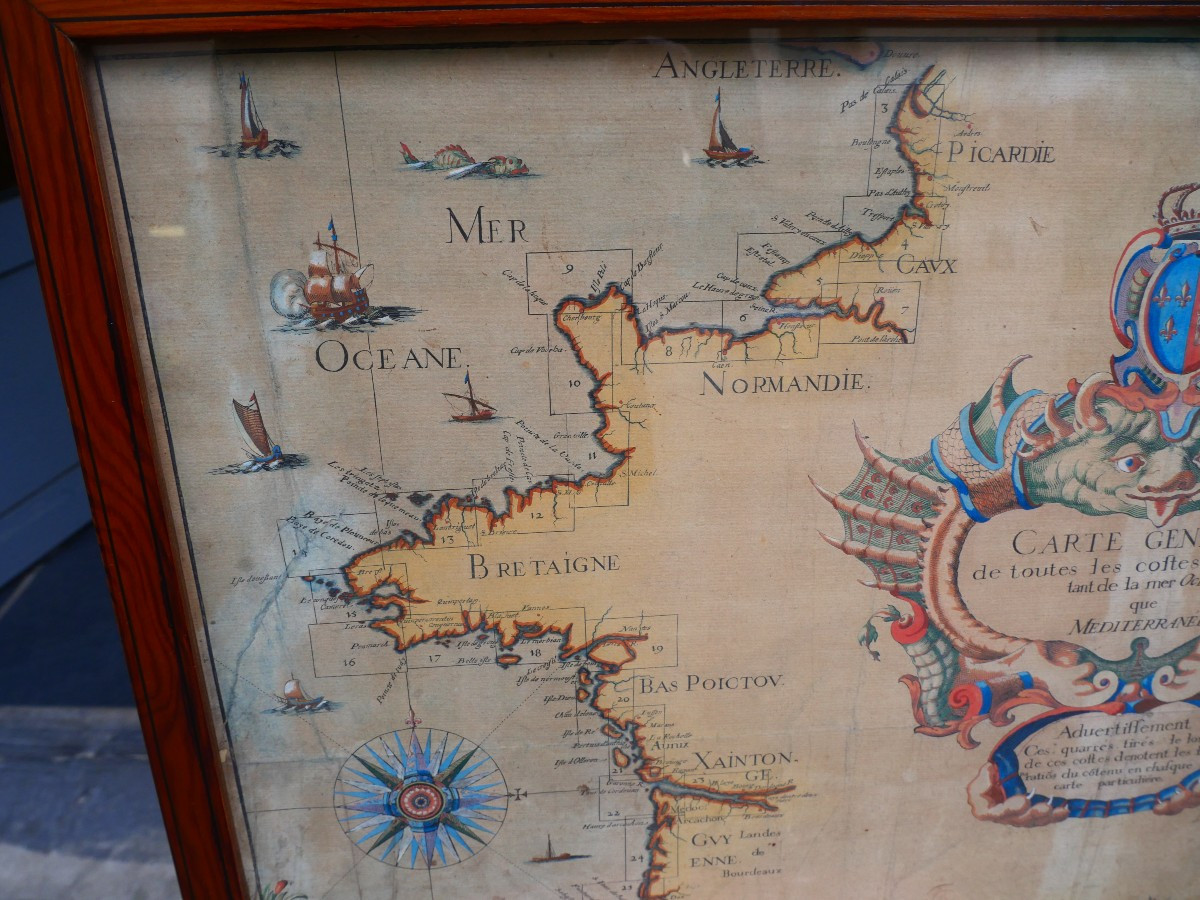


Map Of The Coasts Of France, 18th Century
Map of French coastlines, 18th century
300 €
Period: 18th century
Style: Other Style
Condition: Good condition
Material: Paper
Width: 50 cm
Height: 48 cm
Reference (ID): 1695304
Availability: In stock
Print