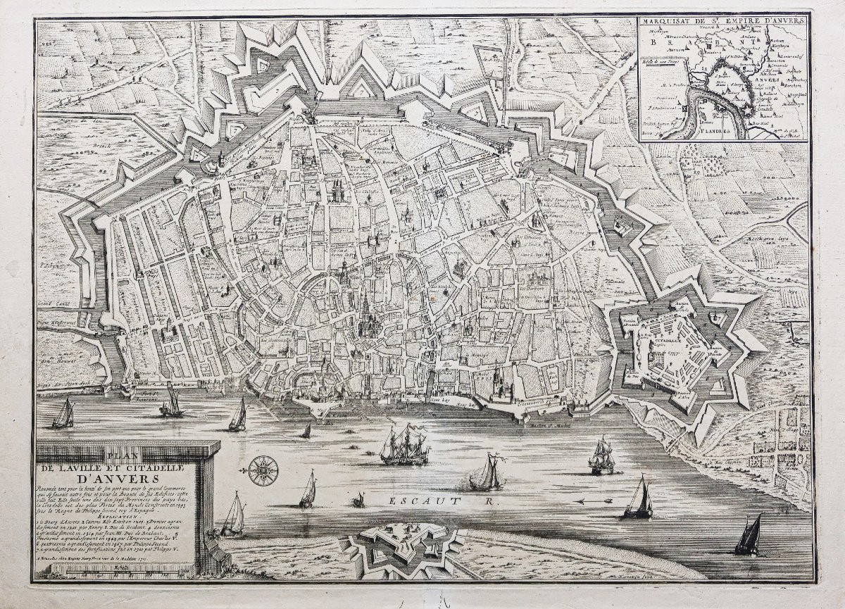
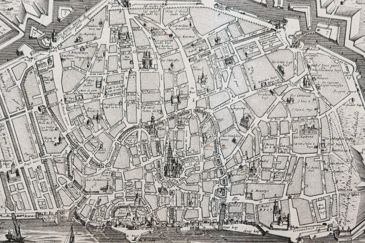


Old Map Of The City Of Antwerp
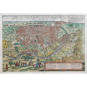
Plan de la ville et citadelle d’Anvers.
Epreuve originale réalisée en 1711. Henri Fricz auteur.
Belle impression bien contrastée.
Très bon état.
Format feuille : 58 x 42 cm.
Format gravure : 53,5 x 39,5 cm.
Original antique engraving of 1711.
Belle épreuve illustrant la ville et la citadelle d’Anvers. 1 cartouche de titre avec explicatif et renvois de 1 à 7 situant les principaux lieux et bourgs de la ville. Cartouche du Marquisat de St Empire d’Anvers. Rose des vents et galions.
Vous pouvez consulter l’ensemble des cartes, livres et gravures disponibles sur votre région en cliquant sur le lien de notre site internet spécialisé en archives anciennes géographiques :
https://cartes-livres-anciens.com/categorie-produit/cartes-geographiques-anciennes-original-antique-maps/europe/paysbas-belgique-luxembourg/
Règlement sécurisé par carte bancaire sur notre site internet en cliquant sur le lien ci-dessous :
https://cartes-livres-anciens.com/produit/cartes-geographiques-anciennes-original-antique-maps/europe/paysbas-belgique-luxembourg/plan-ancien-de-la-ville-danvers-2/
Toutes nos cartes et gravures sont accompagnées d’un certificat d’authenticité.
Map of the city and citadel of Antwerp. Original proof made in 1711. Henri Fricz author. Beautiful, well-contrasted print. Very good condition. Sheet size: 58 x 42 cm. Engraving size: 53.5 x 39.5 cm. Original antique engraving of 1711. Beautiful proof illustrating the city and citadel of Antwerp. 1 title cartouche with explanation and references from 1 to 7 locating the main places and towns of the city. Cartouche of the Marquisate of St Empire of Antwerp. Compass rose and galleons. You can consult all the maps, books and engravings available in your region by clicking on the link to our website specializing in old geographical archives: https://cartes-livres-anciens.com/categorie-produit/cartes-geographiques-anciennes-original-antique-maps/europe/paysbas-belgique-luxembourg/Secure payment by credit card on our website by clicking on the link below: https://cartes-livres-anciens.com/produit/cartes-geographiques-anciennes-original-antique-maps/europe/paysbas-belgique-luxembourg/plan-ancien-de-la-ville-danvers-2/All our maps and engravings are accompanied by a certificate of authenticity.
400 €
Period: 18th century
Style: Other Style
Condition: Excellent condition
Material: Paper
Reference (ID): 1617584
Availability: In stock
Print