


"Old Map Of Italy 1706"
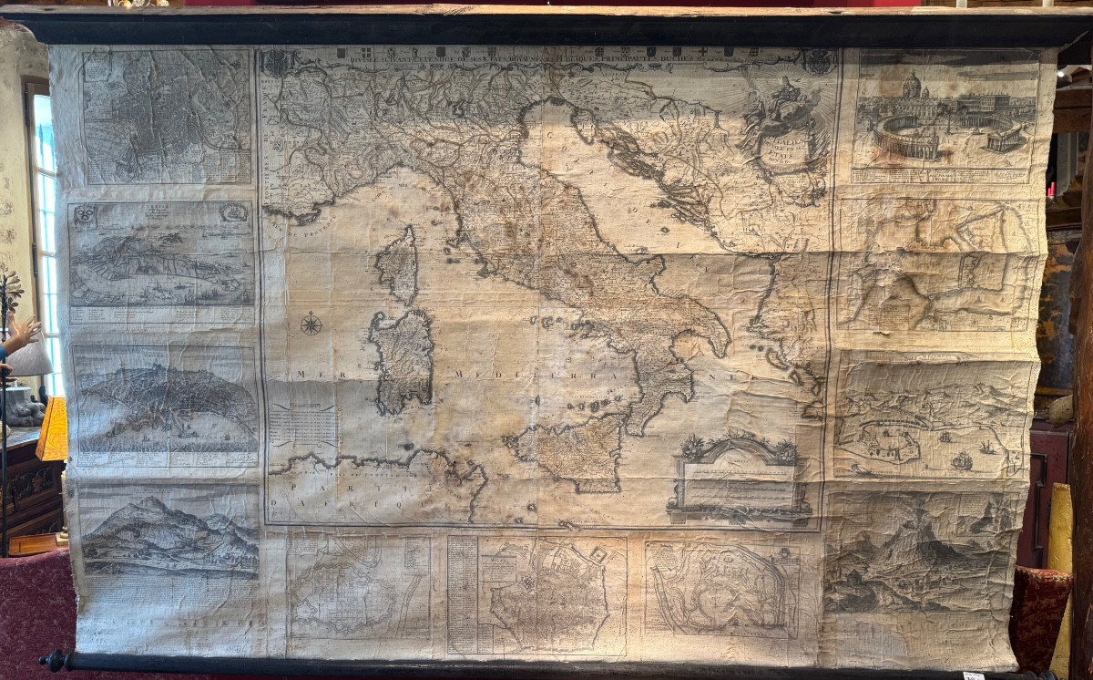
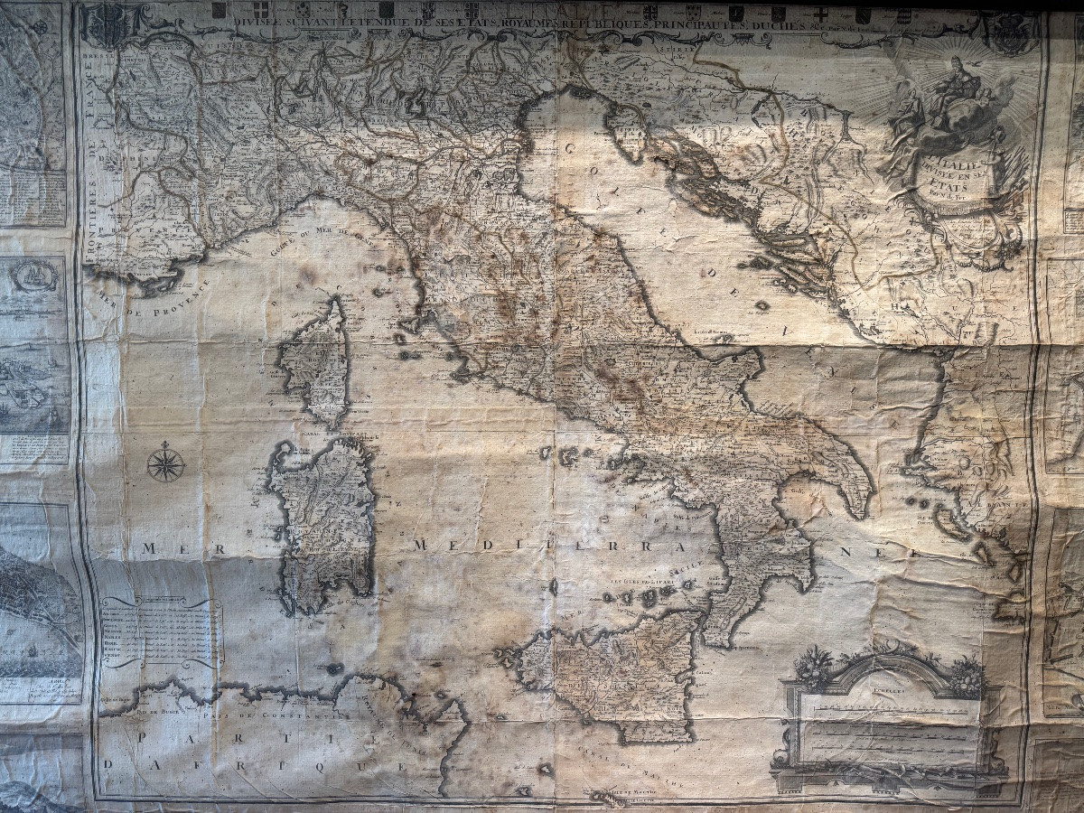
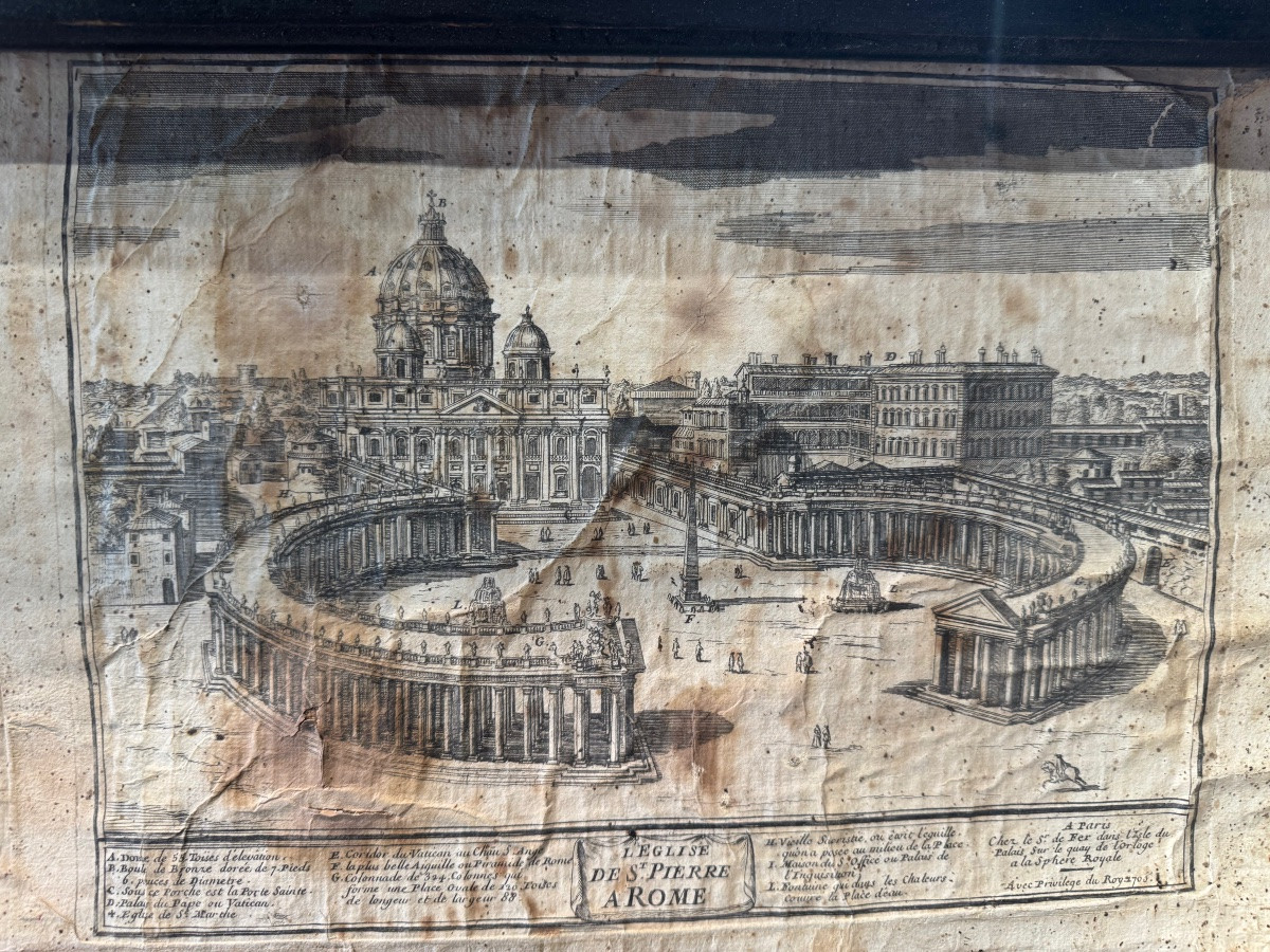
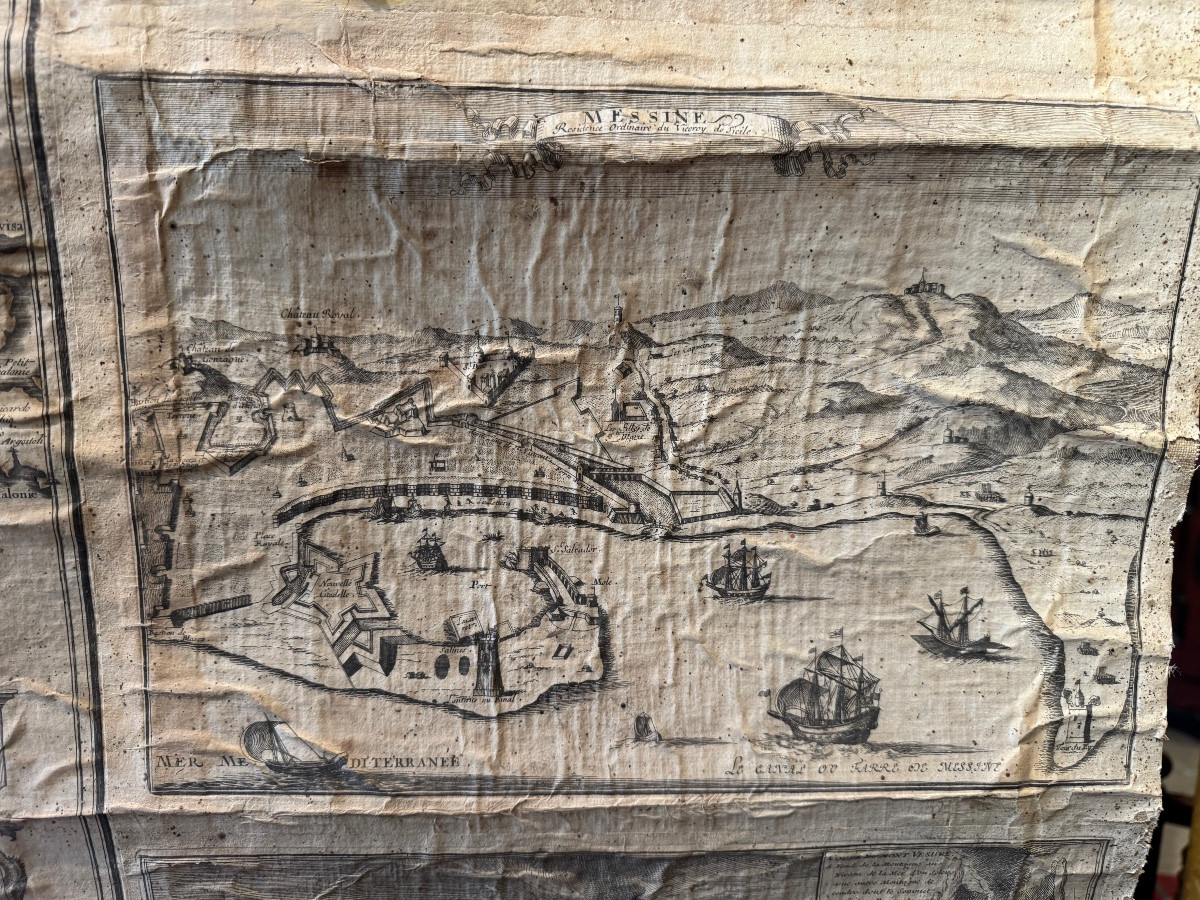
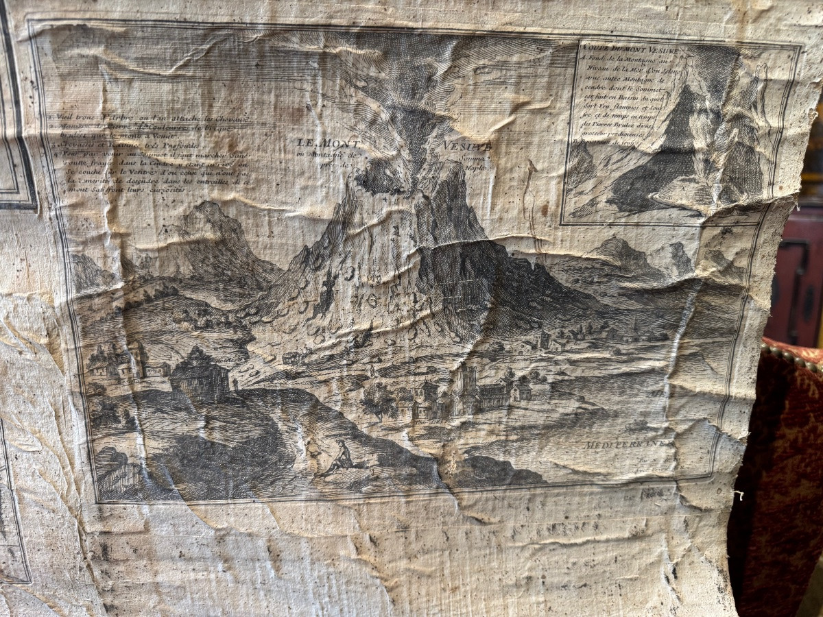
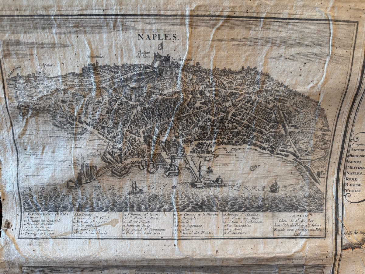
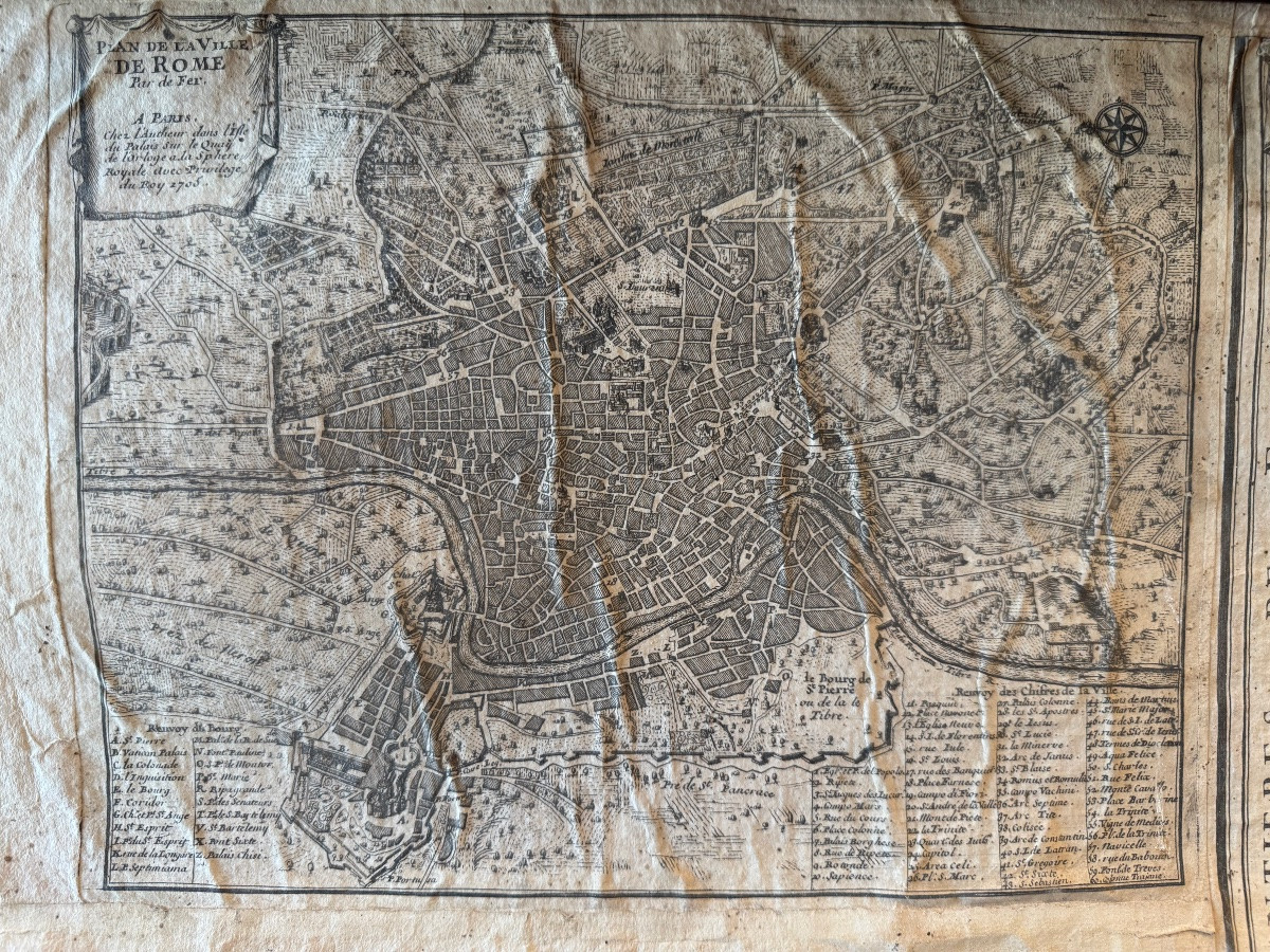
Very large wall map of Italy, dated 1706, entitled "Italy divided into its States". It illustrates the Italian peninsula in the modern era, still fragmented into a mosaic of kingdoms, republics, duchies and principalities (Kingdom of Naples, Duchy of Milan, Papal States, Republic of Venice, Savoy, Tuscany, etc.).Very large wall map of Italy, dated 1706, entitled "Italy divided into its States". It illustrates the Italian peninsula in the modern era, still fragmented into a mosaic of kingdoms, republics, duchies and principalities (Kingdom of Naples, Duchy of Milan, Papal States, Republic of Venice, Savoy, Tuscany, etc.). Around the central map are several views and engraved plans representing the main cities or remarkable sites: Rome and the Vatican, Venice, Naples, Florence, Genoa, as well as emblematic landscapes and fortifications. Great rarity due to its monumental format (185 x 115 cm) Ornate cartouche and numerous marginal illustrations: Italy divided into its States Date: 1706 Period: 18th century Support: Engraving mounted on canvas, original mounting with blackened wooden rods 


 Le Magazine de PROANTIC
 TRÉSORS Magazine
 Rivista Artiquariato