
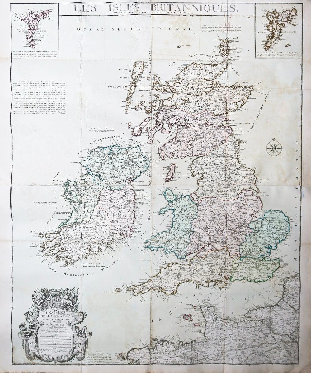
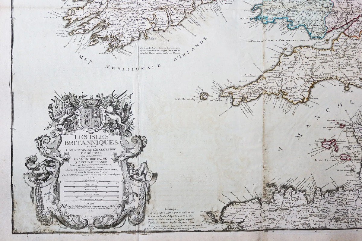
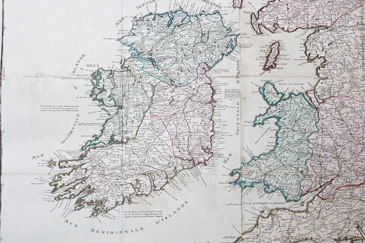
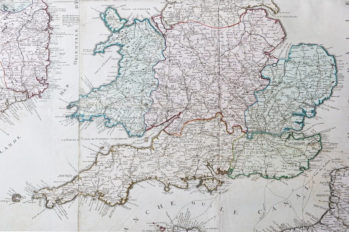


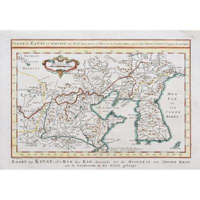
"Monumental Map Of The British Isles"
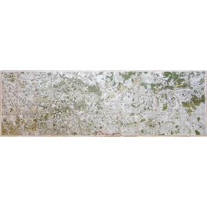
Grande carte murale originale de 1766. Desnos géographe.Coloris anciens.
Fines rousseurs et petit pli dans le haut de la carte au niveau du titre.
Bon état.
Format feuille : 110 x 96 cm.
Format gravure : 107,5 x 87 cm.
Original antique map of 1766.
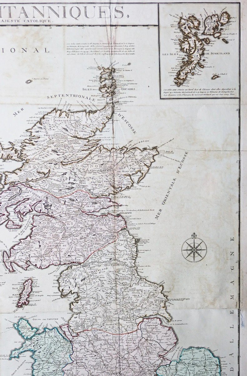
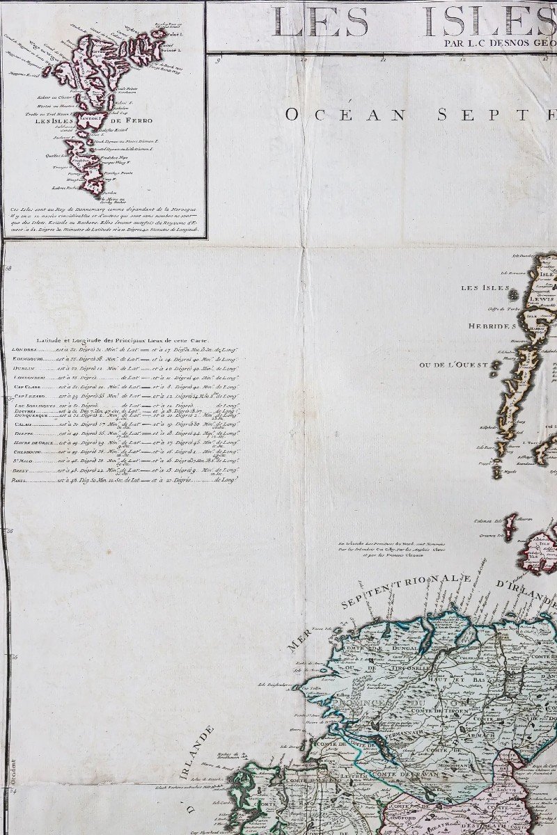
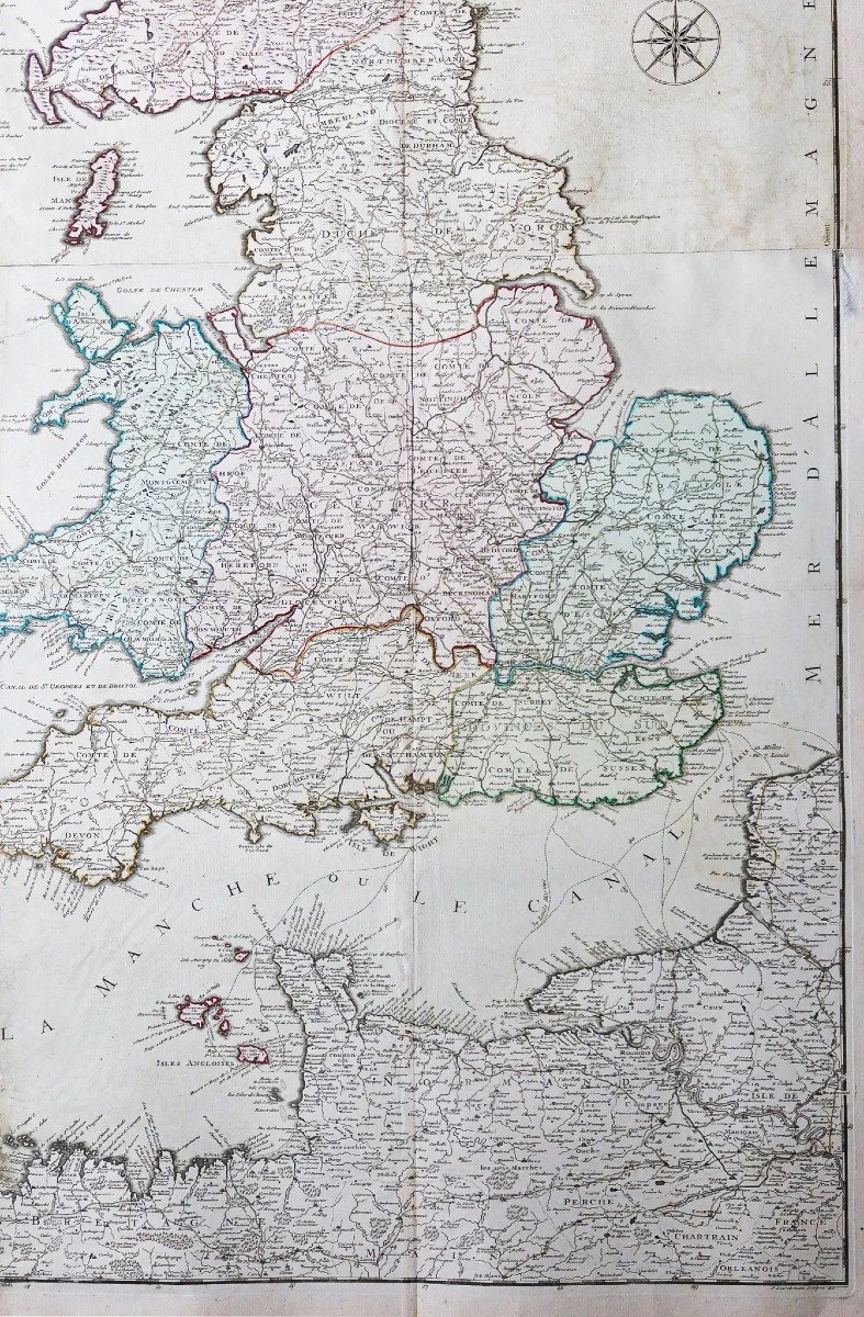
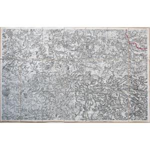
Grande carte gravée su 4 feuillets joints. 2 cartouches illustrant les Iles Féroé et les Iles de Shetland. Grand cartouche de titre avec échelle des lieux. Latitude et longitude des principales villes, rose des vents.
Vous pouvez consulter l’ensemble des cartes, livres et gravures disponibles sur votre région en cliquant sur le lien de notre site internet spécialisé en archives anciennes géographiques :
https://cartes-livres-anciens.com/categorie-produit/cartes-geographiques-anciennes-original-antique-maps/europe/iles-deurope/
Règlement sécurisé par carte bancaire sur notre site internet en cliquant sur le lien ci-dessous :
https://cartes-livres-anciens.com/produit/cartes-geographiques-anciennes-original-antique-maps/europe/iles-deurope/carte-geographique-des-iles-britanniques-2/
Toutes nos cartes et gravures sont accompagnées d’un certificat d’authenticité.
Desnos a été un fabricant important d’instruments de cartographie et de globes. Il occupa auprès du Roi de Danemark, Christian VII, le poste convoité de royal globe maker. Il recevait pour cela une allocation annuelle de 500 livres. En retour il envoyait chaque année au roi des cartes, des livres et des atlas. Il fut libraire et éditeur et produit une collection de cartes importante. Il fut souvent associé aux géographes Zannoni et Louis brion de la Tour (1756-1823).
Sa grande production de cartes publiées lui a valu parfois, parmi ses détracteurs jaloux de sa notoriété, une mauvaise réputation parmi les autres cartographes, qui l’ont considéré sans scrupules et sans discernement de ce qui devait être publiable ou non.
Large original wall map from 1766. Desnos geographer. Old colors. Fine foxing and small crease at the top of the card at title level. Good condition. Sheet size: 110 x 96 cm. Engraving format: 107.5 x 87 cm. Original antique map of 1766. Large engraved map on 4 attached sheets. 2 cartridges illustrating the Faroe Islands and the Shetland Islands. Large title cartouche with scale of places. Latitude and longitude of the main cities, wind rose. You can consult all the maps, books and engravings available in your region by clicking on the link of our website specializing in ancient geographical archives: https://cartes-livres-anciens.com/categorie-produit/cartes-geographiques -anciens-original-antique-maps/europe/iles-deurope/ Secure payment by credit card on our website by clicking on the link below: https://cartes-livres-anciens.com/produit/cartes-geographiques -anciens-original-antique-maps/europe/islands-of-europe/map-geographic-of-the-british-islands-2/ All our maps and engravings are accompanied by a certificate of authenticity. Desnos was an important manufacturer of cartographic instruments and globes. He held the coveted position of royal globe maker with the King of Denmark, Christian VII. For this he received an annual allowance of 500 pounds. In return, he sent maps, books and atlases to the king every year. He was a bookseller and publisher and produced an important collection of maps. He was often associated with the geographers Zannoni and Louis Brion de la Tour (1756-1823). His large output of published maps sometimes earned him, among his jealous detractors of his notoriety, a bad reputation among other cartographers, who considered him unscrupulous and indiscriminate as to what should or should not be publishable.


 Le Magazine de PROANTIC
 TRÉSORS Magazine
 Rivista Artiquariato