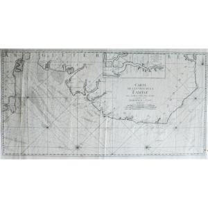
Map of the entrance to the Thames with benches, passes, Isles and Costes between Sandwich and Clay.
Probably by Le Rouge; middle 18th century
Dimensions: 45.7 x 89 cm 17.99 x 35 inches subject
67 x[...]
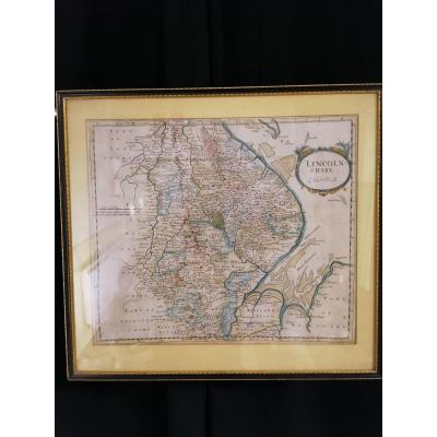
Trois carte antique de régions d'angleterre tel que le Surrey, le Warwick Shire et le Lincoln Shire par Robert Morden datant de 1722. Cartes coloriées à la main publiées pour la première fois dans la [...]
Proantic uses a cookie to analyze traffic and improve its service by using Google Analytics. Data sent to Google Analytics (frequency of visits to the site and pages visited) are anonymous. No other cookie tracks your activity, your personal data is not collected. Thank you for helping us to have better understanding how Proantic is used.


 Le Magazine de PROANTIC
 TRÉSORS Magazine
 Rivista Artiquariato