
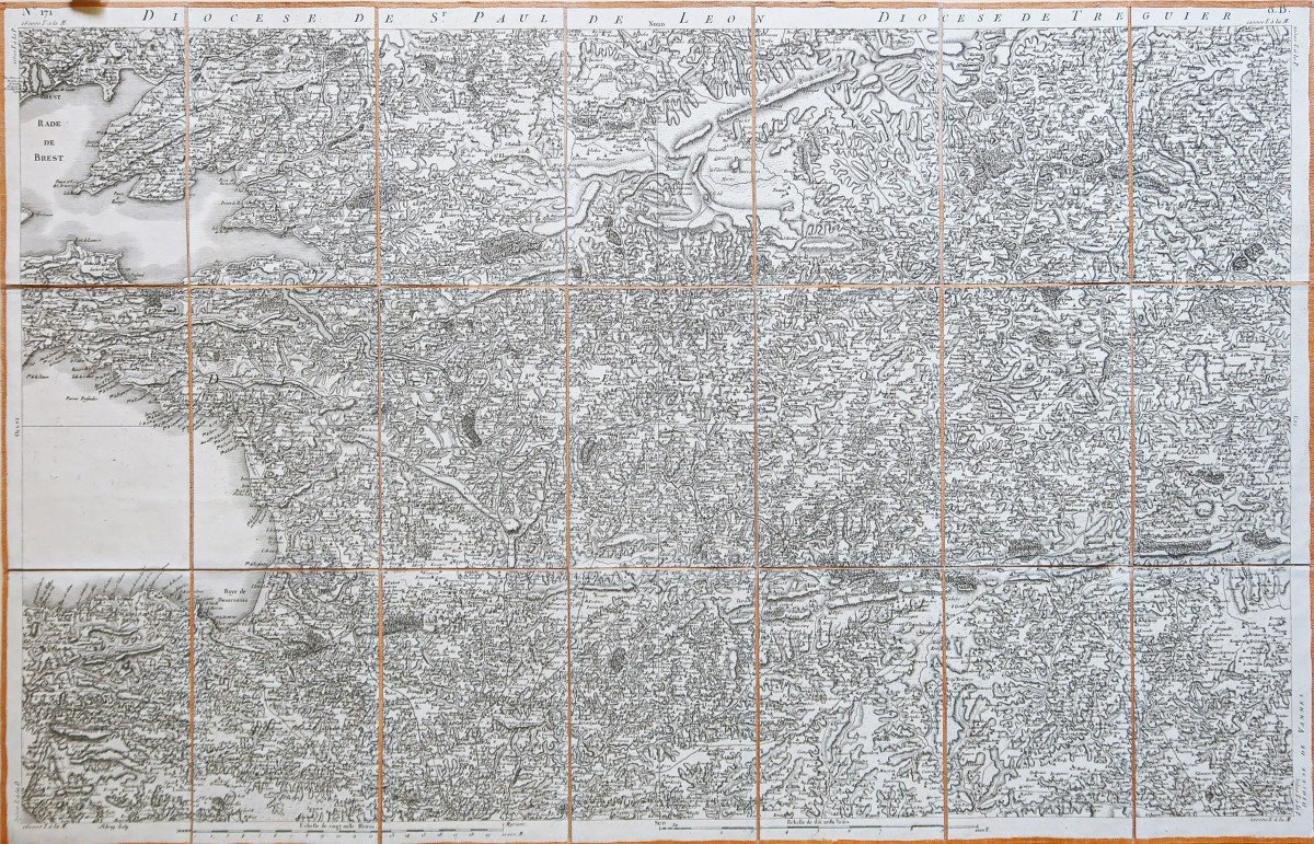
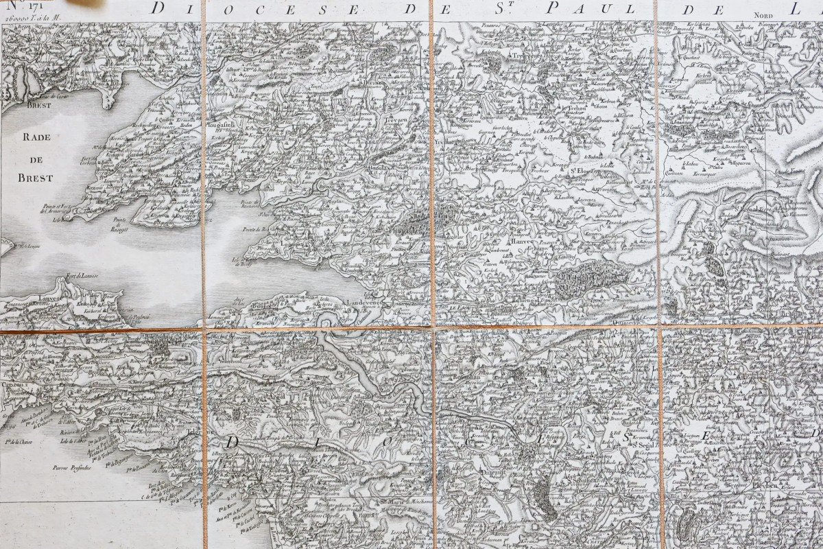
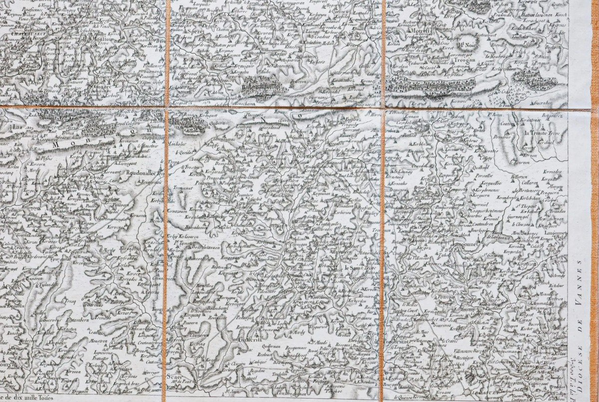
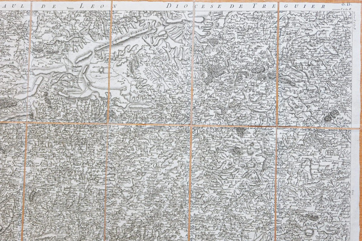
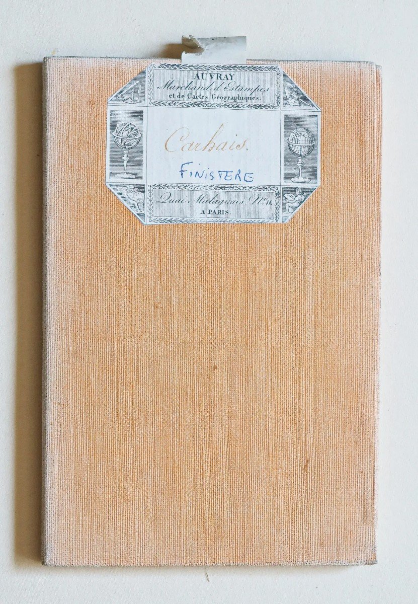


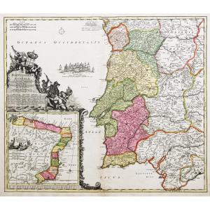
"Old Map Of Saint Pol De Léon - Brittany"
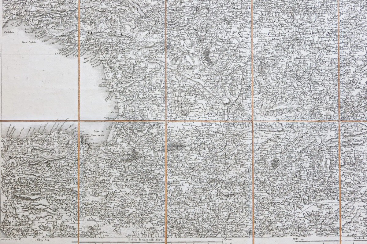
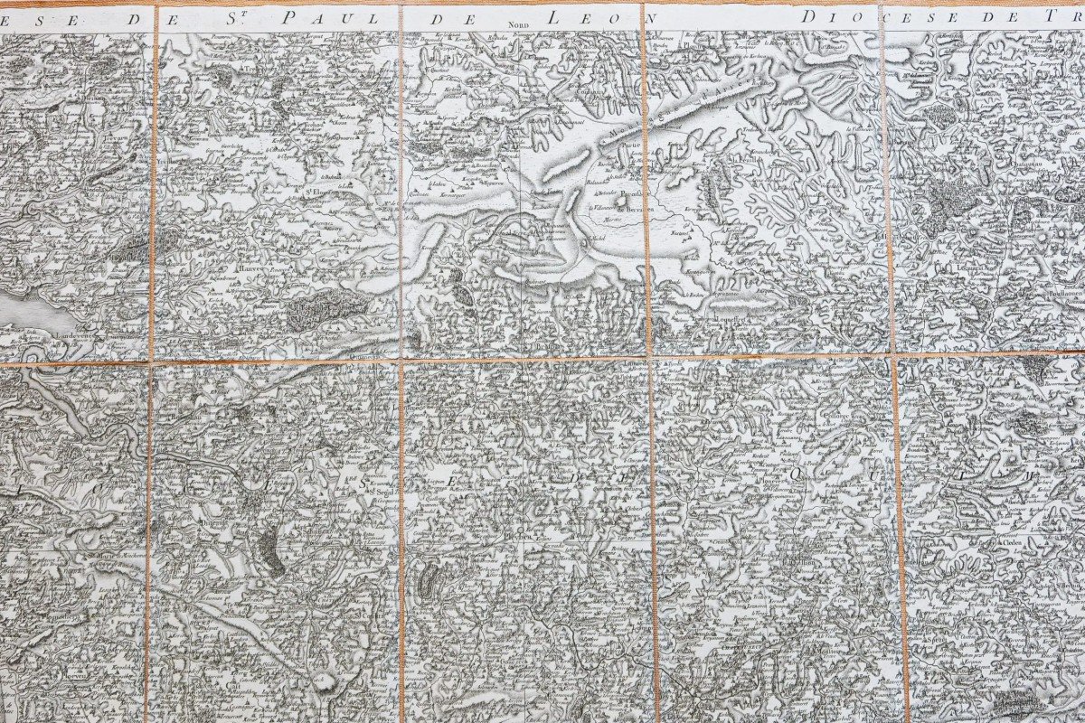
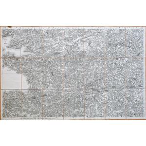
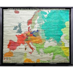
Original Cassini proof produced in 1784. Published by Auvray. Vintage canvas and mounted in 21 sections. Very good state. Sheet size: 93.5 x 60 cm. Folded format: 20 x 13 cm. You can consult all the maps, books and engravings available in your region by clicking on the link of our website specializing in ancient geographical archives: https://cartes-livres-anciens.com/categorie-produit/cartes-geographiques -anciens-original-antique-maps/france/bretagne/ Secure payment by credit card on our website by clicking on the link below: https://cartes-livres-anciens.com/produit/cartes-geographiques-anciennes -original-antique-maps/france/bretagne/carte-ancienne-de-saint-pol-de-leon-cassini/ All our maps and engravings are accompanied by a certificate of authenticity. The Cassini map, which it would be more accurate to call the Cassini map, since it takes its name from a family of four Italian geographers who settled in the kingdom at the end of the 17th century, is the first major cartographic undertaking covering the whole of France. It is made up of 180 sheets whose surveys, begun in 1756, were completed in 1789. They were engraved on copper plates and then printed at the Paris Observatory from 1757 to 1790. Intended to be marketed to a rich public, some editions have also been watercoloured. Cassini's map owes its extraordinary precision to the method of triangulation, used for its development. This method consists in measuring the distance between two points B and C then, from a reference point A, in measuring the angles of the straight lines BA and CA. It is then sufficient for the geographer to apply the trigonometry formulas in order to know the distances BA and CA. This method was used by the Dutchman Snellius in 1615, then by the Abbé Picard in 1670 and, finally, from 1683 to 1718, for the measurement of a long meridian going from Dunkirk to Perpignan. The corners of each sheet of Cassini's map bear the distances in toises to the meridian of Paris and to its perpendicular (which joins Saint-Malo and Strasbourg). In addition to this main triangulation, each board has nearly 300 landmarks (buildings, heights), useful for establishing a secondary triangulation. In fact, the mentions on the map are numerous and varied. One thus finds there information relative to the relief (the forests, the marshes, the rivers, the ponds), to the ways of communication (the roads, the channels, the bridges), to the administrative and religious organization (the province, diocese, parish boundaries) or to civil and religious buildings (churches, abbeys, priories, mills, castles). Cassini's map is still used today by many researchers, amateurs or professionals, attached to the study of toponyms, archeology, historical geography or environmental history. (Departmental archives) Canvas-backed maps Initially reserved for wall maps, canvas-backing, whose function is to consolidate the paper, is gradually being used for other types of maps such as those drawn up and used in the 17th century by military engineers . […] This technique experienced considerable growth in the 18th century and in particular from 1740-1750, when publishers and geography merchants systematically distributed maps “glued on canvas” or “mounted on canvas” or even “folding ". Because it can be folded in different ways, the map becomes more manageable and easier to consult. The merchant Julien proposes the covering of the cards "to be able to fold them in all directions, and to have under the eyes only the necessary part" or even "so as to use them on a desk without them causing the less embarrassment. Finally, he indicates that “these cards, or cut sheets, have the further advantage, being glued to canvas, of not spoiling”. Desnos, meanwhile, sells the sheets of Cassini's Map "stuck on canvas & bent for the pocket". In the 18th century, the interfacing was done in the publisher's shop, sometimes even by him […]. In the 19th century, interfacing became a specialty of certain map publishers and merchants. Goujon announces himself as a “Geographical Map Collector and Merchant”, rue de Savoie then quai des Augustins. Depot de la Guerre, a major card producer, did not always carry out the covering and frequently entrusted it to Goujon and Vignon. In 1802-1803, the expenses of supplies and interfacing by the care of these publishers are such that the production of maps (drawing and engraving) is slowed down. It is true that the covering sometimes considerably increases the price of the map […] especially since the map, then folded, is very often offered in a case. 


 Le Magazine
 Rivista Artiquariato
 TRÉSORS magazine