


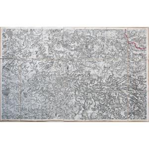
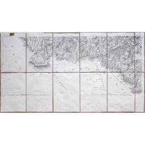
"Nautical Chart Of The Ile De Sein - Guilvinec - Kerity"
Carte originale gravée en 1879.Très bon état.
Format feuille : 66 x 49 cm.
Original antique chart of 1879.
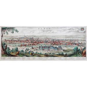
Rare collection illustrant les ports de France fin 19 ème siècle.
Institution qui modèle le littoral français (1667 – 2000), dans la tradition des Neptune français .
Vous pouvez consulter l’ensemble des cartes, livres et gravures disponibles sur votre région en cliquant sur le lien de notre site internet spécialisé en archives anciennes géographiques :
https://cartes-livres-anciens.com/categorie-produit/cartes-geographiques-anciennes-original-antique-maps/france/bretagne/
Règlement sécurisé par carte bancaire sur notre site internet:
https://cartes-livres-anciens.com/produit/cartes-geographiques-anciennes-original-antique-maps/france/bretagne/carte-marine-ancienne-ile-de-sein-kerity-guilvinec-original-antique-chart/
Toutes nos cartes et gravures sont accompagnées d’un certificat d’authenticité.
Original card engraved in 1879. Very good condition. Sheet size: 66 x 49 cm. Original antique chart from 1879. Rare collection illustrating the ports of France at the end of the 19th century. Institution that models the French coast (1667 - 2000), in the tradition of the French Neptunes. You can consult all the maps, books and engravings available in your region by clicking on the link of our website specializing in ancient geographic archives: https://cartes-livres-anciens.com/categorie-produit/cartes-geographique -anciennes-original-antique-maps / france / bretagne / Secure payment by credit card on our website: https://cartes-livres-anciens.com/produit/cartes-geographique-anciennes-original-antique-maps/france / bretagne / carte-marine-ancien-ile-de-sein-kerity-guilvinec-original-antique-chart / All our maps and engravings are accompanied by a certificate of authenticity.


 Le Magazine de PROANTIC
 TRÉSORS Magazine
 Rivista Artiquariato