


"Ancient Atlas Of Ptolemy"
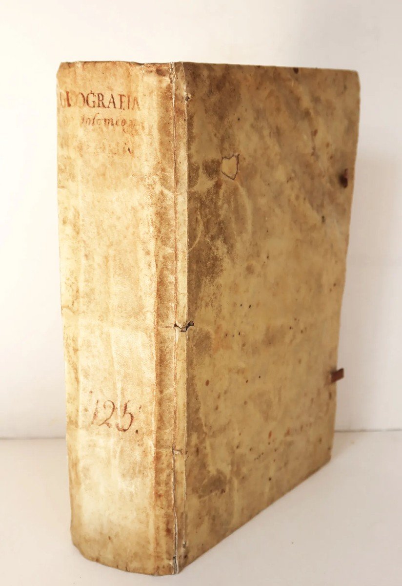
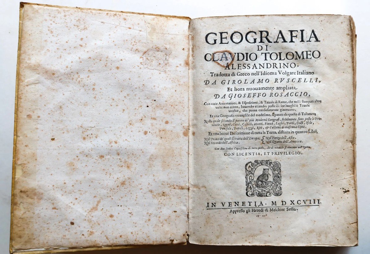
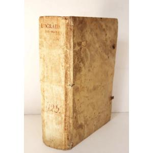
Géographie de Claude Ptolémée d’Alexandrie, traduite du grec en langue vernaculaire italienne parClaudio Tolomeo Alessandrino.Venise, 1598. 1 volume in-4 (24 x 17, 5 cm). Plein vélin de l’époque. Dos lisse, titre manuscrit.
Rebouchage ancien d’une perforation, de la page de titre et des 25 premiers feuillets de la table.
Quelques fines oxydations du temps.
Bon exemplaire sur grand papier.
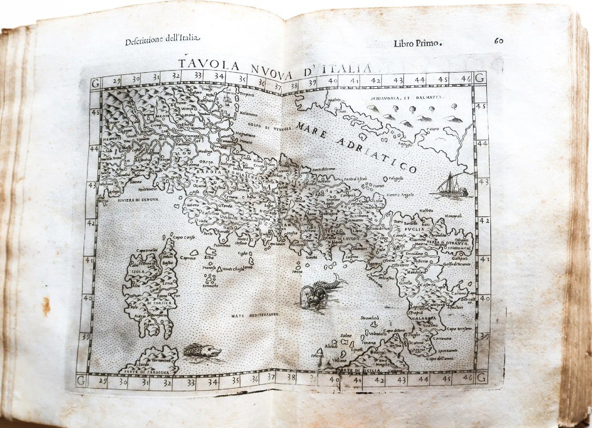
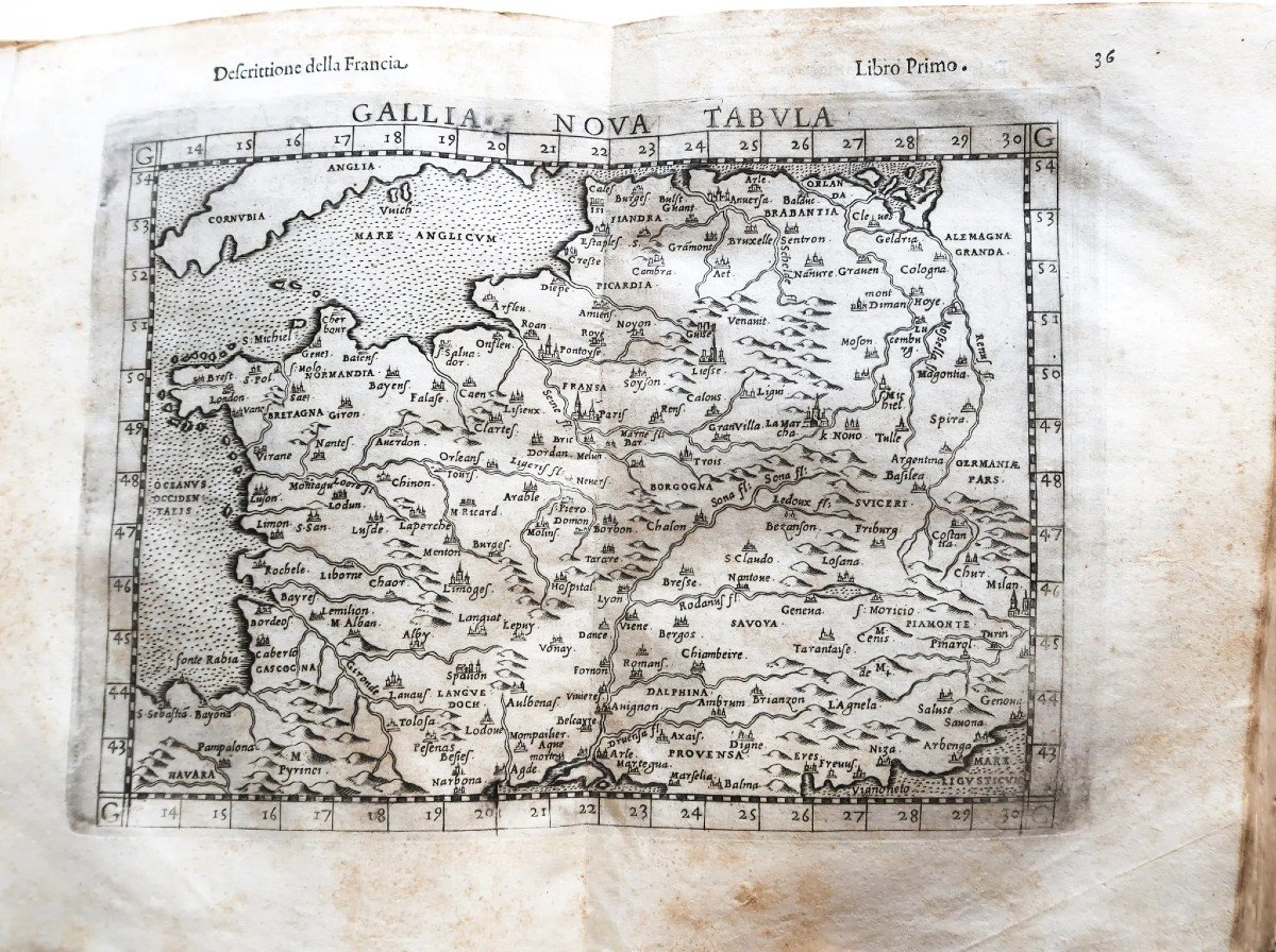
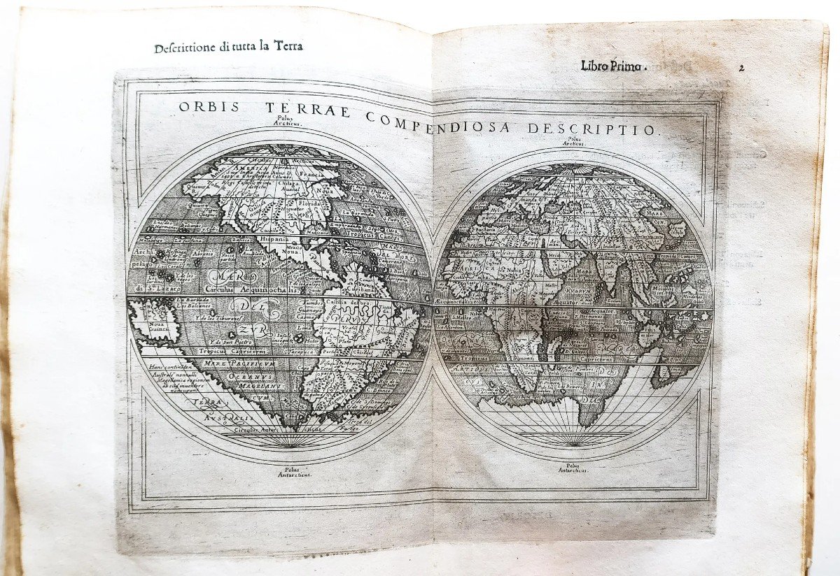
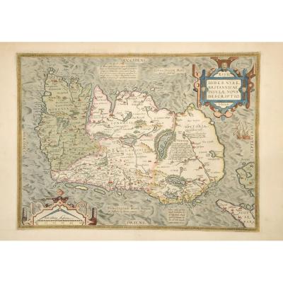
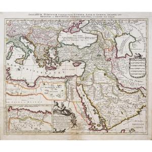
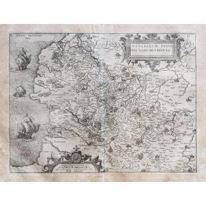
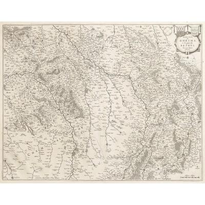
Bien complet des 69 cartes gravées à double page. (d'autres photographies sur notre site.)
Atlas particulièrement important pour l’histoire de la géographie, marquant l’évolution de la cartographie antique de Ptolémée et de la cartographie dite « Moderne » de Girolamo Ruscelli, Mercator Gérard et d’Ortelius Abraham.
Vous pouvez consulter l’ensemble des cartes, livres et gravures disponibles sur votre région en cliquant sur le lien de notre site internet spécialisé en archives anciennes géographiques:
https://cartes-livres-anciens.com/categorie-produit/livres/atlas-livres/
Règlement sécurisé par carte bancaire sur notre site internet en cliquant sur le lien ci-dessous:
https://cartes-livres-anciens.com/produit/livres/atlas-livres/atlas-ancien-de-ptolemee/
Toutes nos cartes et gravures sont accompagnées d’un certificat d’authenticité.
Un excellent exemple de l’amélioration de Rosaccio sur le Ptolémée de Ruscelli, ajoutant des connaissances et des interprétations contemporaines et retravaillant en profondeur les cartes gravées sur cuivre avec des monstres marins et des navires décoratifs.
Il s’agit de la sixième édition du Ptolémée de Ruscelli et de la quatrième à être publiée en italien.Le volume contient deux parties, dont la première est en huit livres et la seconde en quatre.
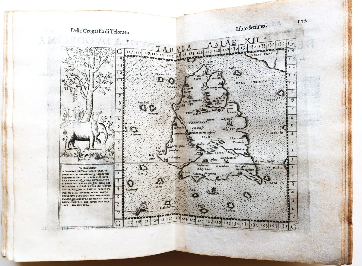
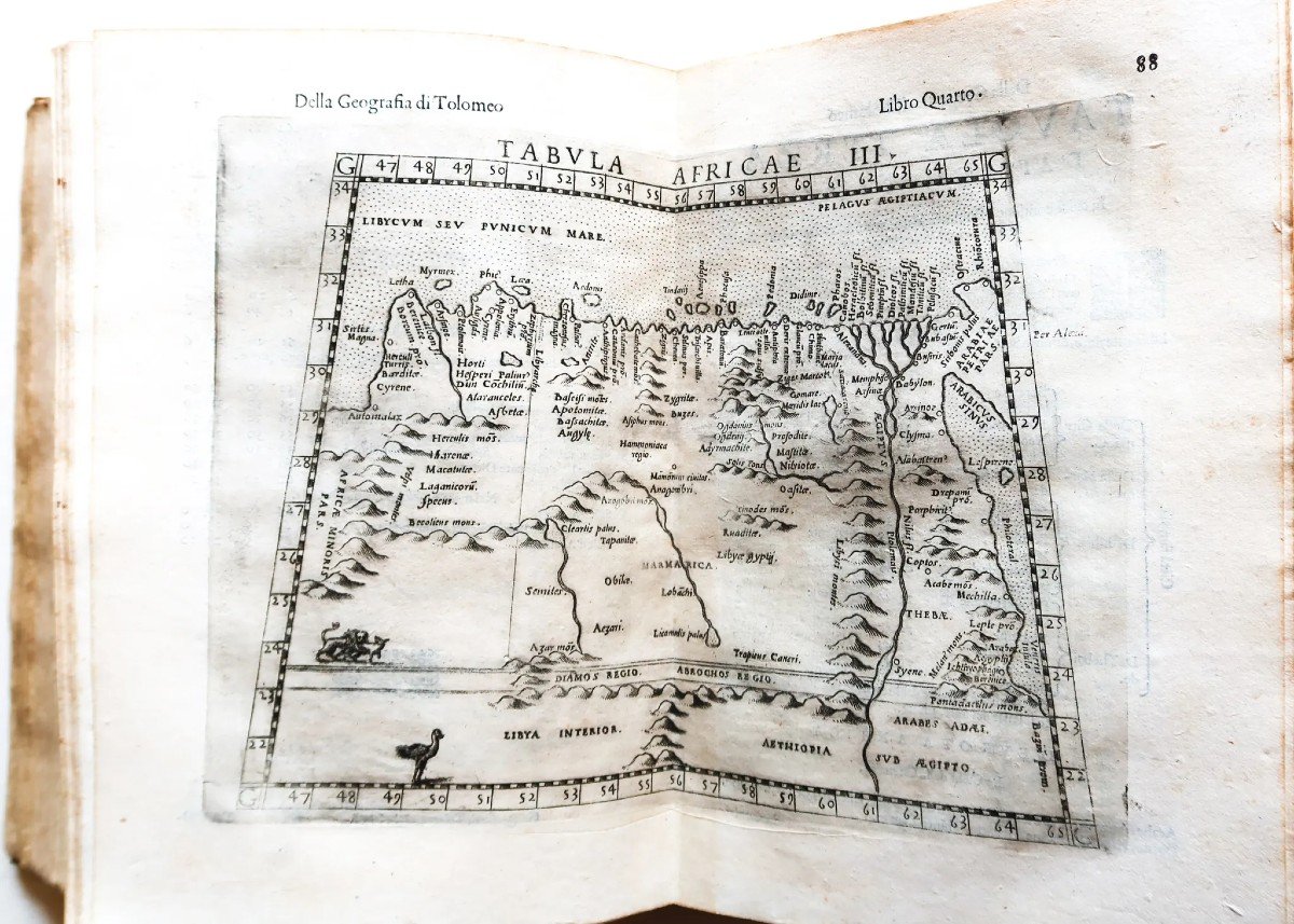
La première section fournit un compte rendu complet de la géographie ptolémaïque, détaillant les coordonnées de centaines de localités, y compris des villes, des montagnes et des caractéristiques historiques supposées.Cette section comprend 27 cartes, toutes les descriptions et discussions superflues de la géographie ptolémaïque sont limitées aux vingt pages de texte de pont entre les deux sections.
5 nouvelles cartes ont été ajoutées depuis l’édition précédente, qui avait été publiée en 1574 ((Europe, Hongrie et Transylvanie, Afrique, Asie et Amérique). De nombreuses cartes ont été mises à jour, comme la carte du monde à double hémisphère dessinant un grand sud de la Terra Australis, occupant une vaste partie du globe.
La deuxième partie, composée de quatre livres, aborde des concepts plus modernes de la géographie.Cette section comprend 42 cartes avec descriptions détaillées des régions du monde.Ces deux sections sont ordonnées de la même manière,permettant une comparaison aisée entre les deux écoles de pensée.
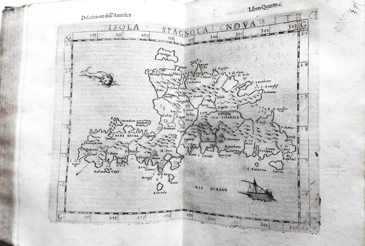
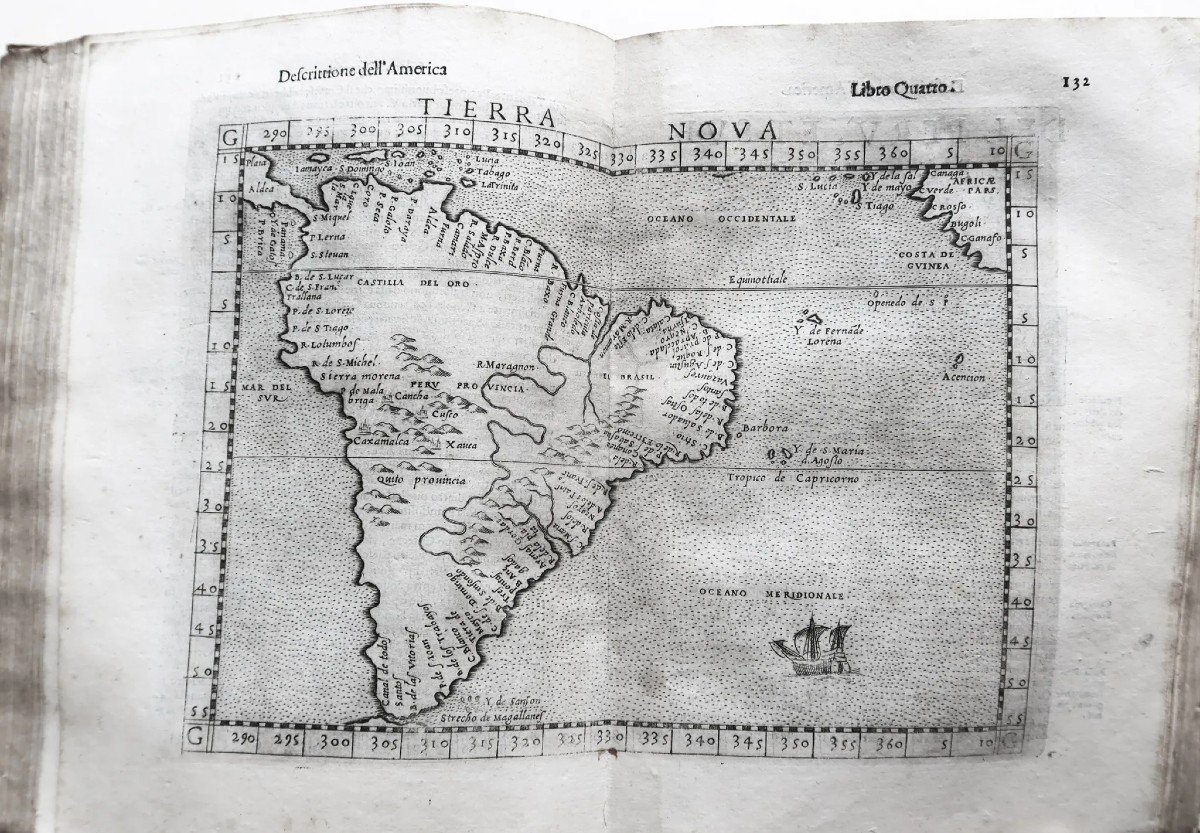
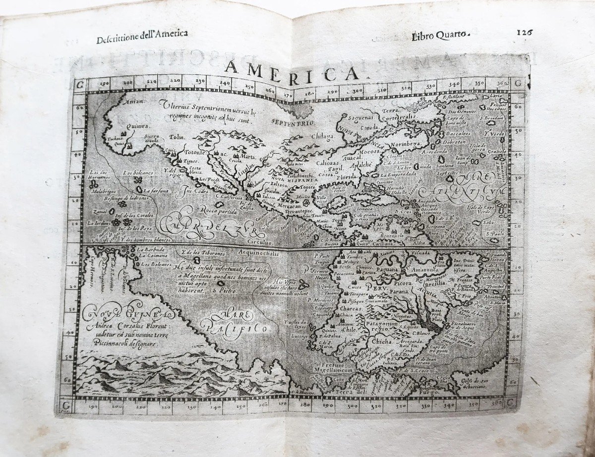
Le quatrième livre est particulièrement important, entièrement consacré à l’Amérique, avec la grande carte décrivant l’ensemble du continent américain et les sept cartes suivantes montrant en détail les différentes régions d’Amérique découvertes et explorées au 16èmesiècle.
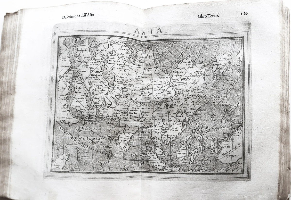
Nous trouvons également, la carte générale d’Asie la » Terra Australis «, une grande Nouvelle-Guinée et quelques îles à l’est de l’Inde absentes des éditions précédentes de Ptolémée.
Des gravures sur bois in-texte illustrent la conception des cartes.
Geography of Claudius Ptolemy of Alexandria, translated from Greek into the Italian vernacular by Claudio Tolomeo Alessandrino. Venice, 1598. 1 volume in-4 (24 x 17.5 cm). Full contemporary vellum. Smooth spine, handwritten title. Old filling of a perforation, of the title page and of the first 25 leaves of the table. Some fine oxidations of time. Good copy on large paper. Complete with 69 double-page engraved maps. (Other photographs on our site.) Particularly important atlas for the history of geography, marking the evolution of the ancient cartography of Ptolemy and the so-called "Modern" cartography of Girolamo Ruscelli, Mercator Gérard and Ortelius Abraham . You can consult all the maps, books and engravings available in your region by clicking on the link of our website specializing in ancient geographical archives: https://cartes-livres-anciens.com/categorie-produit/livres/atlas -livres/ Secure payment by credit card on our website by clicking on the link below: https://cartes-livres-anciens.com/produit/livres/atlas-livres/atlas-ancien-de-ptolemee/ All our maps and engravings are accompanied by a certificate of authenticity. A great example of Rosaccio's improvement on Ruscelli's Ptolemy, adding contemporary insights and interpretations and extensively reworking the copperplate maps with decorative sea monsters and ships. This is the sixth edition of Ruscelli's Ptolemy and the fourth to be published in Italian. The volume contains two parts, the first of which is in eight books and the second in four. The first section provides a comprehensive account of Ptolemaic geography, detailing the coordinates of hundreds of localities, including towns, mountains, and supposed historical features. This section comprises 27 maps, all superfluous descriptions and discussions of Ptolemaic geography are limited to the twenty pages of bridge text between the two sections. 5 new maps have been added since the previous edition, which was published in 1574 ((Europe, Hungary and Transylvania, Africa, Asia and America). Many maps have been updated, such as the double hemisphere world map drawing a great southern part of the Terra Australis, occupying a vast part of the globe. The second part, consisting of four books, deals with more modern concepts of geography. This section includes 42 maps with detailed descriptions of the regions of the world. These two sections are ordered in the same way, allowing an easy comparison between the two schools of thought.The fourth book is particularly important, entirely devoted to America, with the large map describing the whole of the American continent and the seven following maps showing in detail the different regions of America discovered and explored in the 16th century. We also find, the general map of Asia the "Terra Australis", a large New -Guinea and some islands east of India missing from previous editions of Ptolemy. In-text woodcuts illustrate the design of the cards.


 Le Magazine
 Rivista Artiquariato
 TRÉSORS magazine