THIS OBJECT WAS SOLD

Map Of Corsica 18th Century By Tobias Conrad

Sold
Map Of Corsica 18th Century By Tobias Conrad
Sold
Map Of Corsica 18th Century By Tobias Conrad -photo-2
Sold
Map Of Corsica 18th Century By Tobias Conrad -photo-3
Sold
Map Of Corsica 18th Century By Tobias Conrad -photo-4
Sold
Map Of Corsica 18th Century By Tobias Conrad -photo-1
Sold
Map Of Corsica 18th Century By Tobias Conrad -photo-2
Sold
Map Of Corsica 18th Century By Tobias Conrad -photo-3
More pictures
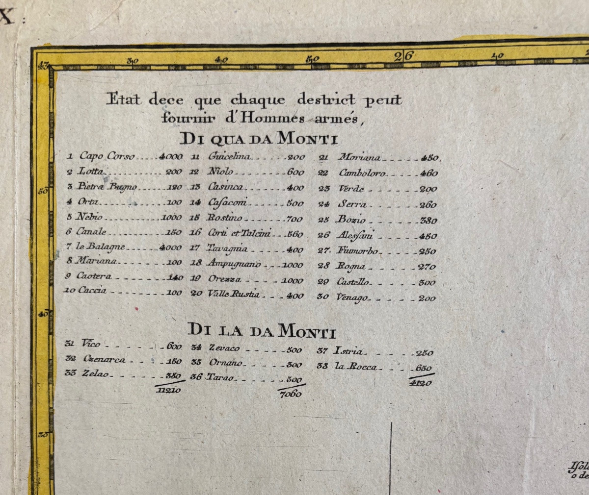
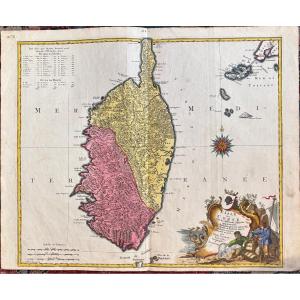
Lotter Tobias Conrad The island of Corsica with its various districts, belonging to the Republic of Genoa, but divided and in revolt for several years. Augsburg around 1740 49.5 X 57.5cm

Explore similar pieces and discover your ideal find:

Old Maps

Rare Engraving Of The Island Of Narmoustier (island Of Noirmoutier) - Ep. 17th
Old Plan Of Bourges
Optical View Eighteenth Port Maseille
Panoramic Chalons XVII
View Of The Arno And The City Of Florence, Optical Engraving 18th Time.
Optical View 18 ° Augsburg View From The Ditches 42 X 31 Views

20 Rue Saint Saens
Marseille 13001, France

0491337794

0603007991 & 0695107275

Follow the dealer

CONTACT

SIGN UP TO OUR NEWSLETTER

facebook
instagram

Antiquités Porcher
Optical View 18 ° Augsburg View From The Ditches 42 X 31 Views
136352-1.jpg

0491337794

0603007991 & 0695107275


*We will send you a confirmation email from info@proantic.com .
Please check your messages, including the spam folder.