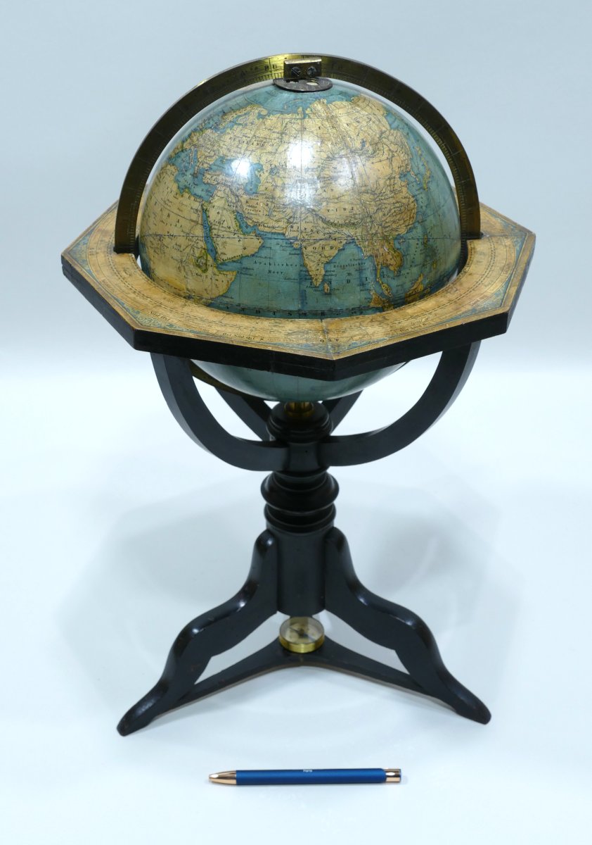


Terrestrial Globe Signed Kiepert Berlin Dated 1870
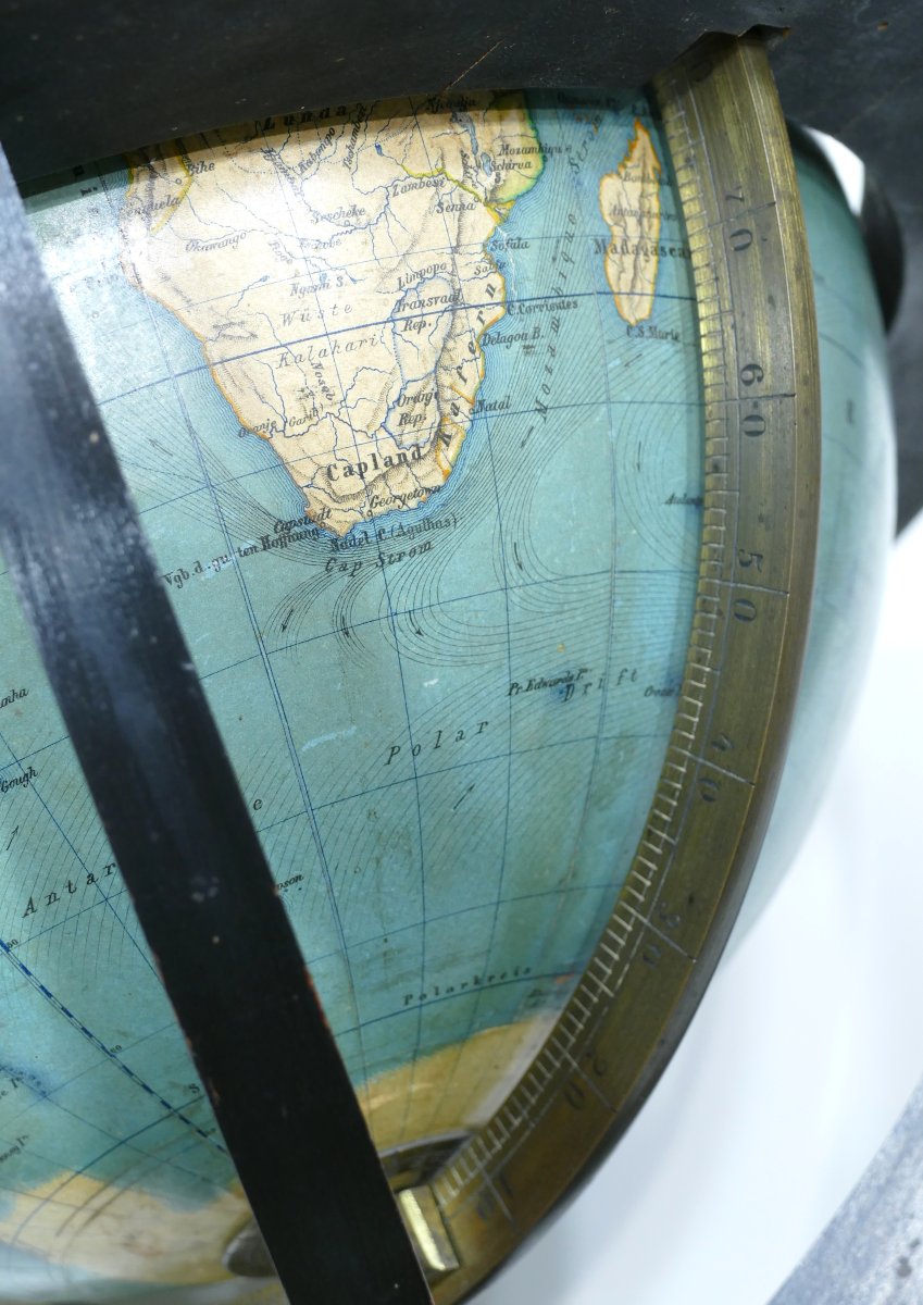
Terrestrial globe with its brass meridian mounted on its original tripod base with compass in the center.
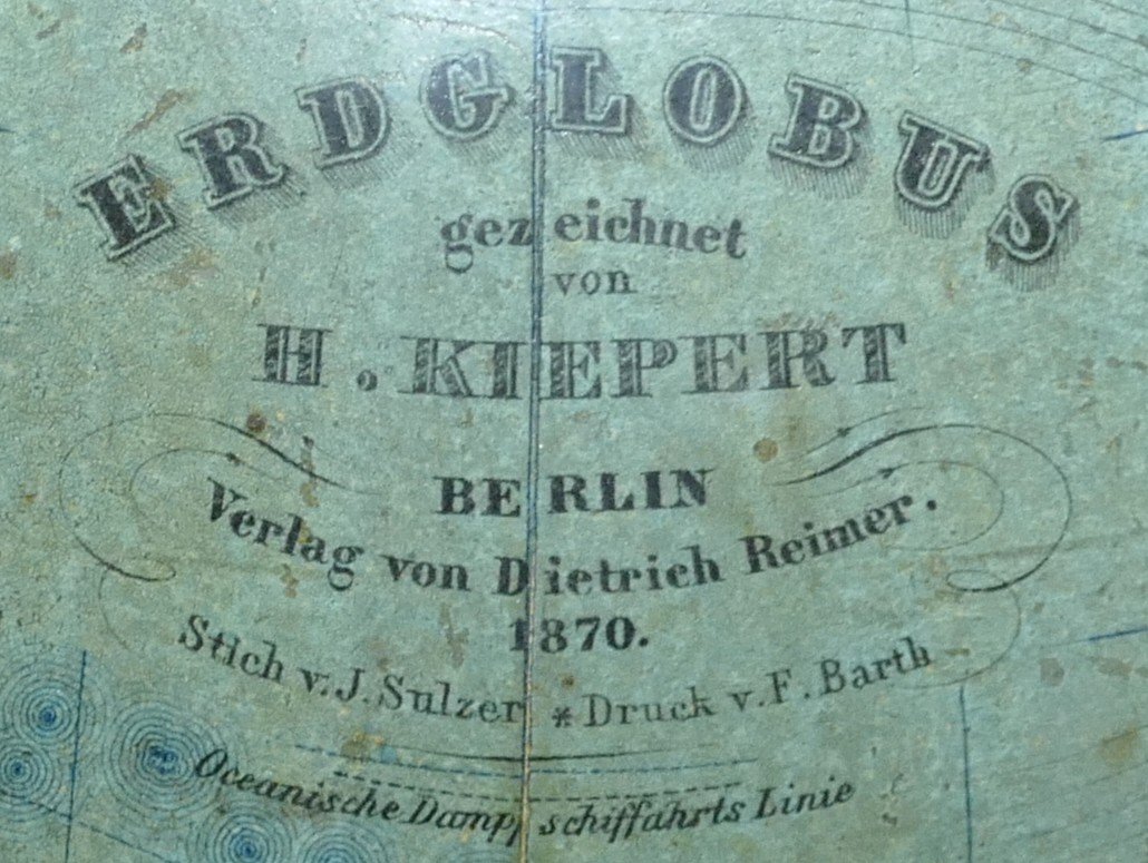
The globe is signed "ERD GLOBUS H. KIEPERT BERLIN 1870".
Equatorial table with all the signs of the Zodiac.
Note:
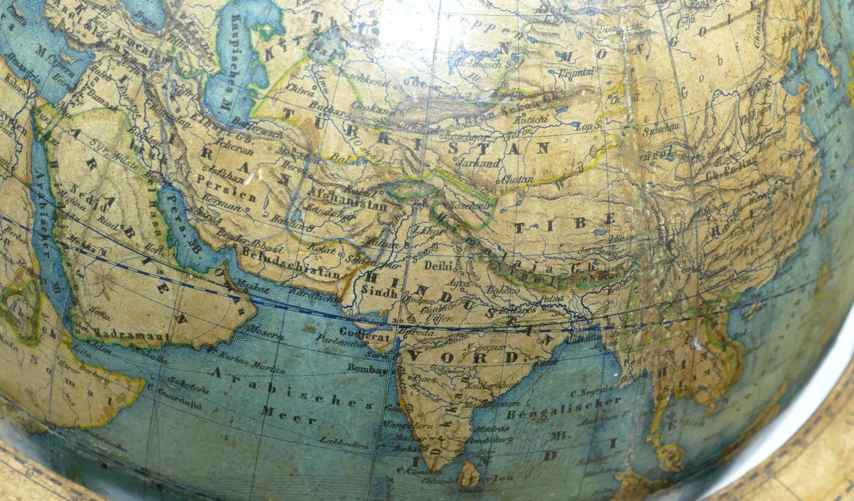
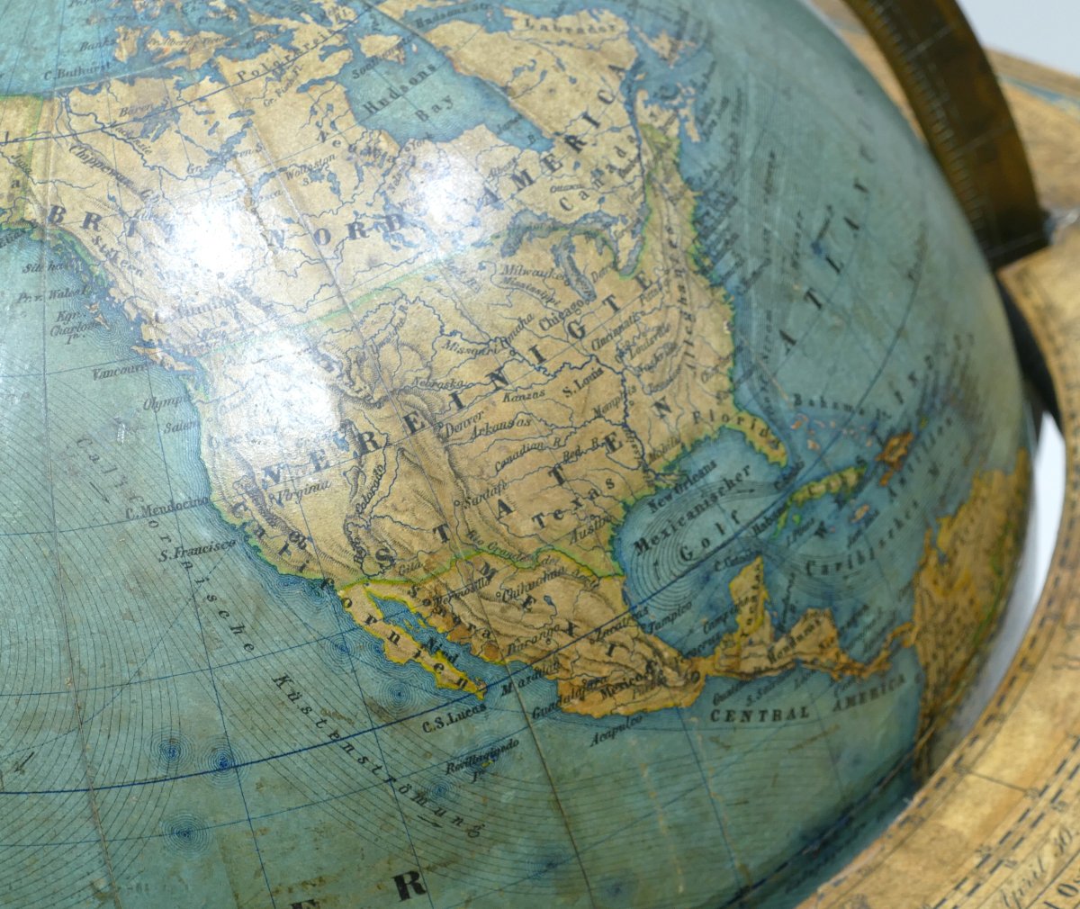
- The cartography of this globe is historically very interesting because Germany was not yet a unified country in 1870. The German territory was divided into many independent states: Kingdom of Prussia, Kingdom of Bavaria, Kingdom of Saxony, Duchies, principalities, etc. These states formed the German Confederation, then the North German Confederation. It was not until 1871, after the Franco-Prussian War, that the German Empire (the Second Reich) was founded under the leadership of Wilhelm I. This globe dated 1870 therefore still shows the old political map of Central Europe, with the separate German states.
- Heinrich Kiepert (1818–1899), great German cartographer and geographer. Famous for his historical, school and geopolitical maps. He worked in Berlin and produced several highly accurate globes and atlases. His name on a globe is a guarantee of scientific rigor and cartographic quality.
Dimensions: Height 48 cm x width 31 cm.
Germany dated 1870.
The globe is signed "ERD GLOBUS H. KIEPERT BERLIN 1870".
Equatorial table with all the signs of the Zodiac.
Note:
- The cartography of this globe is historically very interesting because Germany was not yet a unified country in 1870. The German territory was divided into many independent states: Kingdom of Prussia, Kingdom of Bavaria, Kingdom of Saxony, Duchies, principalities, etc. These states formed the German Confederation, then the North German Confederation. It was not until 1871, after the Franco-Prussian War, that the German Empire (the Second Reich) was founded under the leadership of Wilhelm I. This globe dated 1870 therefore still shows the old political map of Central Europe, with the separate German states.
- Heinrich Kiepert (1818–1899), great German cartographer and geographer. Famous for his historical, school and geopolitical maps. He worked in Berlin and produced several highly accurate globes and atlases. His name on a globe is a guarantee of scientific rigor and cartographic quality.
Dimensions: Height 48 cm x width 31 cm.
Germany dated 1870.
4 300 €
Period: 19th century
Style: Other Style
Condition: Good condition
Material: Paper
Width: 31 cm
Height: 48 cm
Reference (ID): 1616238
Availability: In stock
Print