


"Series Of Ten Geographical Maps Of France From The End Of The 19th Century "
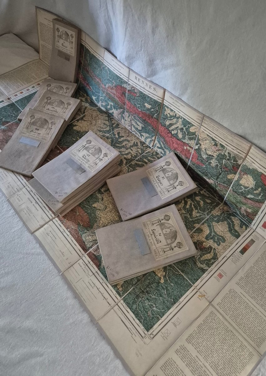
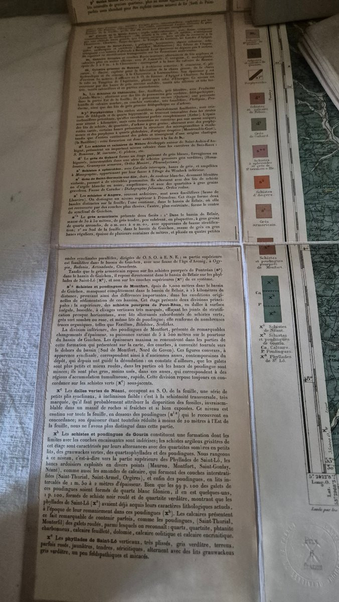
These geographical maps with intact and fresh colors are accompanied by very detailed explanatory notes of all kinds of geological data, drawn up with the information by different mining engineers and who are all mentioned. They bear the stamp of the Ministry of Public Works - Geological Service of the Ministry and dates December 1895 for one, February 1882 for another ... These maps were engraved and chromolithographed by the Wuhrer house at 4 rue de l'Abbé de l'Épée and later canvas-mounted by the Forest house (known for its terrestrial globes) at 17 rue de Buci in Paris and all bear beautiful graphic labels. The canvases were then stamped in ink on April 22, 1931 and then written in pen on 1934. I do not know what these last dates correspond to, probably to archive them in new places. Shipping in France and internationally, contact me for the terms


 Le Magazine de PROANTIC
 TRÉSORS Magazine
 Rivista Artiquariato