THIS OBJECT WAS SOLD
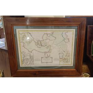
Framed Marine Chart Van Keulen 1699, Noirmoutier, Yeu Island, Nantes, Le Croisic

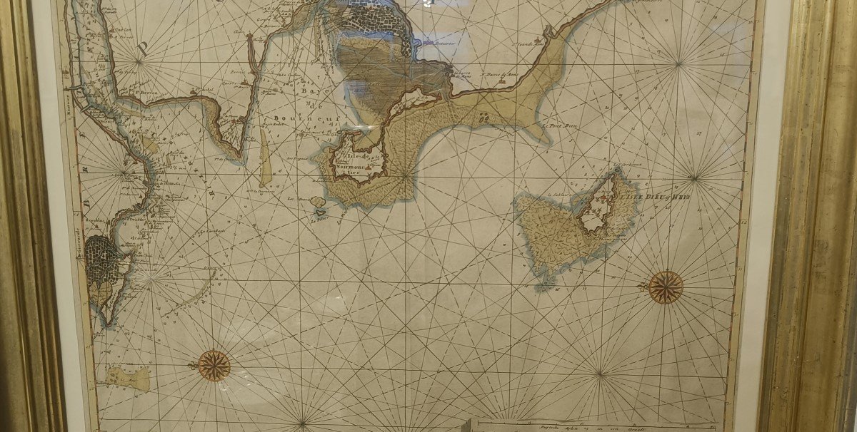
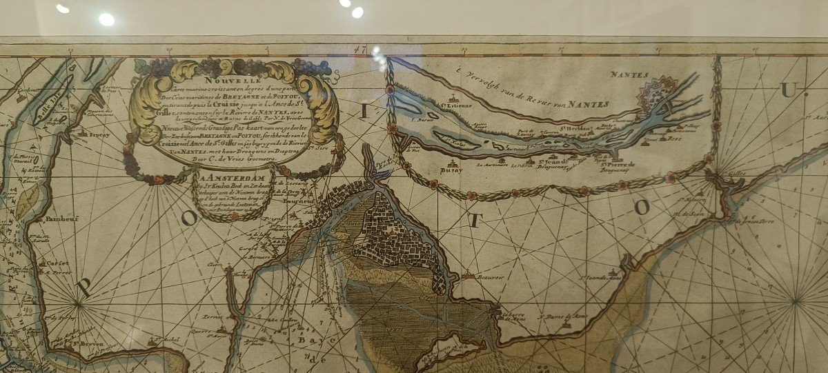

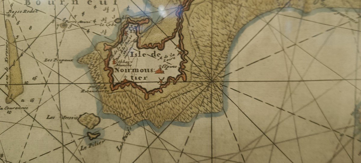
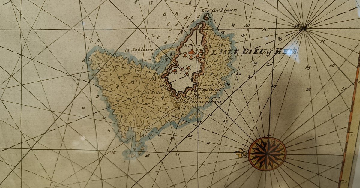
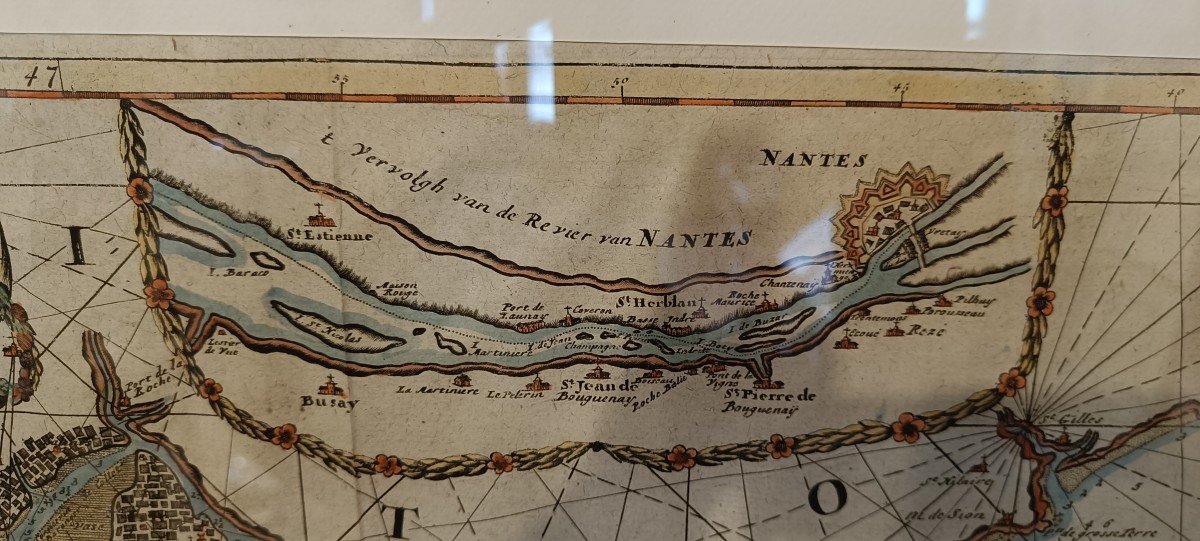
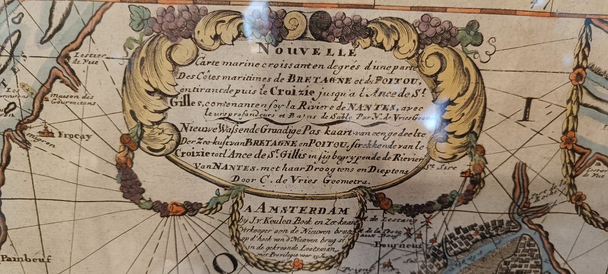
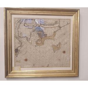


Rare watercolored marine chart from 1699 by Johannes Van Keulen. "New marine chart increasing in degrees of part of the maritime coasts of Brittany and Poitou antirant from Le Croisic to the ancd of St Gilles containing the river of Nantes with their depth and sandbanks". Superb colors and gilded wooden frame 77 cm x 71.5 cm
Explore similar pieces and discover your ideal find:
Old Maps