


"Carrington Bowles Map Of The River Thames - 1787"
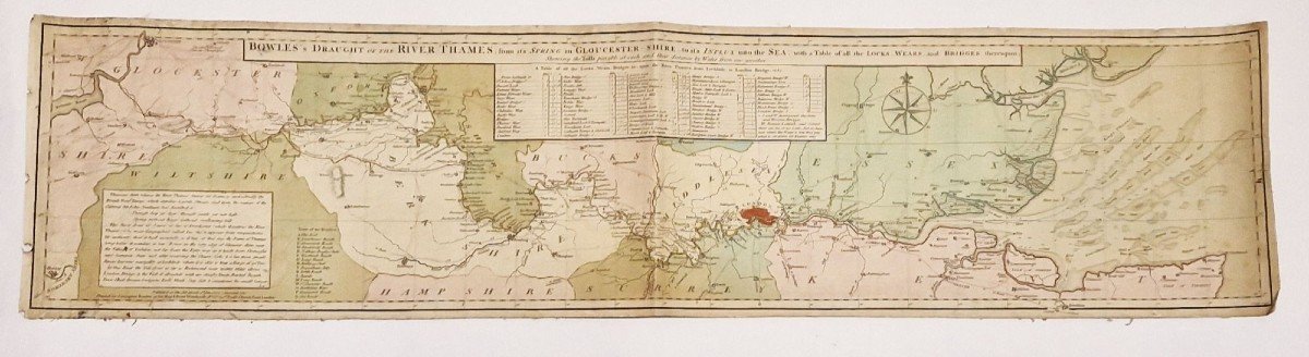
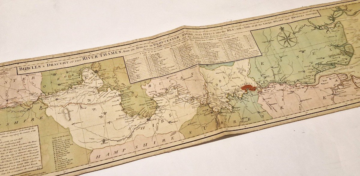
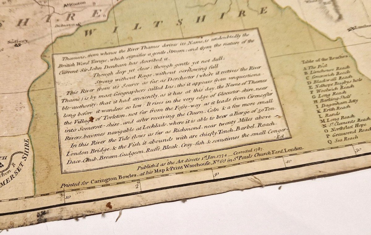
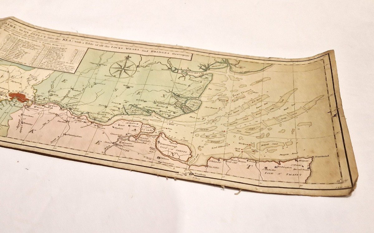
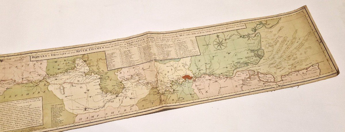
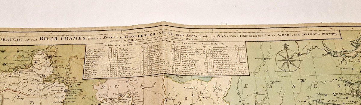
BOWLES (Carrington) Bowles's draught of the river Thames, from it's spring in Gloucestershire, to it's influx into the sea [Map of the Thames from Gloucester to the Isle of Thanet] Second revised edition, published in 1787, of the map of the Thames after Carrington Bowles. The original edition appeared in 1774. A third edition appeared by Bowles in 1793, then around 1810-1820 new editions were published by Bowles & Carver under the title "Bowles's New Map of the River Thames". Coming from a family of printers, Carrington Bowles was a prolific seller of maps and illustrations of all kinds. This map gives the list of locks, ports and bridges, the passages which we had to pass in order to cross them and the different distances separating them from each other. The first two editions are uncommon. 


 Le Magazine
 Rivista Artiquariato
 TRÉSORS magazine