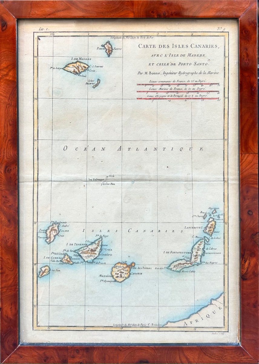
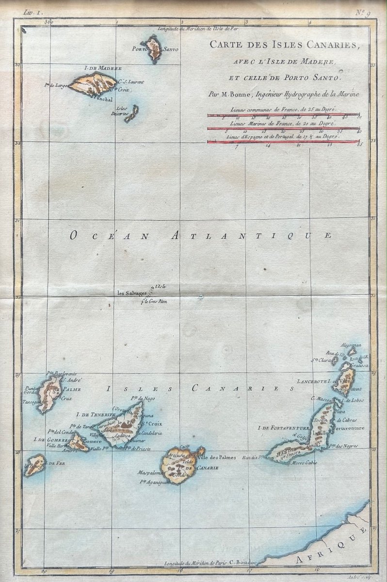
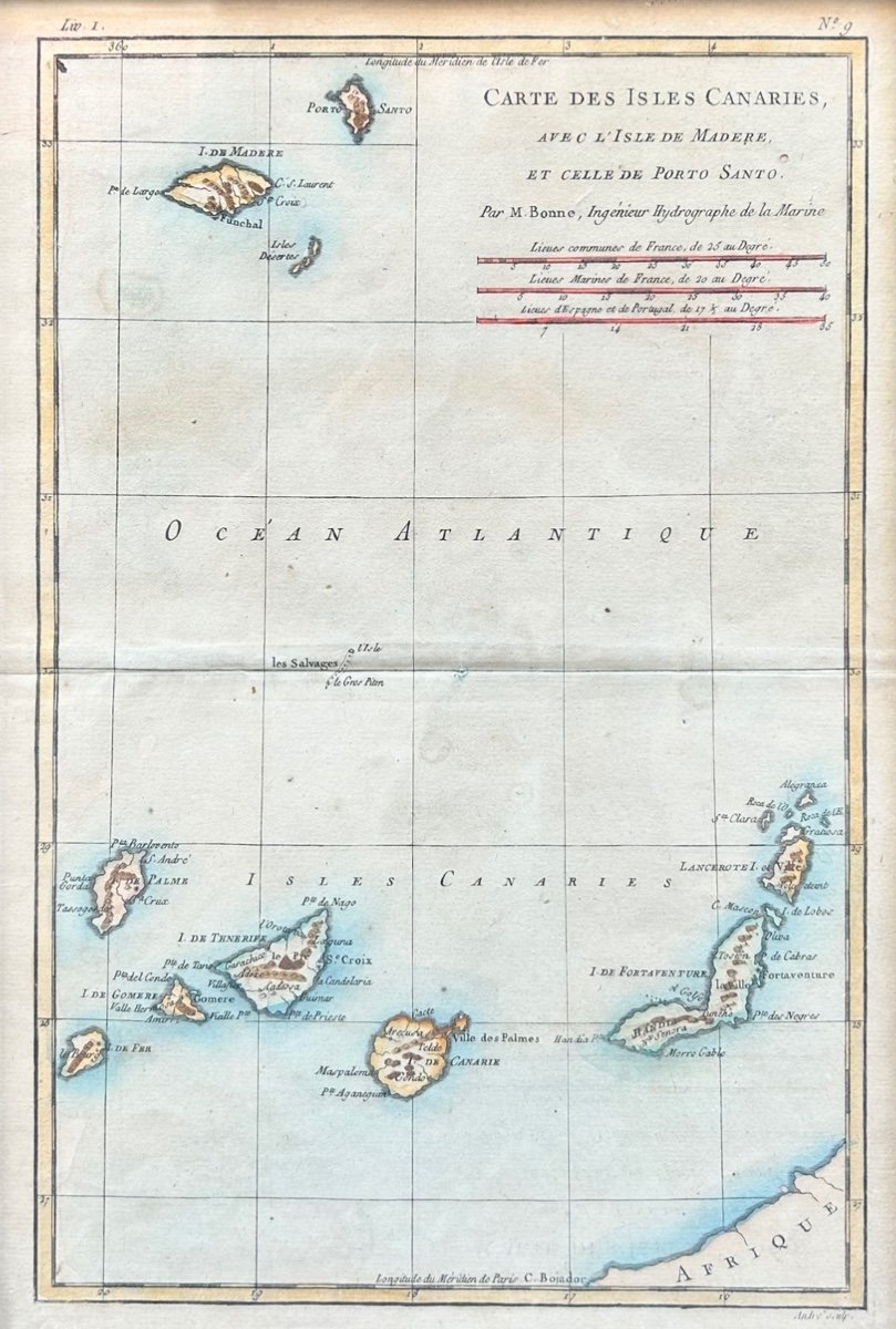


Rigobert Bonne (1727-1795) Map Of The Canary Islands With The Island Of Madeira And Porto Santo
Artist: Rigoler Bonne
Map of the Canary Islands, with the island of Madeira and that of Porto Santo Color engraving after Rigobert Bonne engineer and hydrographer of the Navy 32 x 21 cm
450 €
Period: 18th century
Style: Other Style
Condition: Good condition
Material: Paper
Width: 21
Height: 32
Reference (ID): 1234139
Availability: In stock
Print