this object was sold
line

Map Of Lorraine From 1633 Mainly On The Vosges By Johannes Janssonius

Sold
Map Of Lorraine From 1633 Mainly On The Vosges By Johannes Janssonius
Sold
Map Of Lorraine From 1633 Mainly On The Vosges By Johannes Janssonius-photo-2
Sold
Map Of Lorraine From 1633 Mainly On The Vosges By Johannes Janssonius-photo-3
Sold
Map Of Lorraine From 1633 Mainly On The Vosges By Johannes Janssonius-photo-4
Sold
Map Of Lorraine From 1633 Mainly On The Vosges By Johannes Janssonius-photo-1
Sold
Map Of Lorraine From 1633 Mainly On The Vosges By Johannes Janssonius-photo-2
Sold
Map Of Lorraine From 1633 Mainly On The Vosges By Johannes Janssonius-photo-3
Sold
Map Of Lorraine From 1633 Mainly On The Vosges By Johannes Janssonius-photo-4
Sold
Map Of Lorraine From 1633 Mainly On The Vosges By Johannes Janssonius-photo-5
Sold
Map Of Lorraine From 1633 Mainly On The Vosges By Johannes Janssonius-photo-6
Sold
Map Of Lorraine From 1633 Mainly On The Vosges By Johannes Janssonius-photo-7
Sold
Map Of Lorraine From 1633 Mainly On The Vosges By Johannes Janssonius-photo-8
pictures.

Object description :

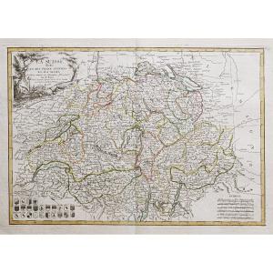
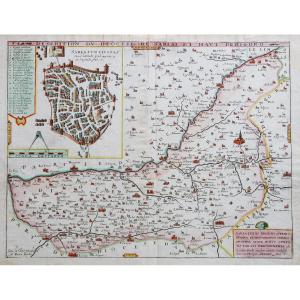
"Map Of Lorraine From 1633 Mainly On The Vosges By Johannes Janssonius"
MAP of LORRAINE watercolored from 1633 Mainly on the VOSGES by JOHANNES JANSSONIUS (1588-1664). The location of this geographical map is mainly on the Vosges. Or we can read for example: (espinael) for Epinal, (girardmer) for (Gerardmer) and (vaigny) for Vagney etc.

View more from this dealer

View more - Old Maps

Subscribe to newsletter
line
facebook
pinterest
instagram

Grenier des Collectionneurs
Objets anciens

Map Of Lorraine From 1633 Mainly On The Vosges By Johannes Janssonius
1200556-main-6515906dc8c0d.jpg

0608072230


*We will send you a confirmation email from info@proantic.com Please check your messages, including the spam folder.

Thank you! Your submission has been received!

Oops! Something went wrong while submitting the form