THIS OBJECT WAS SOLD
"Carte, plan de la ville citadelle et port de Dunkerque...", dessin, circa 1728


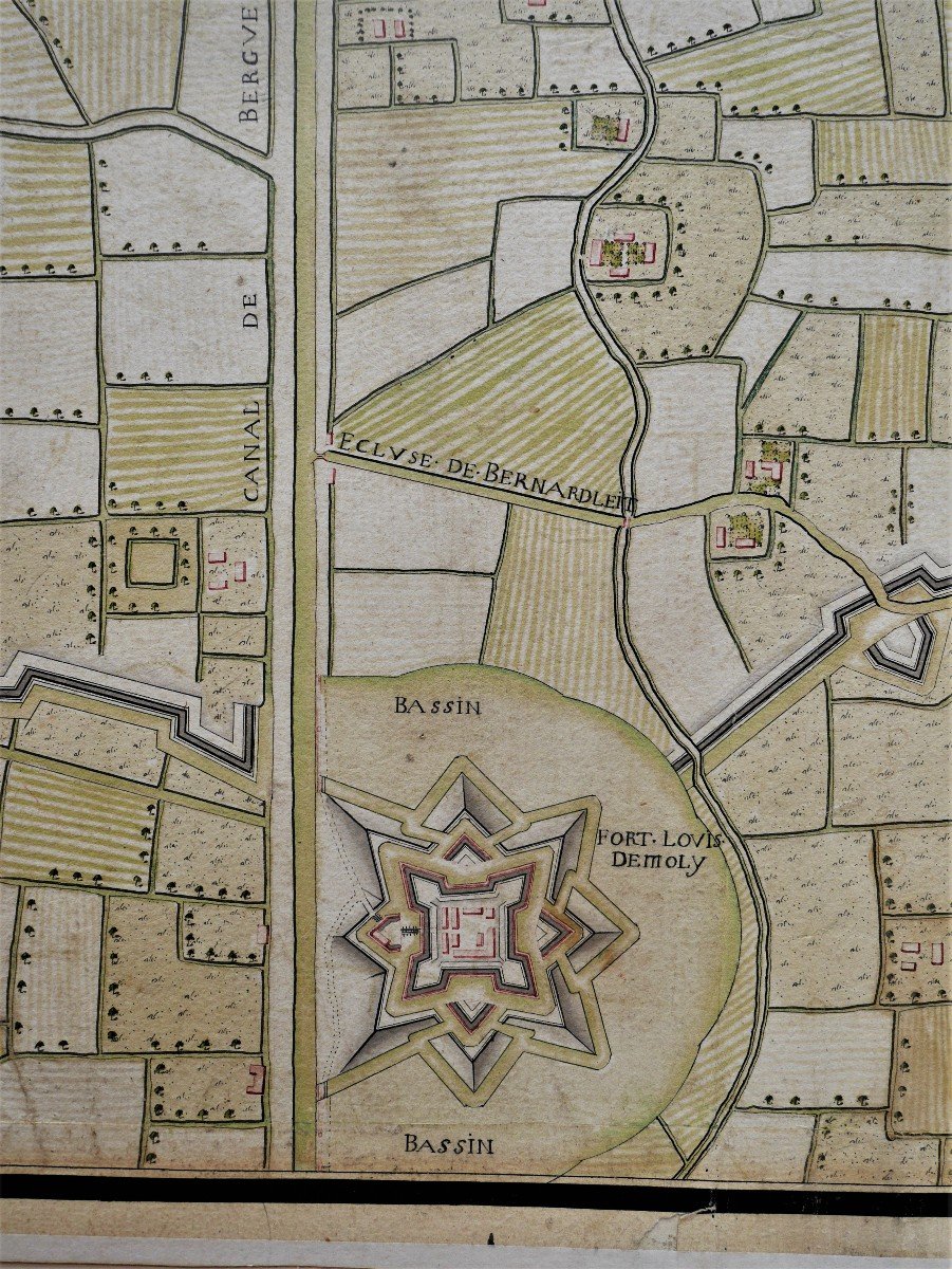


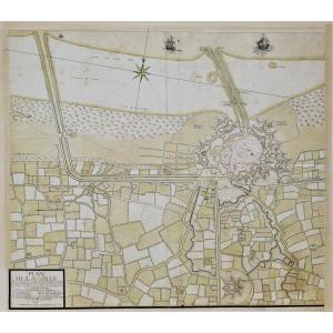


- "Map of the city, citadel and port of Dunkirk...", circa 1728
- France, circa 1728
- Pen, black and brown ink, brush and wash on laid paper.
- 825 mm by 930 mm
- Median folds, a few very rare short tears on the edges and at the junction of the median folds, some stains, the edges reinforced with a strip of paper. Frame with passe-partout
- Provenance: private collection
- Very large and rare plan of the city of Dunkirk with the ramparts of the city reinforced by Vauban, its port and the suburbs in the state it was in after the destruction of the fort Louis in 1714. The author probably belongs to a member of the Masse family, Claude Masse or one of his sons, geographers. - Following the peace of Utrecht of 1713, and the problems of Austrian enclaves along the northern border, it was decided to establish the statements of the maps of the northern borders, and this, from 1723 under the leadership of the engineer Claude Masse. In 1728, the towns of Saint-Omer, Cassel, Gravelines and Dunkirk were relieved.
- Ref. : Lucien Lemaire: "The Masse geographers engineers and the survey of maps of the northern border from Dunkirk to Metz", Revue du Nord, 1922, pp.291-302
Explore similar pieces and discover your ideal find:
drawings