
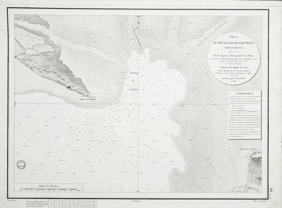
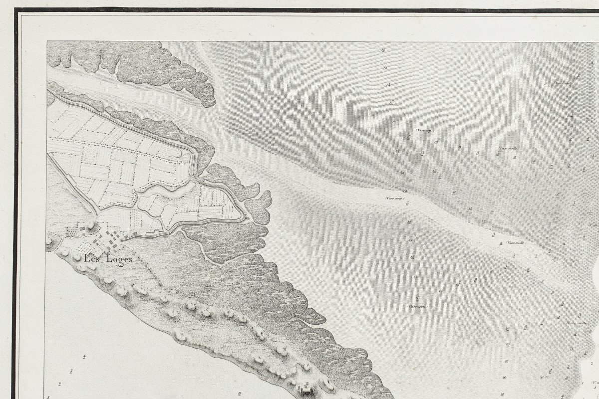
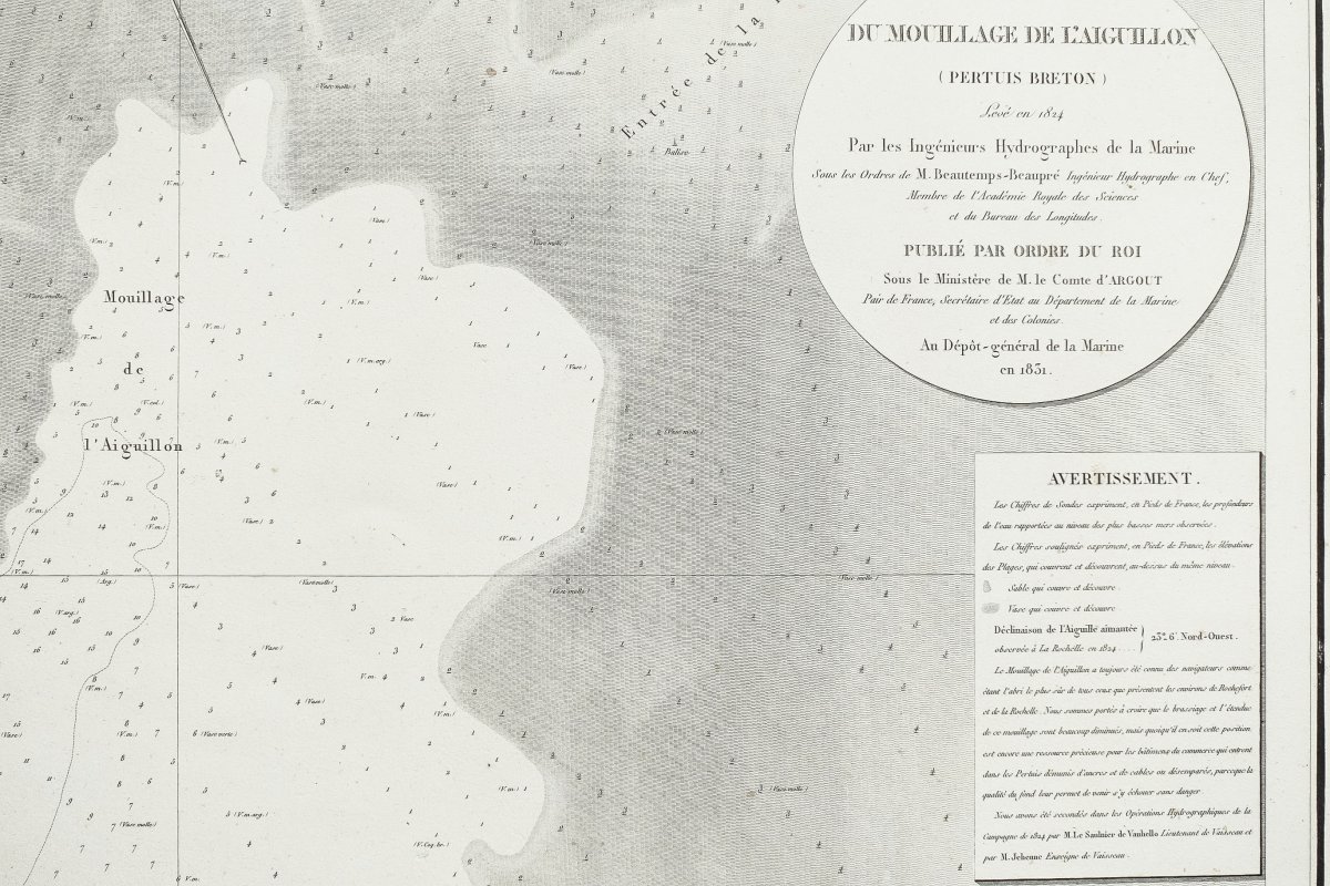

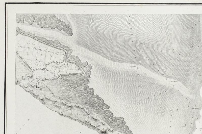

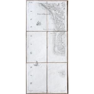
"Antique Chart Of The Aiguillon - Pertuis Breton - Beautemps Beaupré"
Original proof engraved in 1831. Count of Argout.Tiny rednesses in the margins.
Very good state.
Sheet format: 66 x 48.5 cm.
Engraving format: 45 x 35 cm.
Original antique chart of 1831.
You can consult all the maps and engravings available in your region by clicking on the link from our website specializing in ancient geographic archives:https://www.cartes-livres-anciens.com
Charles- François Beautemps-Beaupré
Charles-François Beautemps-Beaupré, born in La Neuville-au-Pont on August 6, 1766 and died in Paris on March 16, 1854, is a French hydrographer and cartographer, member of the Academy of Sciences and the Bureau longitudes. He is considered the father of modern hydrography. First employed as a student without salary, under the orders of his cousin Jean-Nicolas Buache, chief hydrographer of the Navy depot in 1783, Beautemps-Beaupré was quick to demonstrate exceptional qualities in the field of hydrography . Became an engineer in 1785, he was the author of the Neptune maps of the Baltic, before embarking under the orders of Entrecasteaux as the first hydrographic engineer, to go in search of La Pérouse (1791), whose lost track since 1788. In 1789 he was responsible for surveying the coasts of Dunkirk. From 1791 to 1796, Beautemps-Beaupré therefore took advantage of the expedition to survey the coasts of the countries visited. It was during this mission that he experimented with new methods, in particular the reflection circle of Jean-Charles de Borda, and laid down the foundations which made hydrography a real science and which were soon adopted by all the marines. D'Entrecasteaux's Appendix to Travel, which contains all of Beautemps-Beaupré's works dating from this period, had a considerable impact, when it was published in 1808, because it “revolutionized hydrographic methods Used in the past. Returning to France in 1796, he was appointed in 1799 sub-custodian of the deposit of charts and marine plans and proceeded from 1799 to the recognition of the littoral of the French Empire. He was responsible, under the Empire and then under the Restoration, for the execution of all major hydrographic works: these earned him entry in 1810 to the Academy of Sciences. His praise was read by Léonce Élie de Beaumont in 1859. He was appointed in 1814 chief hydrographic engineer and directed from 1814 to 1838 the drafting of new maps of the coasts of France. With Beautemps-Beaupré began the era of methodical coastal surveys and, under his direction, the hydrographic service undertook a new complete survey of the north and west coasts of France. The French Pilot (printed in 1844 in 6 large atlas atlases), testimony of twenty campaigns at sea directed by Beautemps-Beaupré, studies all the western and northern coasts of France from Bayonne to Dunkirk. These documents contain no less than 150 maps and plans, 279 views and 184 tables of high and low tides, forming a set of 613 separate works which are all treasures for navigation. This work is still admired by the maritime world and, in the words of Frédéric Chassériau "will remain, the most beautiful title of contemporary hydrography in the eyes of posterity".


 Le Magazine de PROANTIC
 TRÉSORS Magazine
 Rivista Artiquariato