Sixth Set Of Geographical Maps By Jouy - 1806–1810
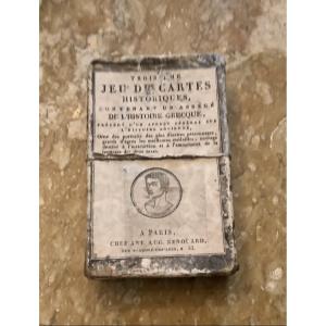
Inside its cardboard case is the "Sixth Set of Geographic Maps,"
It is an educational and historical set from the early 19th century designedby the author and playwright Victor-Joseph Étienne de Jouy ((1764–1846)).
Published in Lille (France) by Vanackere (Grande Place) and in Paris by H. Nicolle (rue de Seine)
Complete with its 48 numbered and engraved maps (by Pierre-François Godard), illustrated with medallions depicting the peoples of the world in their traditional costumes, accompanied by descriptive texts. This set is supplemented by a leaflet containing a “note” from the author.
France, c. 1806–10
320 €
Period: 19th century
Style: Consulat, Empire
Condition: Condition of use
Length: 10,5
Width: 7
Reference (ID): 1850567
Availability: In stock
Print