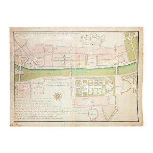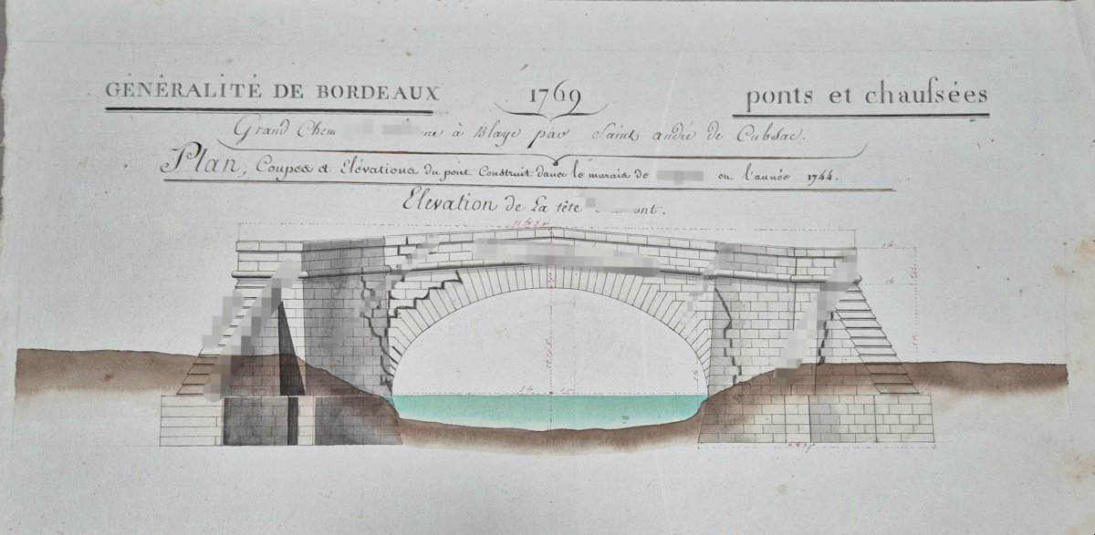

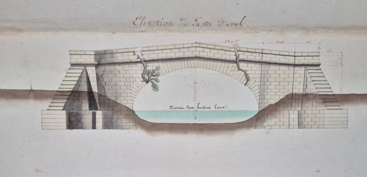
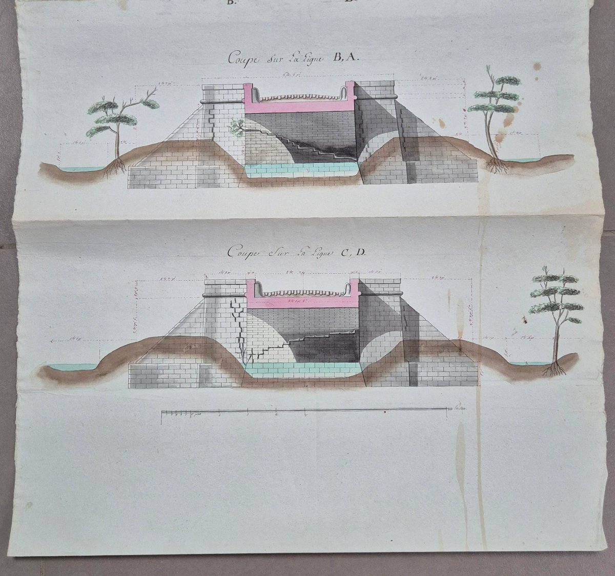
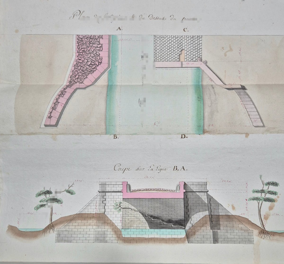


General View Of Bordeaux. Map Of The Magrigne Bridge, 1769.
Generality of Bordeaux, St. André de Cubzac region.
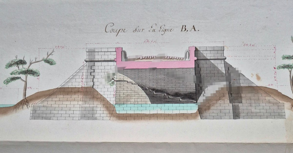
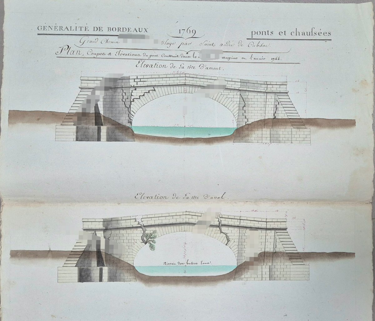
Rare map drawn by hand in 1769 depicting the now-vanished Moron Bridge, built in1744 in the Magrine marshes (now Magrigne) in the Bordeaux Generality and located north of the town of SaintAndré de Cubzac, slightly east of Tauriac in Gironde (France). Map (cross-sections and elevations), colored and drawn by hand. Preparatory work aimed at the restoration of the bridge. It includes various views up stream and down stream, plans of the foundations, measurements... Very good condition. The document is hand written, dated, geolocated, and can be attributed to a civil engineer from the region (1772–1834). Photo shave been intentionally blurred in certain areas. Additional information available upon request.
Period: 18th century
Style: Louis 15th - Transition
Condition: Excellent condition
Material: Paper
Length: 90 cm
Width: 35 cm
Reference (ID): 1787255
Availability: In stock