Large Map Of Tokyo, Meiji Period, 1870 flag

Large Map Of Tokyo, Meiji Period, 1870
Large Map Of Tokyo, Meiji Period, 1870-photo-2
Large Map Of Tokyo, Meiji Period, 1870-photo-3
Large Map Of Tokyo, Meiji Period, 1870-photo-4
Large Map Of Tokyo, Meiji Period, 1870-photo-1
Large Map Of Tokyo, Meiji Period, 1870-photo-2
Large Map Of Tokyo, Meiji Period, 1870-photo-3
Large Map Of Tokyo, Meiji Period, 1870-photo-4
Large Map Of Tokyo, Meiji Period, 1870-photo-5
Large Map Of Tokyo, Meiji Period, 1870-photo-6

Object description :

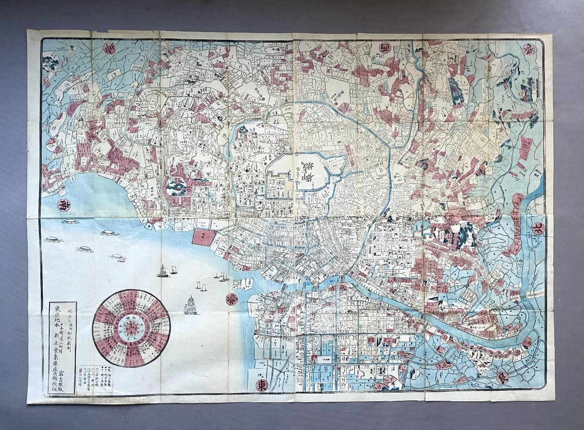
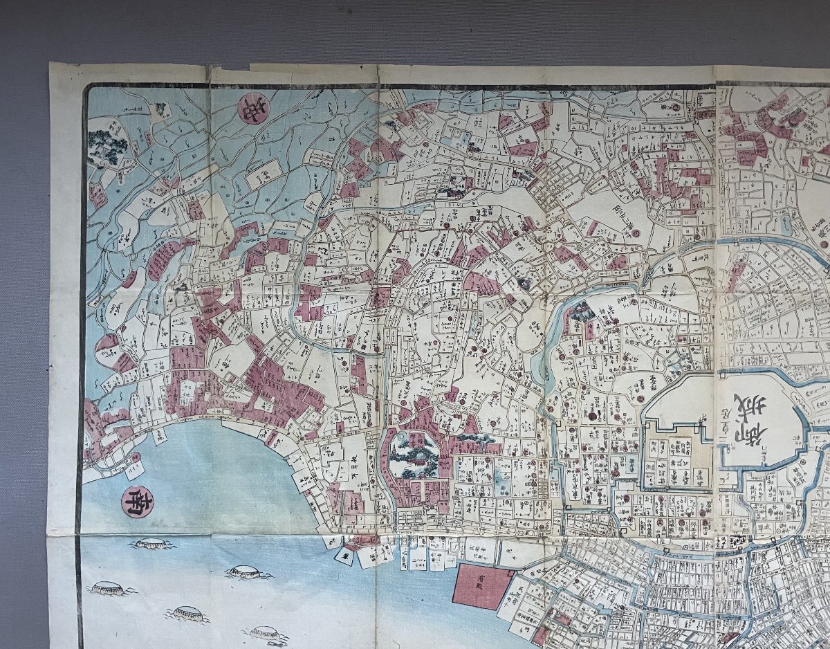
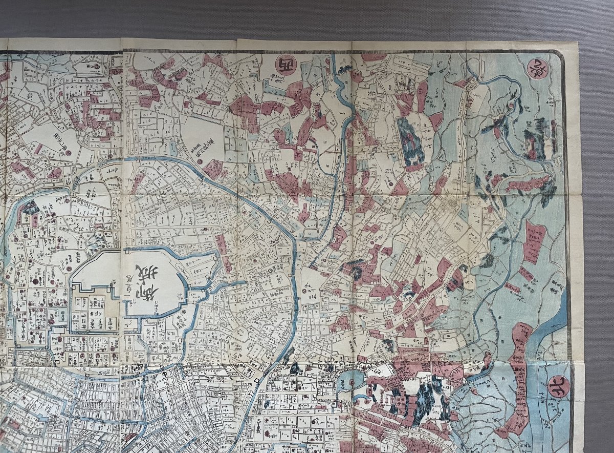
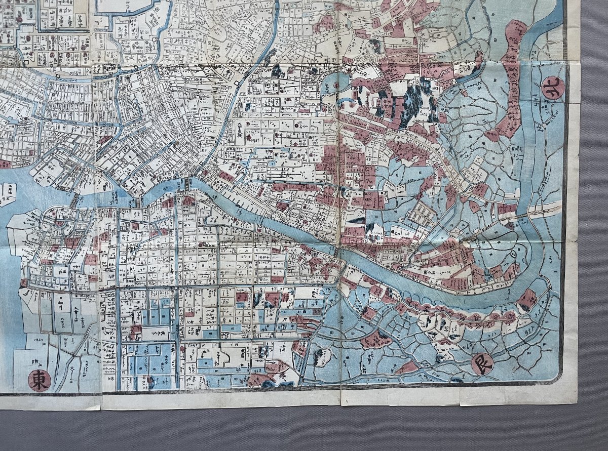
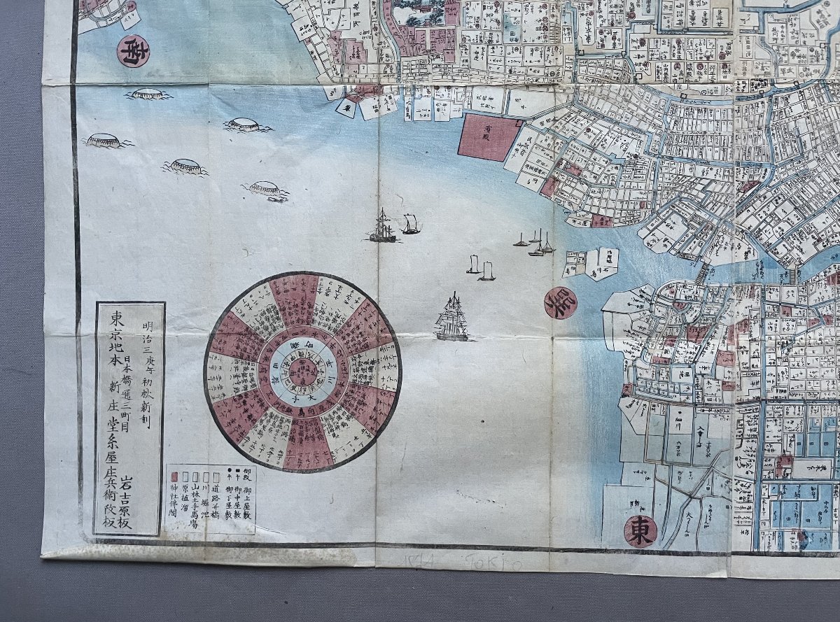
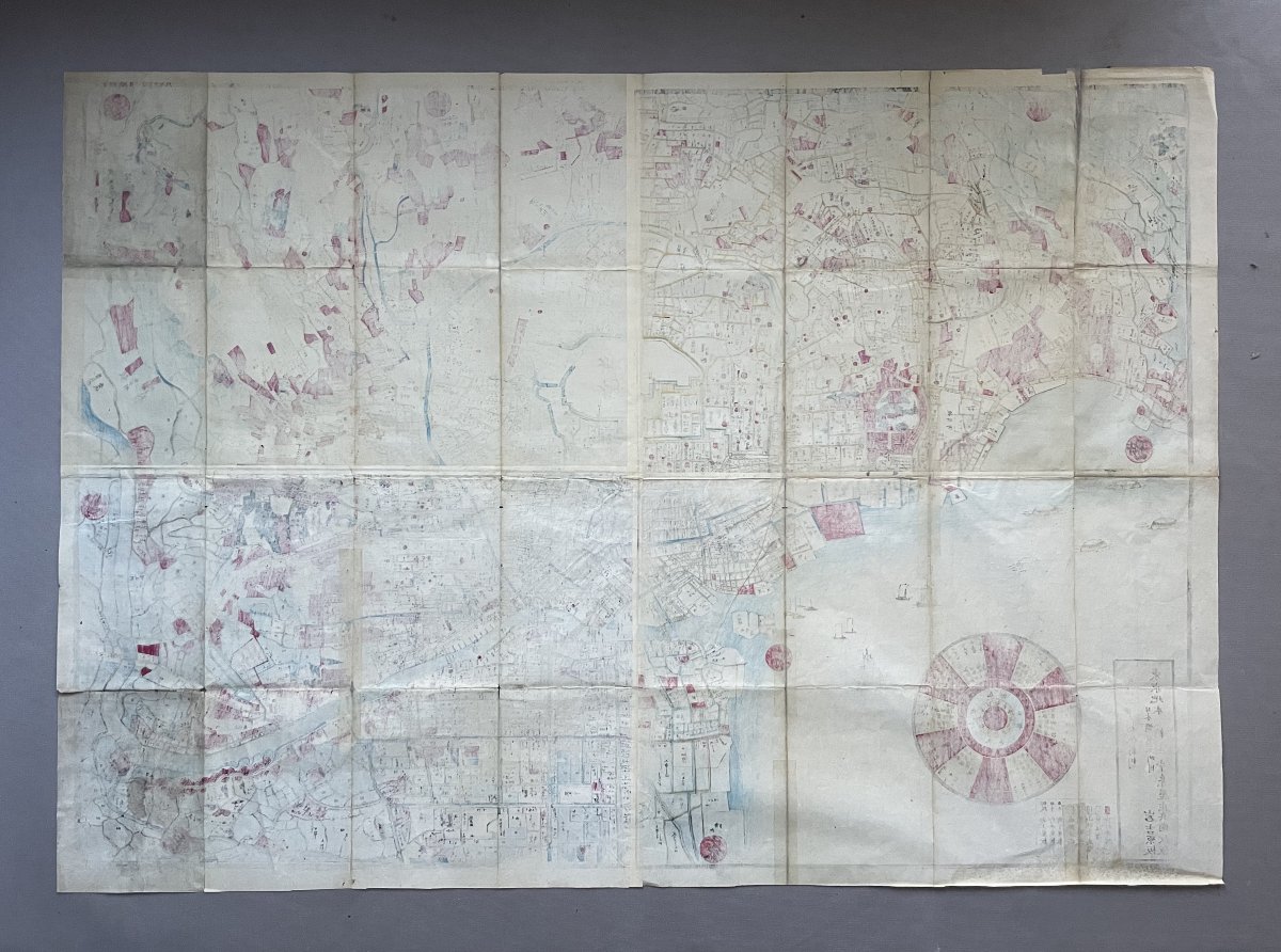
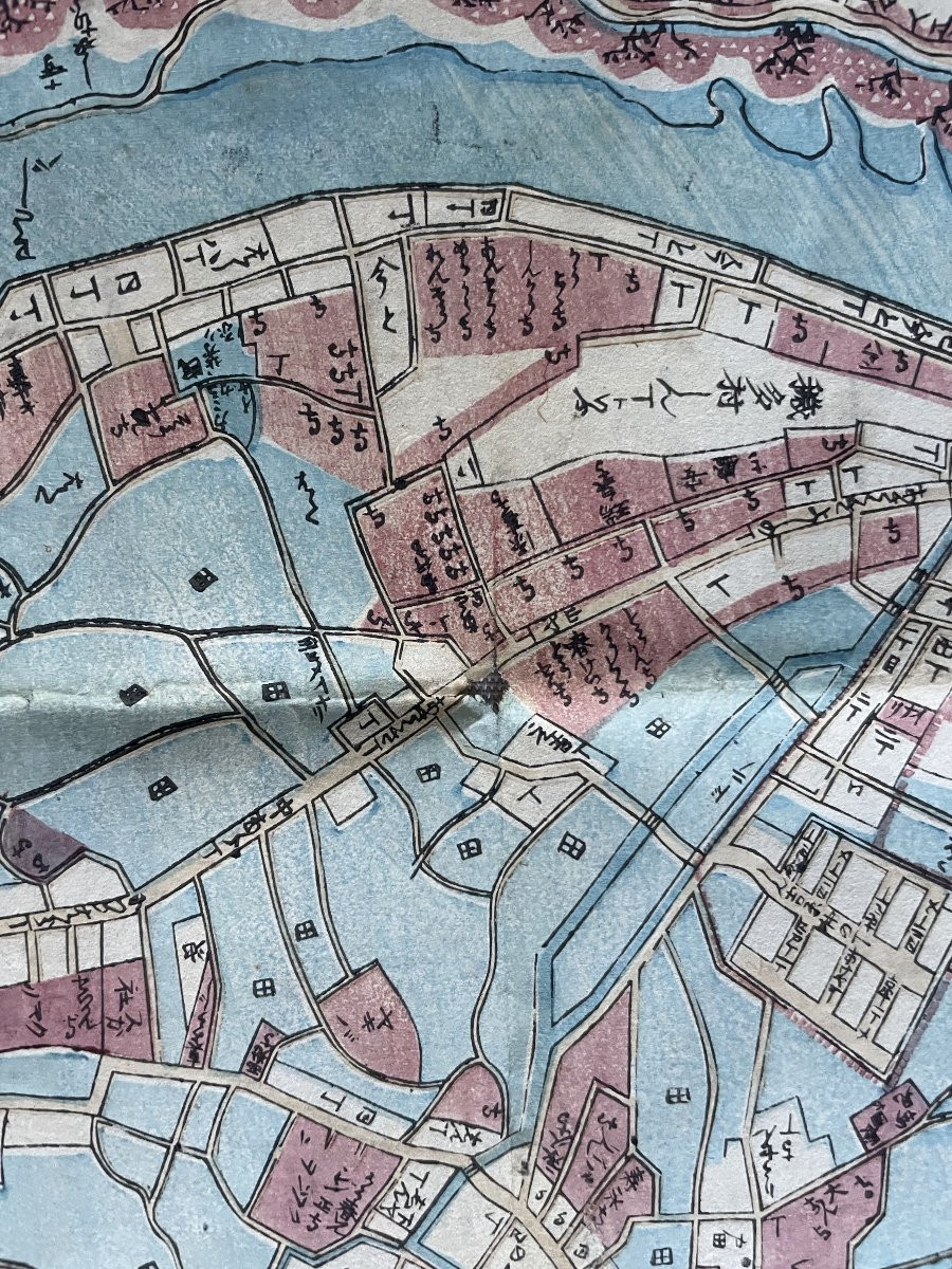
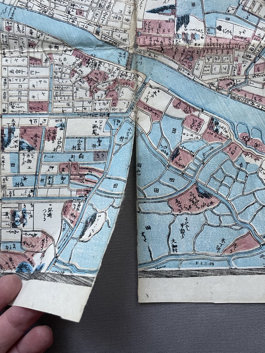
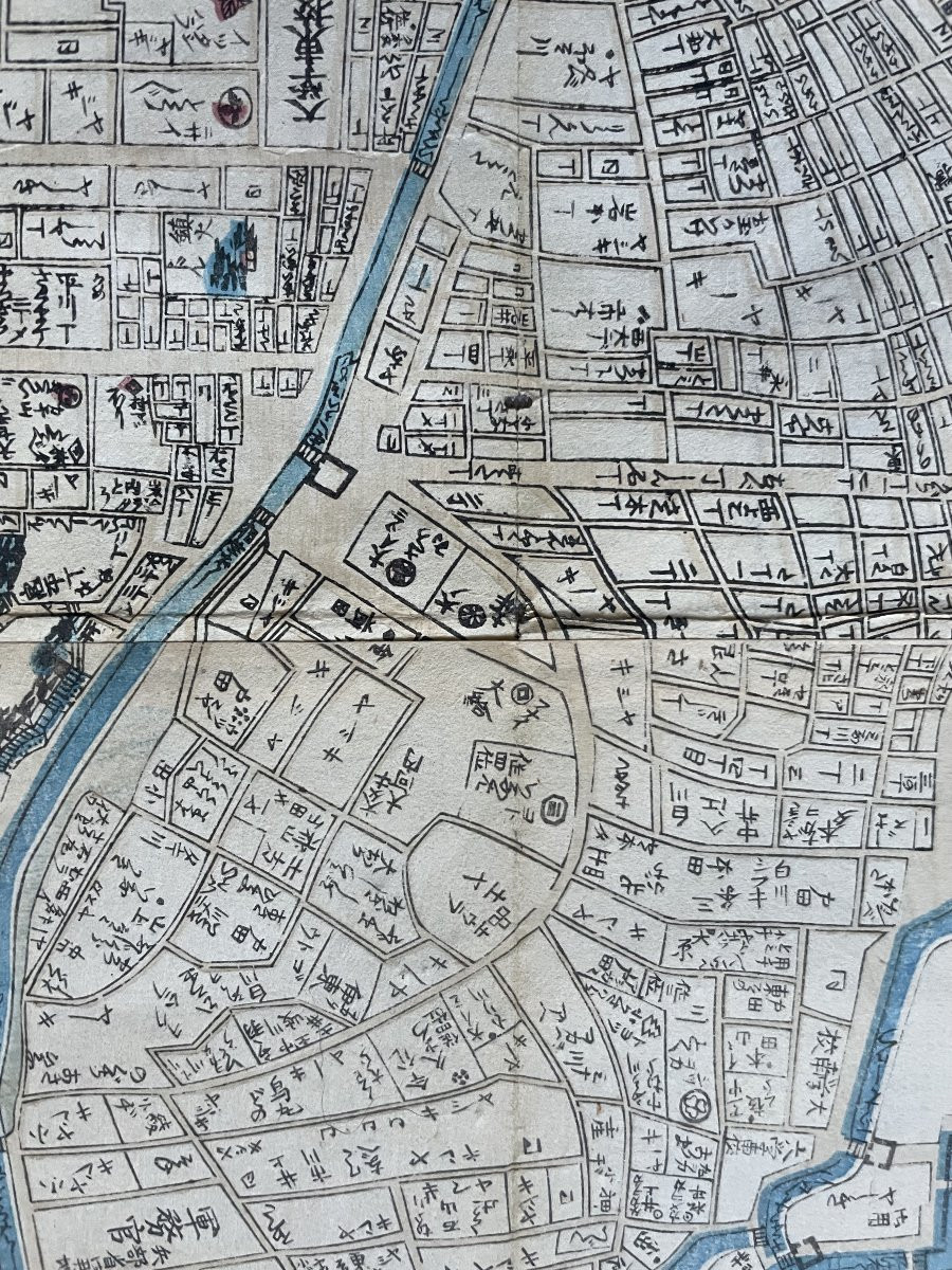
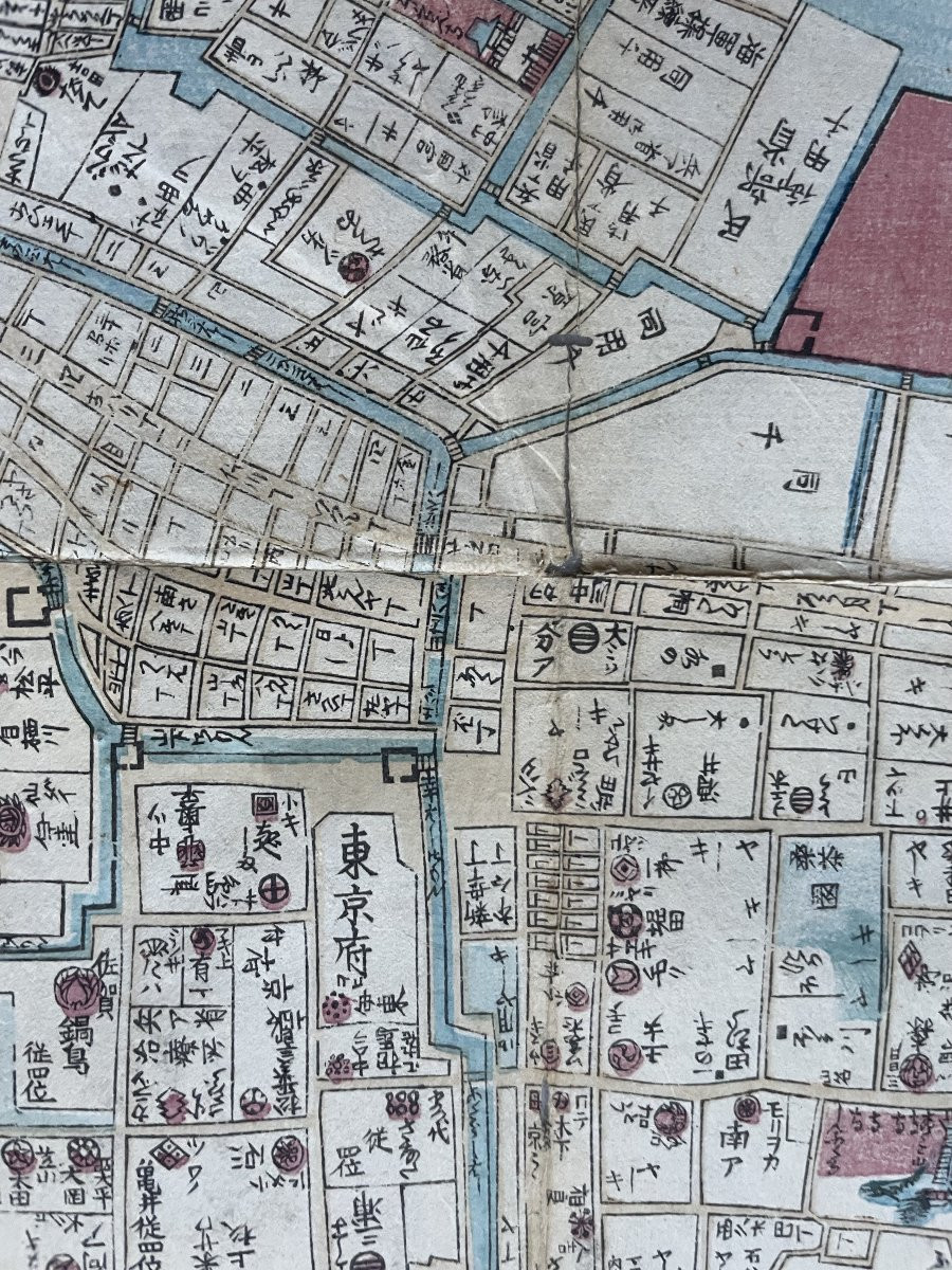
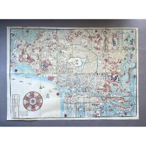
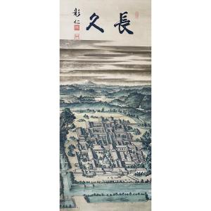
"Large Map Of Tokyo, Meiji Period, 1870"
Large map of Tokyo.
Printed in ink and color on paper, depicting the capital and its surroundings, oriented west, dated Meiji 3 (1870).
Light stains, small tears along the folds.
69.5 x 99 cm.

Shipped via Colissimo with signature confirmation.
Carefully packaged.
Unless otherwise stated, items listed on Proantic are not on display at the Saint-Ouen flea market.
However, you can pick up your purchases at our stand in the Jules Vallès Market by contacting us.
Price: 200 €
credit
Period: 19th century
Style: Asian art
Condition: Condition of use

Material: Paper
Width: 99 cm
Height: 69,5 cm

Reference: 1659310
Availability: In stock
line

"Vue d'optique" See more objects from this dealer

line

"Old Maps, Asian art"

More objects on Proantic.com
Subscribe to newsletter
line
facebook
pinterest
instagram

Vue d'optique
Tableaux, dessins, estampes
Large Map Of Tokyo, Meiji Period, 1870
1659310-main-6925f15917d2e.jpg

0670072302


*We will send you a confirmation email from info@proantic.com Please check your messages, including the spam folder.

Thank you! Your submission has been received!

Oops! Something went wrong while submitting the form