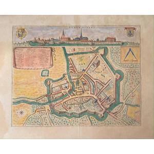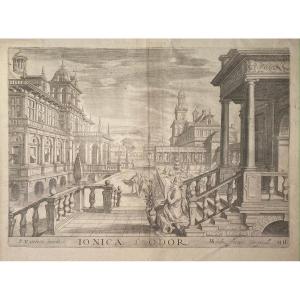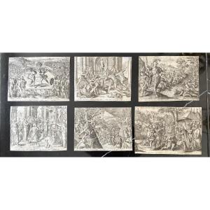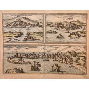

Late 16th Century Print By Braun And Hogenberg: Sibinium, Parens, Modon
Artist: Braun Georg (1541-1622)-hogenberg Frans (1535-1590)
Or Views of Sibenik, Porec (in Croatia) and Modon (in Greece)
Proof in old colors, usual median fold, text in Latin on the back.
Good proof, light uniform dusting, small pinholes visible mainly transparently in the lower part.
The “Civitates Orbis Terrarum”, or “Braun & Hogenberg”, is an urban atlas in six volumes and the largest book of city views and plans ever published: 363 engravings, sometimes colored. It was one of the best-selling works of the last quarter of the 16th century. Georg Braun wrote the text accompanying the plans and views on the back. A large number of plates were engraved after the original drawings of Joris Hoefnagel (1542-1600). The first volume was published in Latin in 1572, the sixth volume in 1617. Frans Hogenberg was responsible for volumes I to IV and Simon van den Neuwel for volumes V and VI. Other contributors were the cartographer Daniel Freese and Heinrich Rantzau. Works by Jacob van Deventer, Sebastian Münster and Johannes Stumpf were also used.
Van der Krogt 4, 3985; Taschen, Braun and Hogenberg, p.187.
Copper width: 483.00
Copper height: 352.00
Sheet width: 520.00
Sheet height: 405.00
350 €
Period: 16th century
Style: Other Style
Condition: Good condition
Material: Paper
Width: 520 mm
Height: 405 mm
Reference (ID): 1198699
Availability: In stock
Print