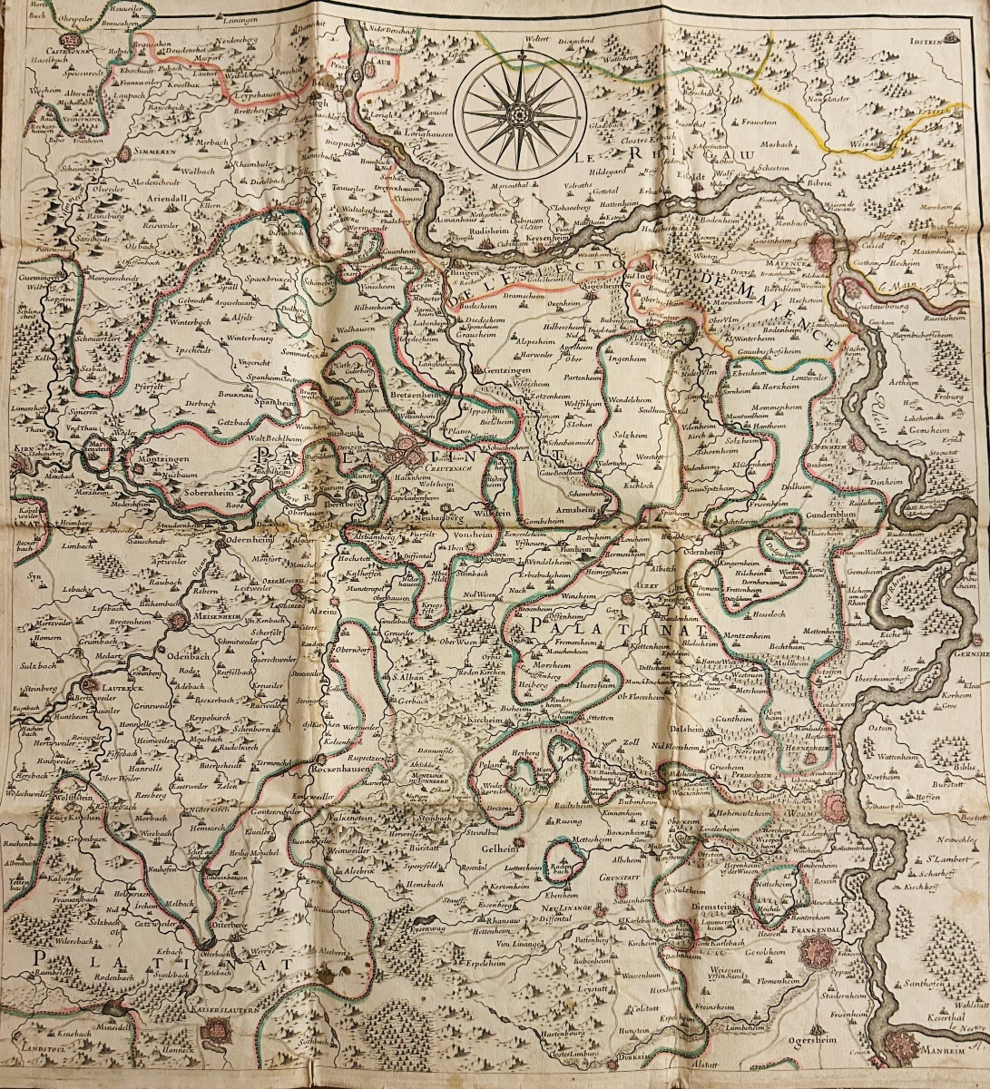

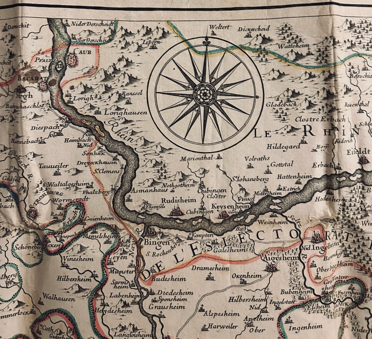
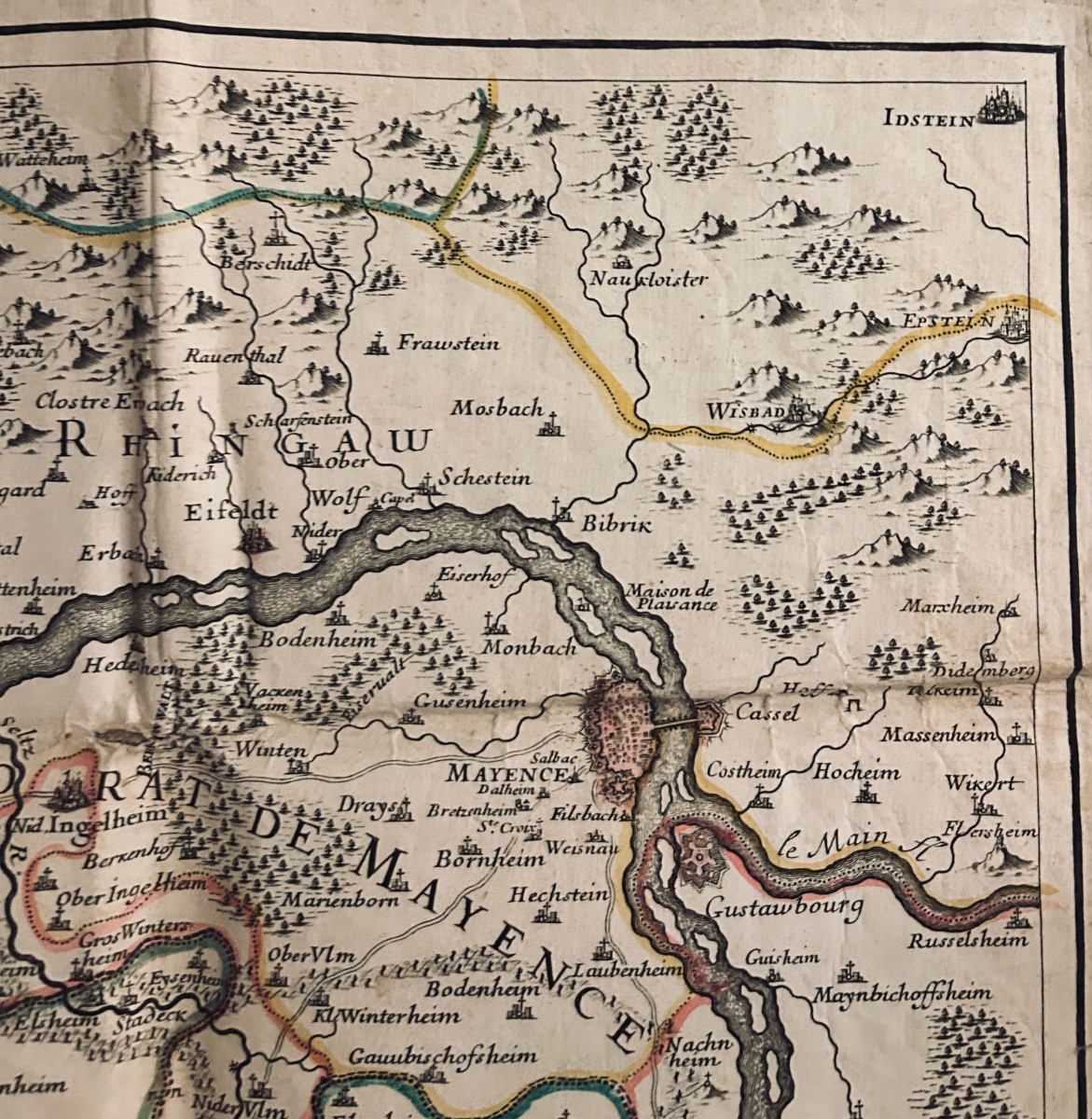

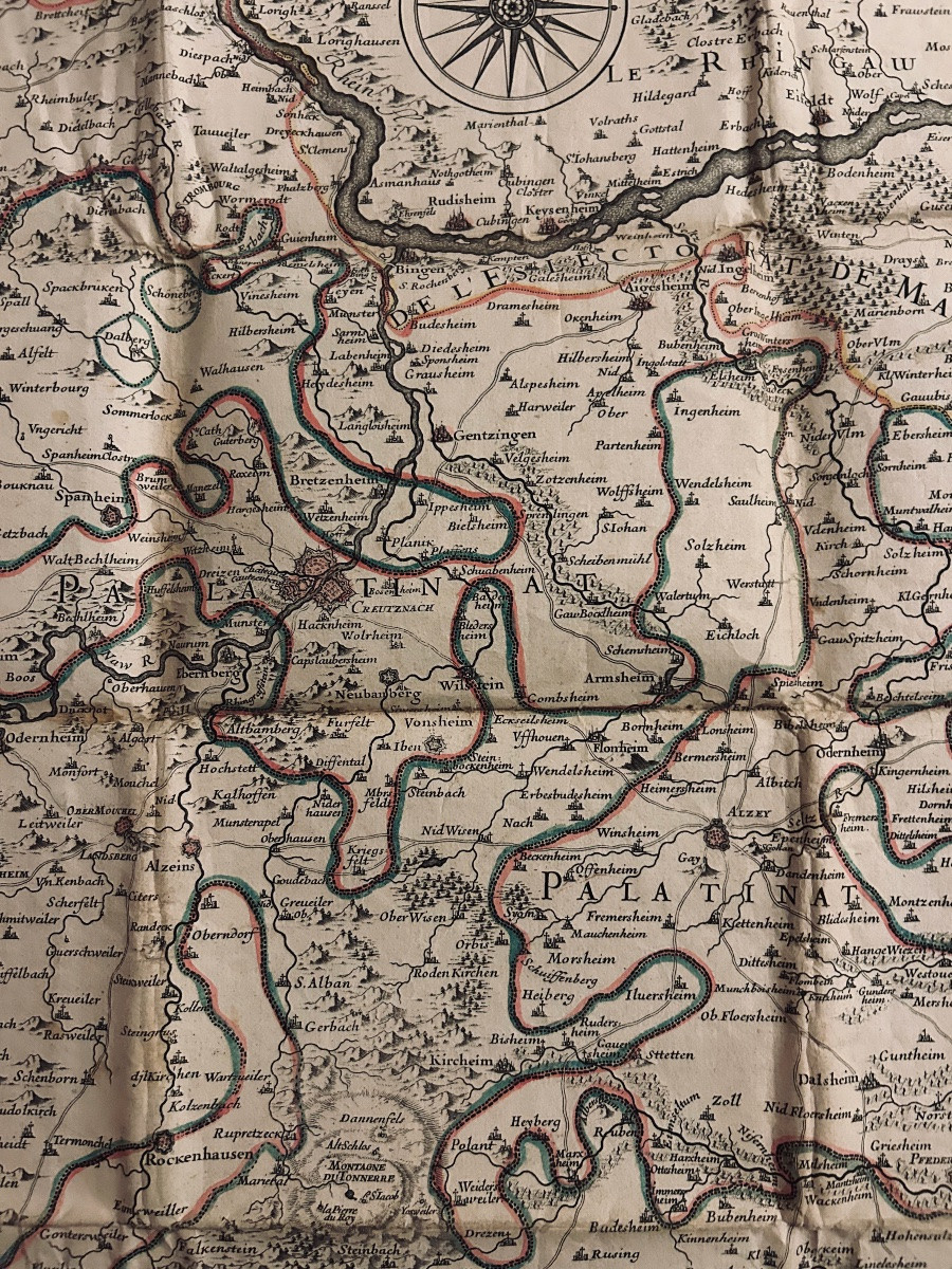
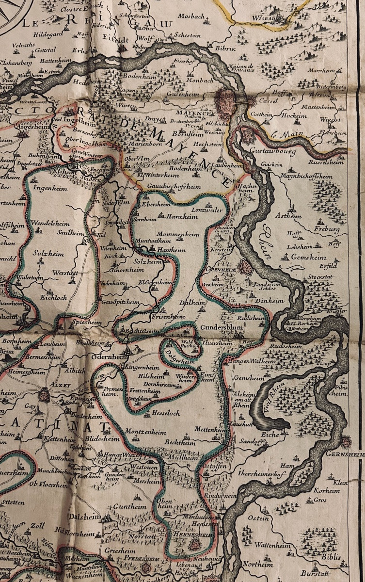
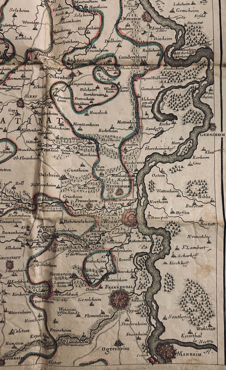

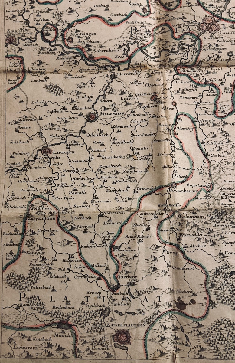

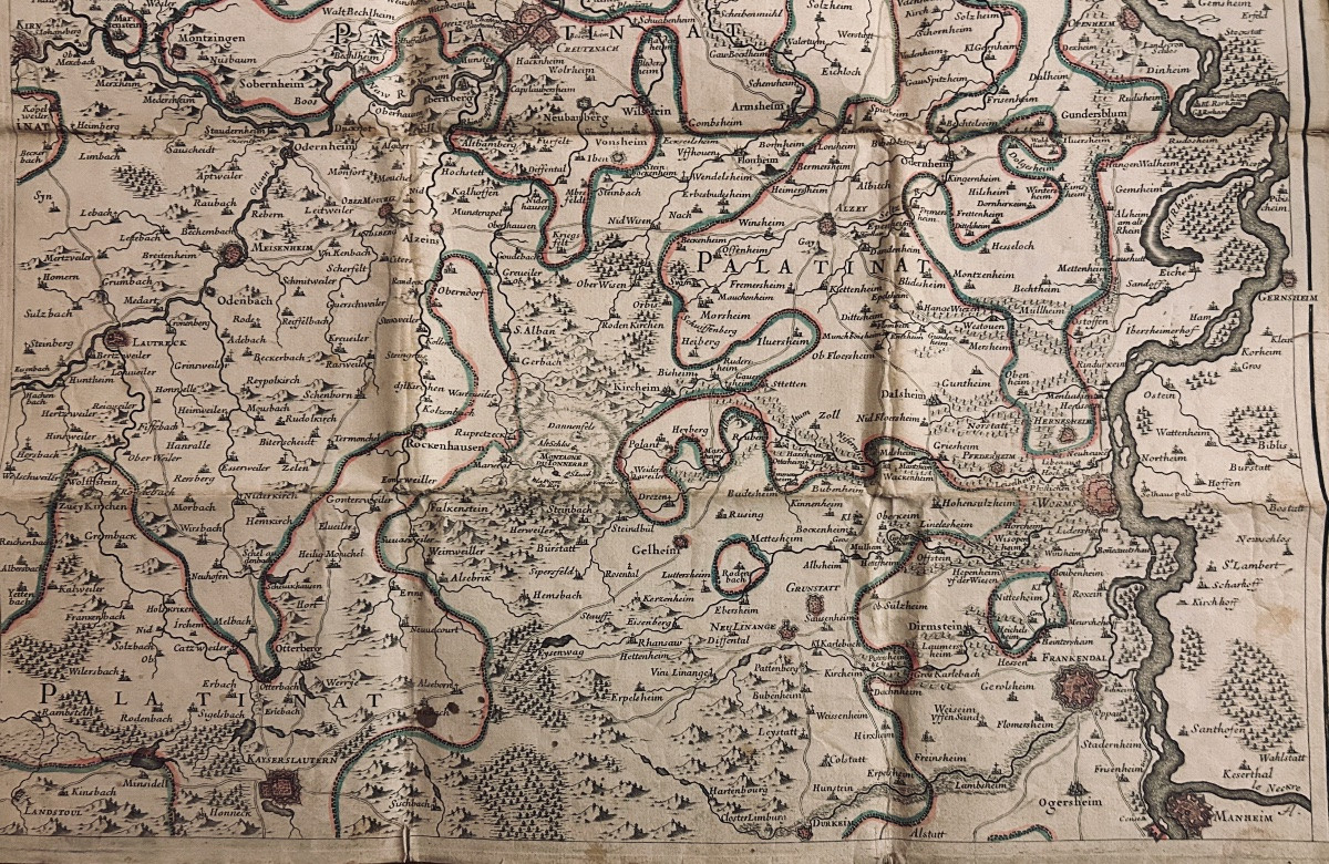


Map Of The Electorate Of Mainz Including The Palatinate. Circa 1780, Coloured Outlines.
Artist: Carte De L'électorat De Mayence Comportant Le Palatinat Et Le Cours Du Rhin De Manheim à Pfaltz. Vers 1780, Contours Coloriés.
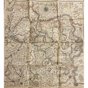
[MAINZ] - ANONYMOUS - Map of the Electorate of Mainz including the Palatinate and the course of the Rhine from Mannheim to Pfalz. Paris, circa 1780; 580/540 mm, one sheet, pasted onto cloth. The outlines of the regions are colored.
80 €
Period: 18th century
Style: Louis 16th, Directory
Condition: Excellent condition
Material: Paper
Length: une feuille de 580/540 mm pliée et collée sur tissu
Reference (ID): 1731016
Availability: In stock
Print