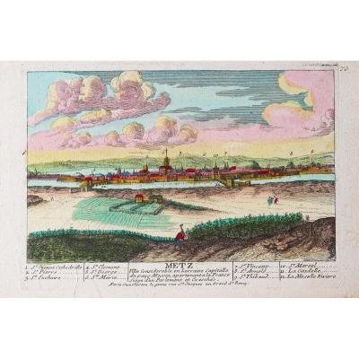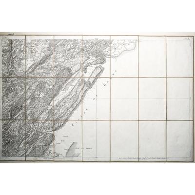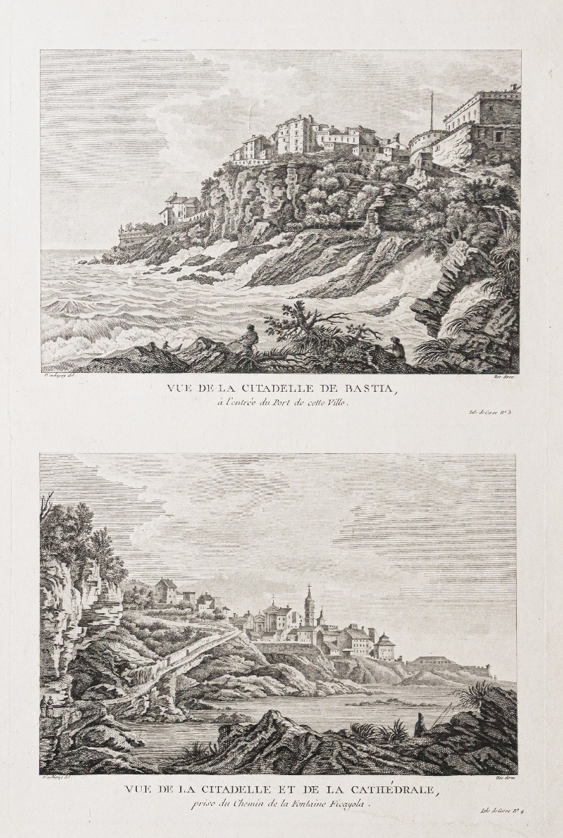


Old Engraving Of Bastia
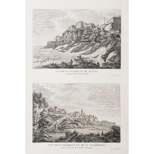
Epreuve originale réalisée vers 1780. D’Aubigny dessinateur.
Un pli ancien dans la partie inférieure de la gravure.
Bon état.
Format feuille : 48,5 x 31,5 cm.
Format gravure : 36,5 x 25 cm.
Original antique engraving around 1780.
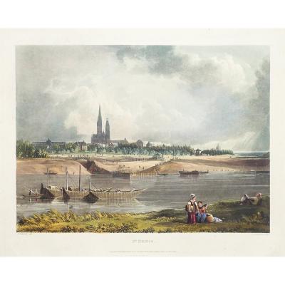
Vue de la Citadelle de Bastia à l’entrée du port.
Vue de la Citadelle et Cathédrale prise du chemin de la Fontaine Ficayola.
Vous pouvez consulter l'ensemble des cartes et gravures disponibles sur votre région en cliquant sur le lien de notre site internet spécialisé en archives anciennes géographiques :
https://cartes-livres-anciens.com/categorie-produit/cartes-geographiques-anciennes-original-antique-maps/france/corse/
Règlement sécurisé par carte bancaire sur notre site internet en cliquant sur le lien :
https://cartes-livres-anciens.com/produit/cartes-geographiques-anciennes-original-antique-maps/france/corse/gravure-ancienne-de-bastia/
Toutes nos cartes et gravures sont accompagnées d'un certificat d'authenticité.
Original proof made around 1780. D'Aubigny draftsman.An old fold in the lower part of the engraving.Good condition.Sheet size: 48.5 x 31.5 cm.Engraving size: 36.5 x 25 cm.Original antique engraving around 1780.View of the Citadel of Bastia at the entrance to the port.View of the Citadel and Cathedral taken from the path of the Fontaine Ficayola.You can consult all the maps and engravings available in your region by clicking on the link to our website specializing in old geographical archives: https://cartes-livres-anciens.com/categorie-produit/cartes-geographiques-anciennes-original-antique-maps/france/corse/Secure payment by credit card on our website by clicking on the link: https://cartes-livres-anciens.com/produit/cartes-geographiques-anciennes-original-antique-maps/france/corse/gravure-ancienne-de-bastia/All our maps and engravings are accompanied by a certificate of authenticity.
Un pli ancien dans la partie inférieure de la gravure.
Bon état.
Format feuille : 48,5 x 31,5 cm.
Format gravure : 36,5 x 25 cm.
Original antique engraving around 1780.
Vue de la Citadelle de Bastia à l’entrée du port.
Vue de la Citadelle et Cathédrale prise du chemin de la Fontaine Ficayola.
Vous pouvez consulter l'ensemble des cartes et gravures disponibles sur votre région en cliquant sur le lien de notre site internet spécialisé en archives anciennes géographiques :
https://cartes-livres-anciens.com/categorie-produit/cartes-geographiques-anciennes-original-antique-maps/france/corse/
Règlement sécurisé par carte bancaire sur notre site internet en cliquant sur le lien :
https://cartes-livres-anciens.com/produit/cartes-geographiques-anciennes-original-antique-maps/france/corse/gravure-ancienne-de-bastia/
Toutes nos cartes et gravures sont accompagnées d'un certificat d'authenticité.
Original proof made around 1780. D'Aubigny draftsman.An old fold in the lower part of the engraving.Good condition.Sheet size: 48.5 x 31.5 cm.Engraving size: 36.5 x 25 cm.Original antique engraving around 1780.View of the Citadel of Bastia at the entrance to the port.View of the Citadel and Cathedral taken from the path of the Fontaine Ficayola.You can consult all the maps and engravings available in your region by clicking on the link to our website specializing in old geographical archives: https://cartes-livres-anciens.com/categorie-produit/cartes-geographiques-anciennes-original-antique-maps/france/corse/Secure payment by credit card on our website by clicking on the link: https://cartes-livres-anciens.com/produit/cartes-geographiques-anciennes-original-antique-maps/france/corse/gravure-ancienne-de-bastia/All our maps and engravings are accompanied by a certificate of authenticity.
250 €
Period: 18th century
Style: Other Style
Condition: Good condition
Material: Paper
Reference (ID): 1544907
Availability: In stock
Print