


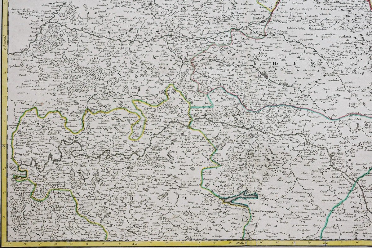
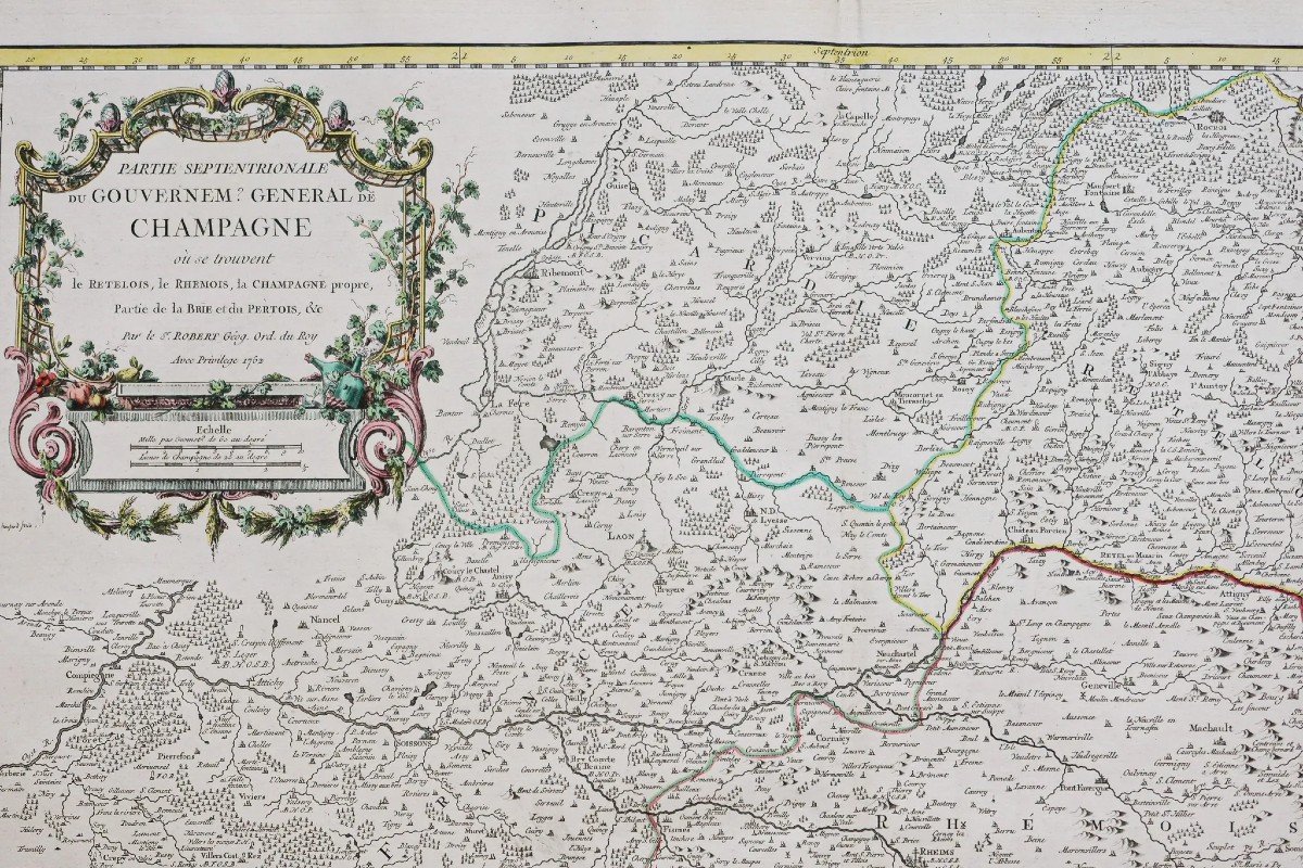
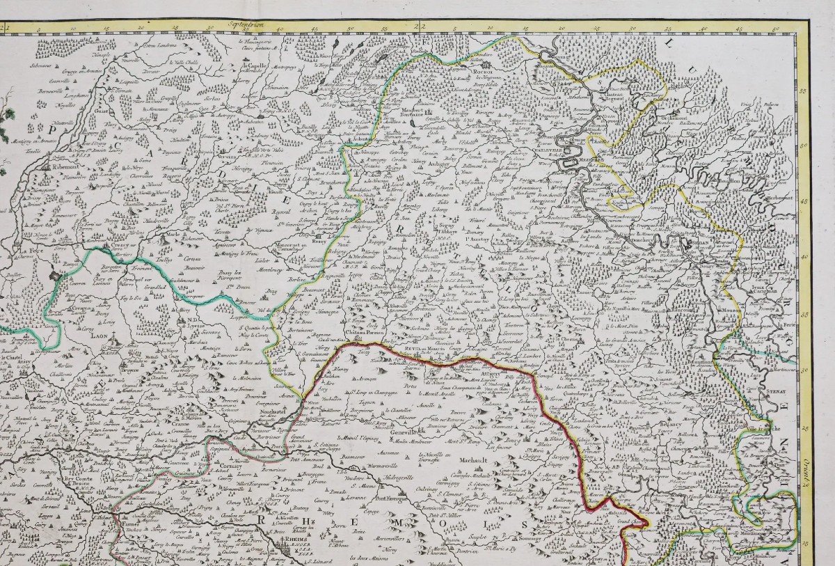

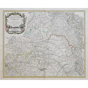


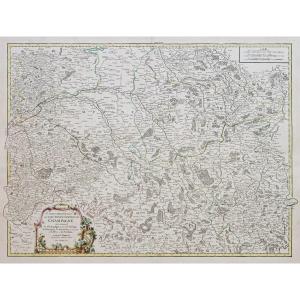
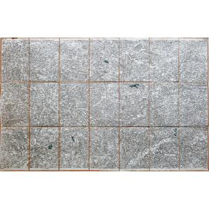
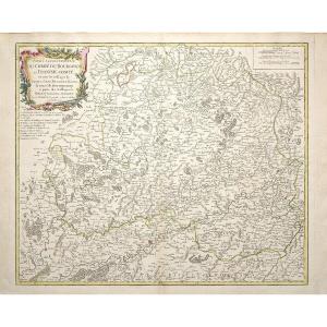
"Old Map Of Champagne"
Epreuve originale réalisée en 1752. Robert de Vaugondy géographes, père et fils.Limites colorées de l’époque.
Très bon état.
Format feuille : 75 x 56 cm.
Format gravure : 62 x 50,5 cm.
Original antique map of 1752.
Partie septentrionale du Gouvernement général de la Champagne, où se trouve le Retelois, le Rhemois, la Champagne propre, partie de la Brie et du Pertois.
Excellente carte du géographe Robert de Vaugondy en première édition. Echelle des mesures, cartouche de titre aquarellé.
Vous pouvez consulter l’ensemble des cartes, livres et gravures disponibles sur votre région en cliquant sur le lien de notre site internet spécialisé en archives anciennes géographiques :
https://cartes-livres-anciens.com/categorie-produit/cartes-geographiques-anciennes-original-antique-maps/france/champagne/
Règlement sécurisé par carte bancaire sur notre site internet en cliquant sur le lien ci-dessous :
https://cartes-livres-anciens.com/produit/cartes-geographiques-anciennes-original-antique-maps/france/champagne/carte-ancienne-de-la-champagne-2/
Toutes nos cartes et gravures sont accompagnées d’un certificat d’authenticité.
Gilles Robert de Vaugondy, dit Robert de Vaugondy, né en 1688 et mort en 1766, est un géographe et cartographe français. En 1757, ils réalisent l’Atlas Universel, considéré comme une autorité pendant de nombreuses années.
Petit-fils de Nicolas Sanson, il est nommé géographe du Roi. Il est le père du géographe et cartographe Didier Robert de Vaugondy (1723-1786), avec lequel il compose une collection de carte sur le Monde, parue en 1757.
Original proof made in 1752. Robert de Vaugondy geographers, father and son. Colored boundaries of the time. Very good state. Sheet size: 75 x 56 cm. Engraving format: 62 x 50.5 cm. Original antique map of 1752. Northern part of the General Government of Champagne, where Retelois, Rhemois, Champagne proper, part of Brie and Pertois are located. Excellent map by geographer Robert de Vaugondy in first edition. Measurement scale, title block in watercolor. You can consult all the maps, books and engravings available in your region by clicking on the link of our website specializing in ancient geographical archives: https://cartes-livres-anciens.com/categorie-produit/cartes-geographiques -anciens-original-antique-maps/france/champagne/ Secure payment by credit card on our website by clicking on the link below: https://cartes-livres-anciens.com/produit/cartes-geographiques-anciennes -original-antique-maps/france/champagne/carte-ancienne-de-la-champagne-2/ All our maps and engravings are accompanied by a certificate of authenticity. Gilles Robert de Vaugondy, known as Robert de Vaugondy, born in 1688 and died in 1766, was a French geographer and cartographer. In 1757, they produced the Atlas Universel, which was considered an authority for many years. Grandson of Nicolas Sanson, he was appointed geographer to the King. He is the father of the geographer and cartographer Didier Robert de Vaugondy (1723-1786), with whom he composed a collection of maps on the World, published in 1757.


 Le Magazine
 Rivista Artiquariato
 TRÉSORS magazine